Good evening, everyone. We continue to track a light snowfall into the region late tonight and Monday. The timing of this system is likely to impact the morning commute across the state. All of this is ahead of a harsh winter pattern starting later next week.
We have a Winter Weather Advisory that’s already out for a few counties across the far southeast…

Given the timing on this, I could make a serious case for a Winter Weather Advisory for many areas all the way back into the Lexington metro. I expect just enough snow to cause delays and cancellations.
Here’s my Latest Call for Snowfall…
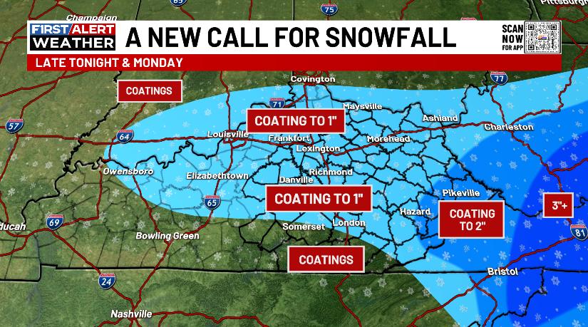
Listen, there’s a chance for this to overachieve from the Bluegrass Region down the Mountain Parkway. There’s a little comma head of snow possible in these areas.
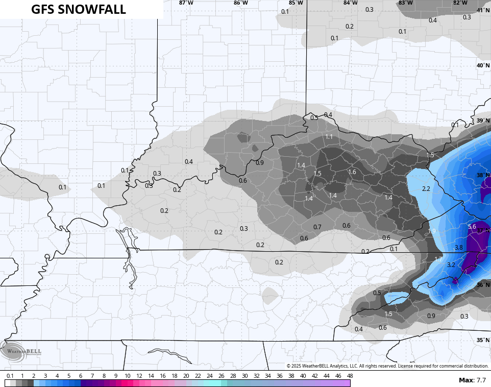
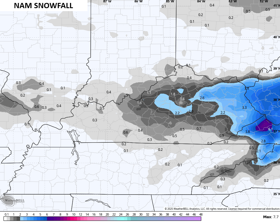
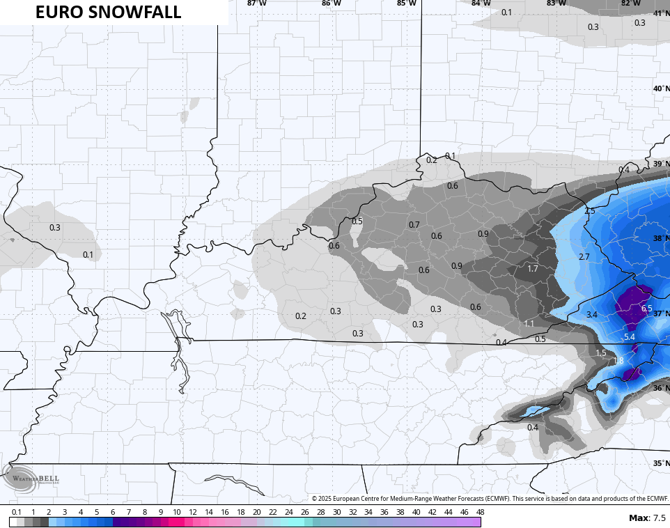
The late day forecast models are picking up on this. All of these totals are with the models taking any melting into account.
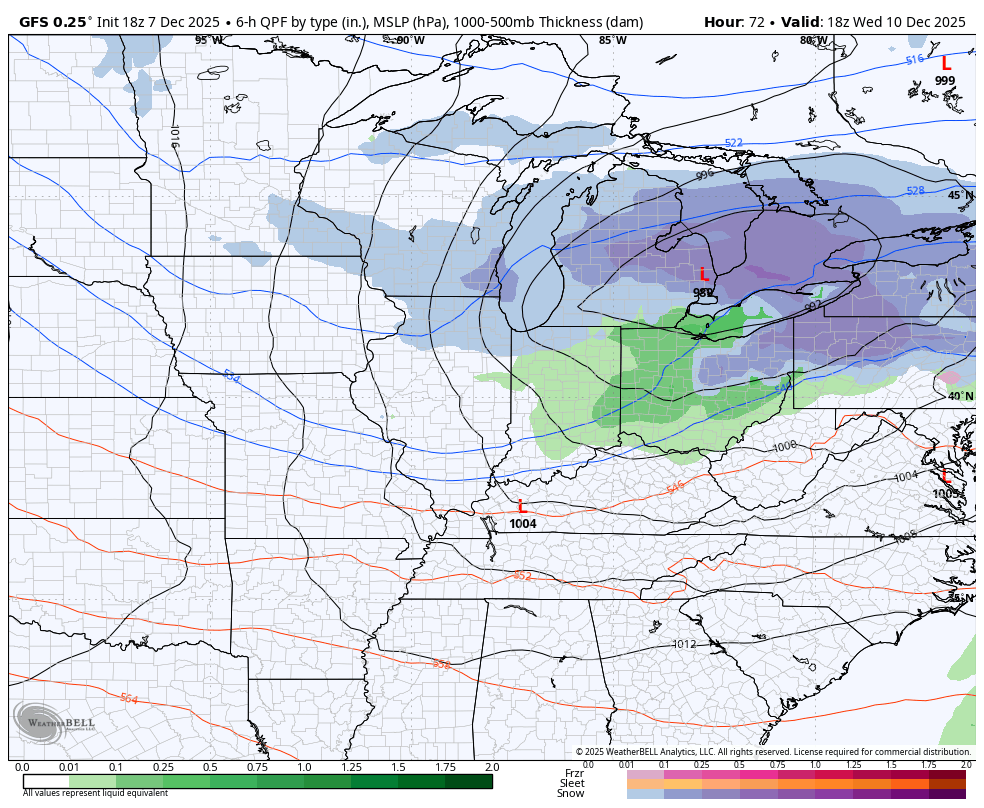
Here’s the GFS…
The NAM fam is amped up and you can actually see the spin in the snowfall totals…

The Short Range Canadian looks like the GFS…

The EURO…
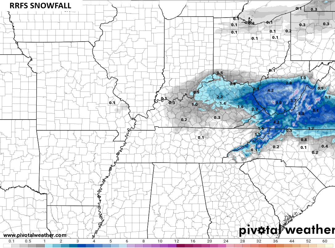
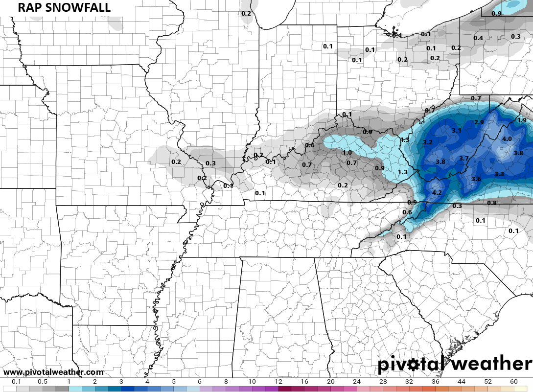
The RRFS and RAP are also seeing the chance for an overachiever…
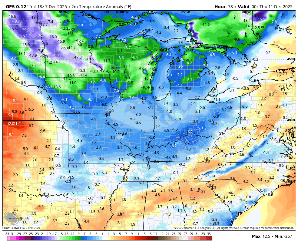
Very cold temps settle in behind this light snowfall and hang into Monday night. Those temps rebound quickly on Tuesday and early Wednesday. This is ahead of the first in a series of clippers diving in. I firmly expect these to produce, at least, some snow in our region.
The details change with each model run, so don’t get too attached with any one model. Here’s the latest GFS…
The cold air coming in is bitter for much of the country with the bullseye on top of us…
I’ll have a full update later tonight and I’ll be on WKYT tonight at 1opm on the CW Lexington and at 11pm on WKYT. I will also have a few updates on my Meteorologist Chris Bailey Facebook Page
Until then, here are your tracking tools for the day…


Make it a great evening and take care.
