Good Monday to one and all. The third snowfall of the month is impacting Kentucky today and will cause some travel issues to start the day. After a brief break, Old Man Winter really flexes later in the week into the weekend as bitterly cold air brings snow chances.
Light snow starts out the day with up to an inch possible for many areas, especially from the Bluegrass Region of central Kentucky into eastern and far southeastern Kentucky. Southern Kentucky has more of a mix and some snow.
The chance is there for this to ramp up a little more, especially from eastern Kentucky into West Virginia. Those last minute computer model forecasts picked up on this…

I do expect some snow days and delays out there this morning.
All of this ends from northwest to southeast through the late morning and early afternoon.
A Winter Weather Advisory is out for several areas during the first half of our Monday…

You can track also catch the light snowfall playing out on our Kentucky Weather Cams .
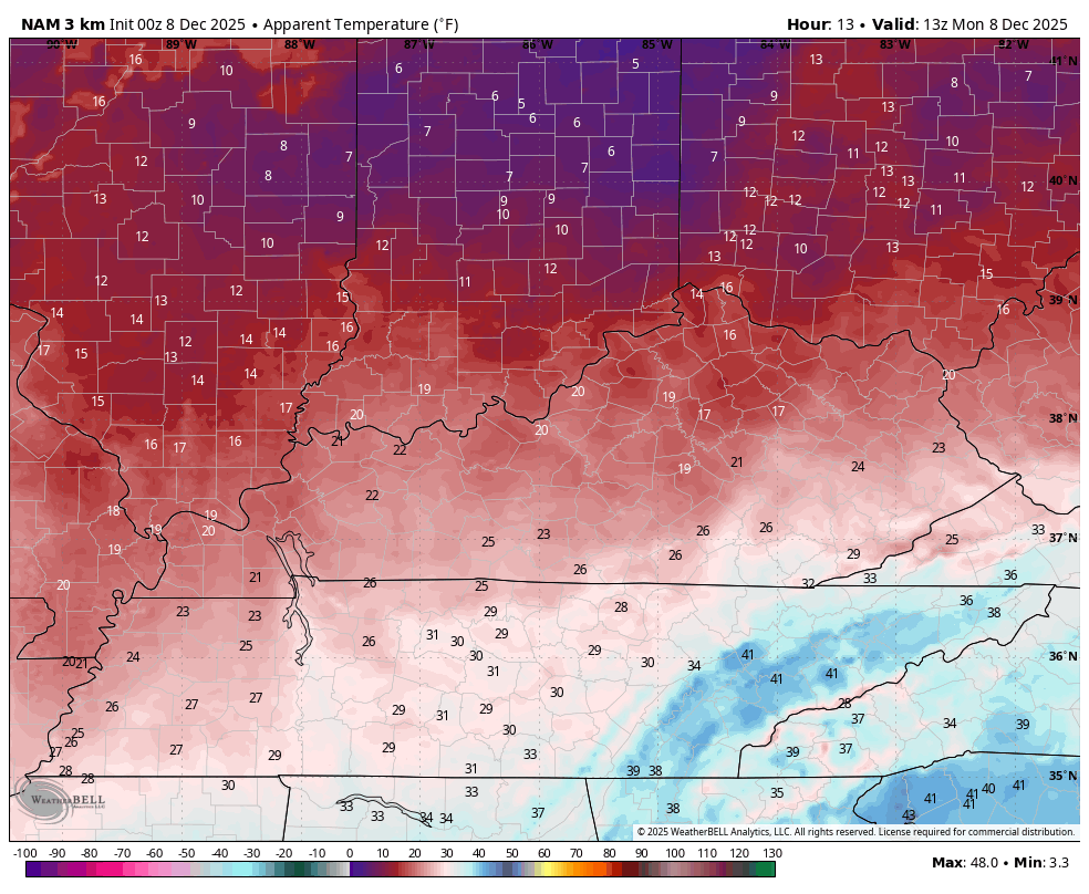
Temps today settle into the upper 20s and low 30s with a gusty northwest wind making it feel MUCH colder. Check out the wind chills from 8am this morning through 8am Tuesday…
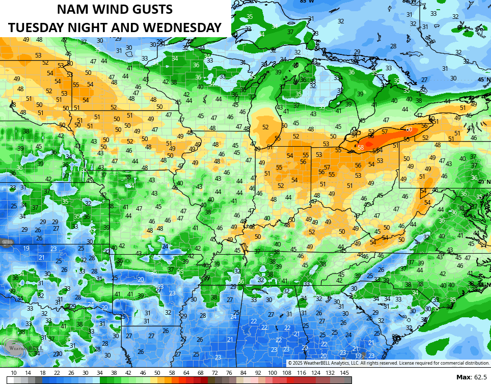
Temps rebound quickly on a strong southwest wind Tuesday afternoon. That’s ahead of our first arctic system diving in late Wednesday and this will create some serious wind gusts. 40mph to 50mph gusts are possible Tuesday night and Wednesday and the models are picking up on this…

That first arctic front moves in with a few showers ahead of it and snow showers and the chance for a few snow squalls behind it Wednesday night and Thursday. From there, we watch a few more clippers dropping in from the northwest, but the models have no idea how to handle any part of them. From the track, to the timing, to the arctic cold behind them… We are seeing some wild model swings.
Of course, this isn’t the first time we’ve talked about this, and I assure you it won’t be the last. The models have been especially poor over the past month or so.
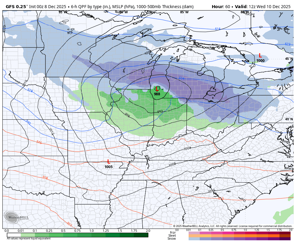
Here’s a look at the current view of the models and the wild swings…
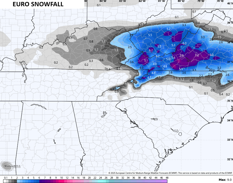
EURO

Canadian

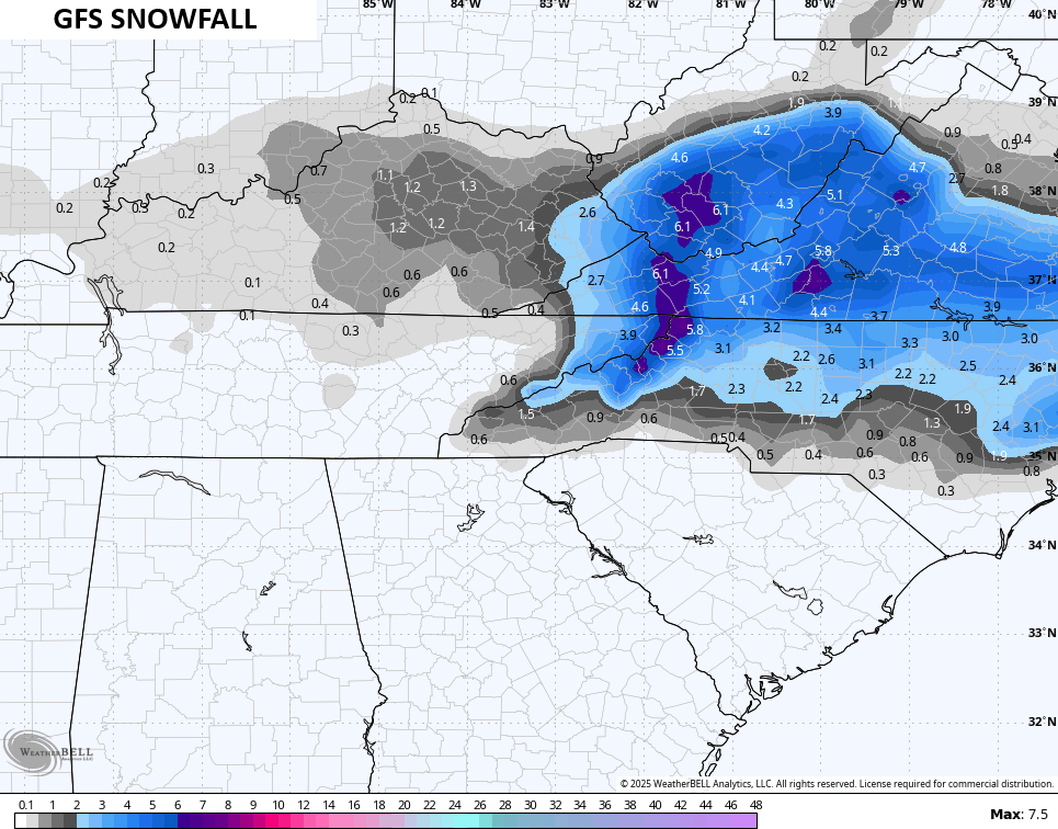
GFS
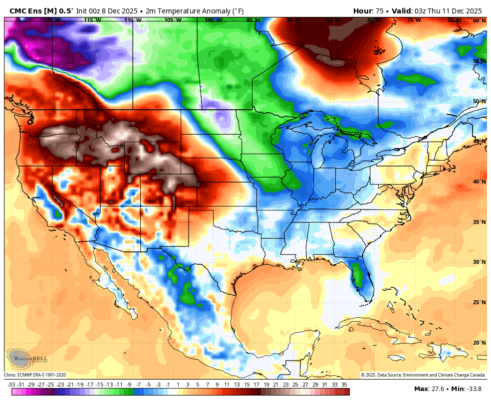
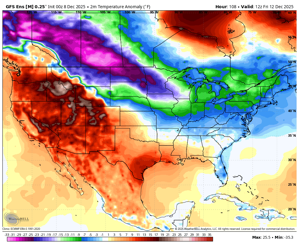
The Ensembles have a much steadier look with the amount of arctic air diving into the country…
Canadian Ensembles
GFS Ensembles
Updates will come your way later today. I’ll also have a few updates on my Meteorologist Chris Bailey Facebook Page
Until then, here are your tracking tools for the day…


Make it a magnificent Monday and take care.

In Pikeville we has some snow flurries fall but nothing is sticking it alternates with sleet. The other cameras are pretty. It is just a bad place here to get snow and it’s just a few degrees temperature that makes the difference. I have enjoyed looking at the web cams with snow.
Thanks Chris. Here in Maple this Morning, we only received a trace of Snow. We only had two events, so far this month. The first Snow event, we received about a half inch. We really need an active subtropical jet stream, to give our area a Snowy landscape. I’m enjoying the Snowscapes on your weathercams. Looks like Lexington received a little over an inch ?
Here’s this Morning’s article from the Climate Impact Company. They make it sound like it’s going to be a very short Winter. AI models were used. No thanks ! )
https://climateimpactcompany.com/u-s-medium-range-cold-retreat-operational-ai-models-warm-the-extended-range-2-2/