Good afternoon, everyone. Our first winter storm is winding down after dropping several inches of snow into much of the area. This system did indeed put down more than 5″ in several areas and now we turn our attention to the next winter storm. This one will be followed by bitterly cold temps.
This is a potentially life-threatening winter storm, and I hope the entire weather community is proactive in getting the word out. The combination of a quick-hitting moderate snowfall that’s immediately followed by a prolonged stretch of bitterly cold air is a serious situation for anyone stranded or caught outdoors for an extended period of time.
Here’s a breakdown:
WINTER STORM ALERT SATURDAY AND SATURDAY NIGHT
- An arctic front drops in from the northwest with a wave of low pressure working along it.
- These arctic waves are usually underplayed by the models.
- Another healthy snowfall is likely across the northern half of the state.
- A few to several inches will be likely in this area.
- Once again, we are left with the question on just how far south the snows can get.
- This snow will be much drier and more powdery with the arctic air coming in.
- Gusty winds will create some blowing and drifting Saturday night.
- Roads will become snow covered again and this will be a HIGH impact travel event.
- Bitterly cold air moves in Saturday evening and night.
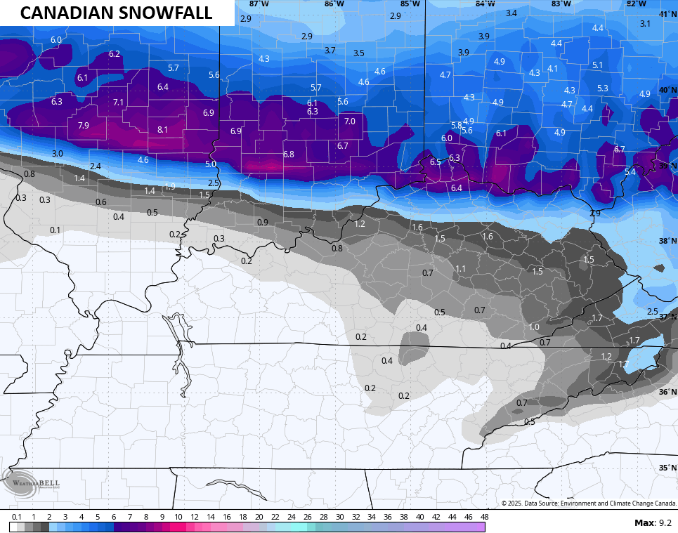
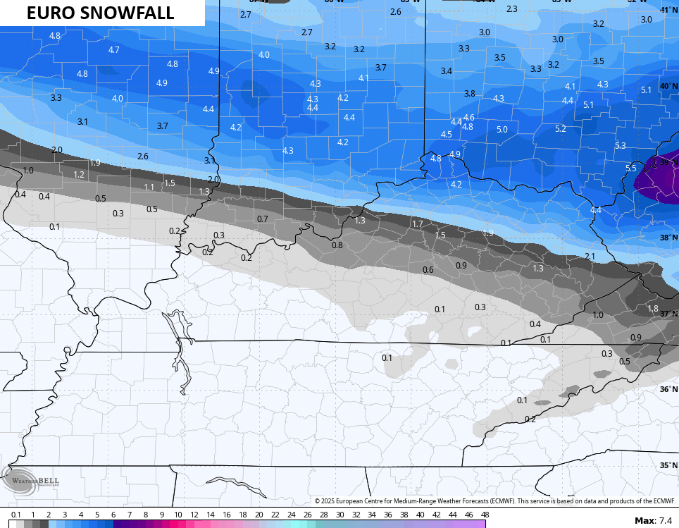
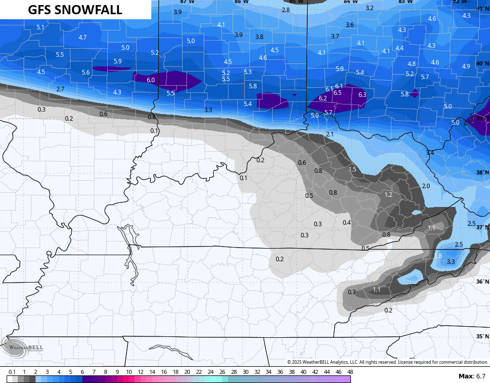
Here’s my New Call for Snowfall…

I’m still worried we have to come farther south with this system and that’s a trend to watch for tonight.
The latest model data continues to focus the snows farther south…
BITTERLY COLD AIR SATURDAY NIGHT THROUGH MONDAY
- This is a dangerously cold air mass, folks.
- Wind chills can drop to -10 to -20 at times by Sunday morning.
- Wind chills stay around zero or as low as -10 through the day into Sunday night and Monday morning.
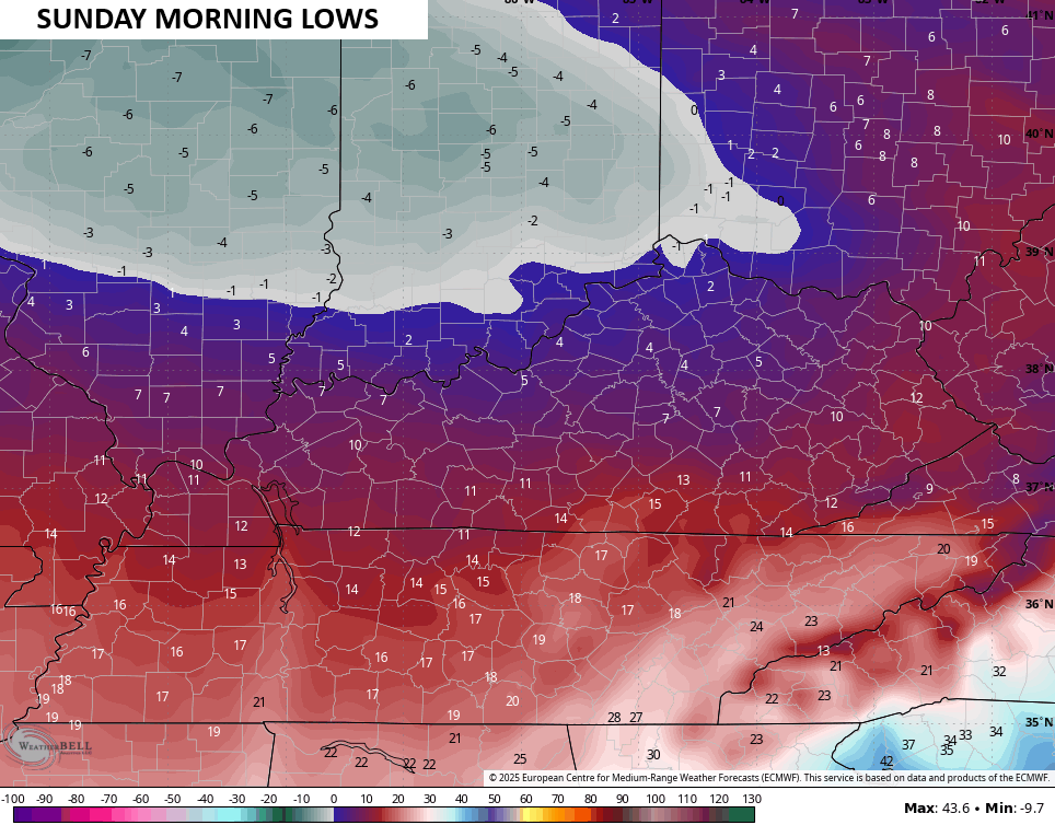
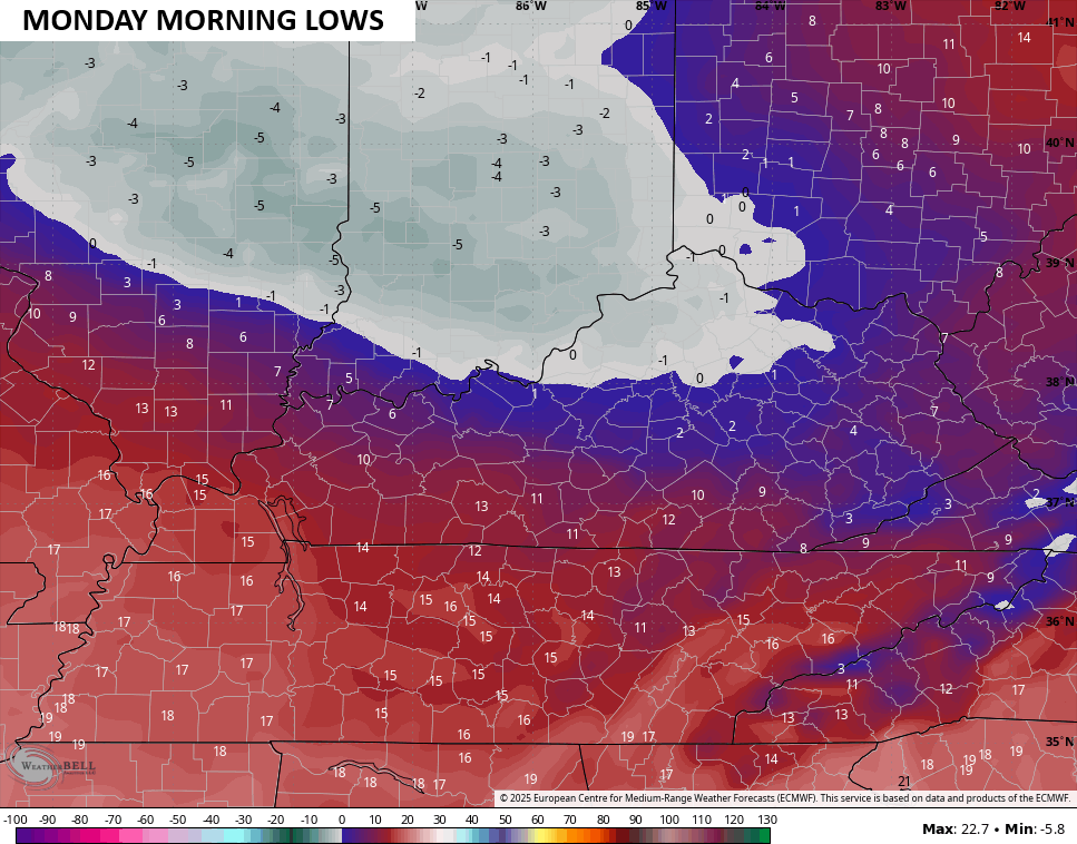
- Actual air temps will range from -5 to 5 above in several areas for Sunday lows and then again for Monday lows.
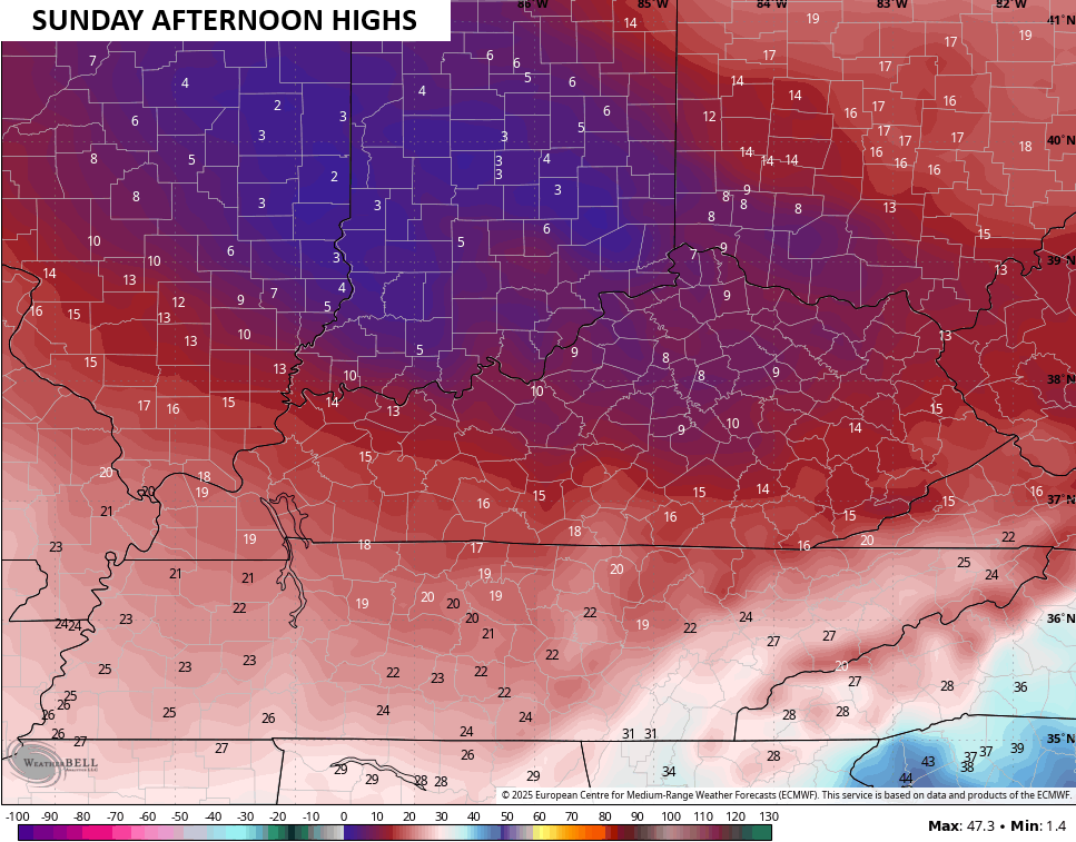
- High temps Sunday may barely get into the low and middle teens for areas with snow on the ground.
- Additional snow showers and flurries will be noted during the first part of Sunday.
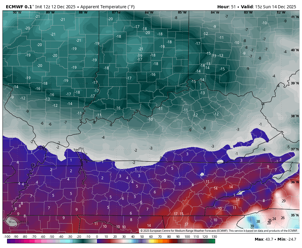
The wind chill forecast from the EURO starting at 7pm Saturday and going through 10am Sunday continues to be nasty…
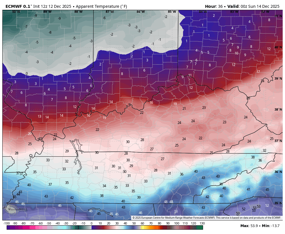
Those wind chills don’t improve much through the rest of Sunday through Monday morning…
Actual low temps Sunday and Monday will range from -5 to 5 above in many areas…
Highs on Sunday look like this on the EURO…
BTW, the trend is for a deeper trough late next week with a colder look…
Updates will come your way throughout the day, so keep checking back. I’ll also have a few updates on my Meteorologist Chris Bailey Facebook Page
Until then, here are your tracking tools for the day…


Make it a fantastic Friday and take care.
