Good Friday to one and all. Our winter storm slowly winds down from northwest to southeast this morning as we turn our attention to the Winter Storm THREAT for Saturday and Saturday night. That will be followed by a blast of brutally cold air to wrap up the weekend.
Several inches of snow have already been reported as of this writing with some 4″ amounts already showing up. The snows still have a ways to go from the time I’m writing this so it’s very likely we get some reports of 5″ or perhaps a little more.
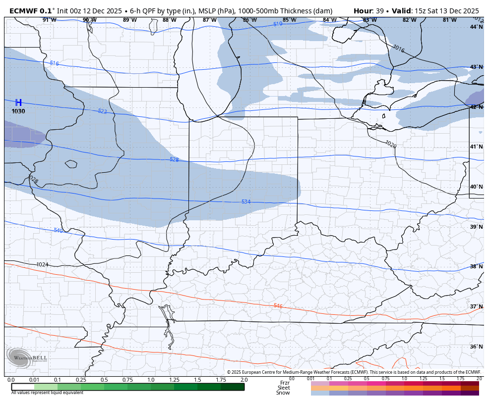
This system came in farther south and that was a trend I started catching on to through the day as it became apparent the high to the north was stronger than the models thought. That slightly colder scenario pushed things a bit south by maybe 40-50 miles which meant more snow in the south with lighter amounts in the north and northeast.
Winter Storm Warnings and Winter Weather Advisories are out there to start the day with a Winter Storm Watch in the north for Saturday…

Many roads are snow covered this morning, and you can watch all this playing out on our Kentucky Weather Cams .
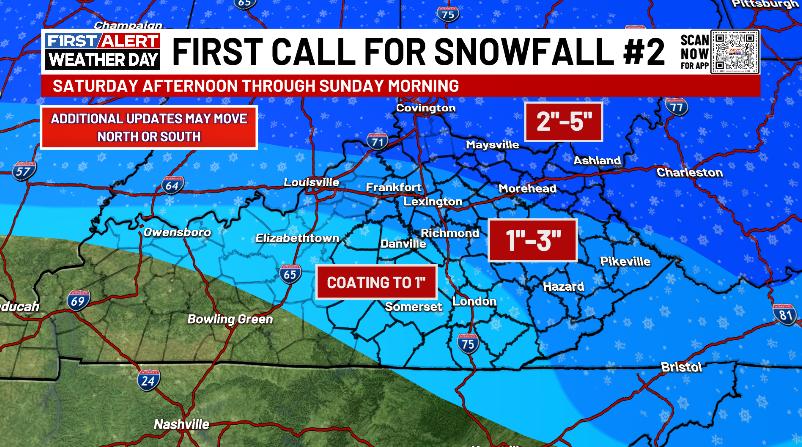
The next system coming in has a MUCH greater impact across northern and northeastern Kentucky than the rest of the state. I’ll be updating this First Call map throughout the day…
Will this system trend south just like the last one? The deep Ohio Valley snowpack and arctic air certainly give it a chance so that’s something to be aware of today.
Here’s how the EURO is seeing this winter storm from Saturday afternoon through Sunday afternoon…
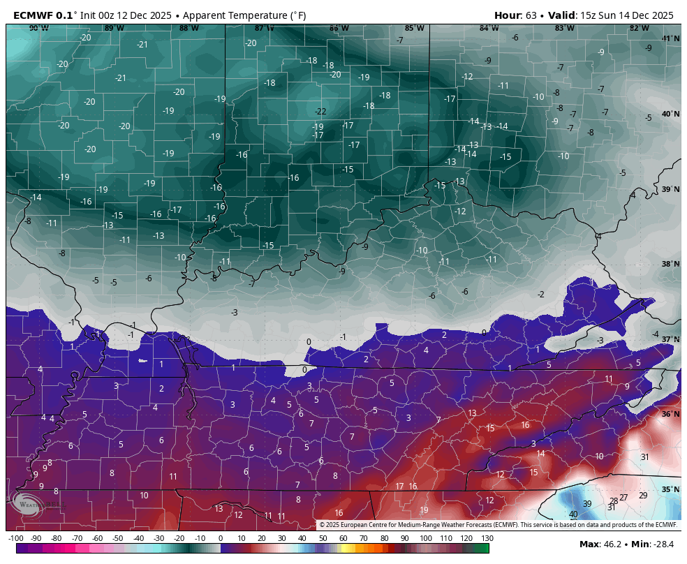
I would imagine Cold Weather Advisories will be widespread from Saturday night through Sunday night as dangerously cold wind chills take over our region. This animation shows the wind chill temps from 7pm Saturday through 10am Sunday…
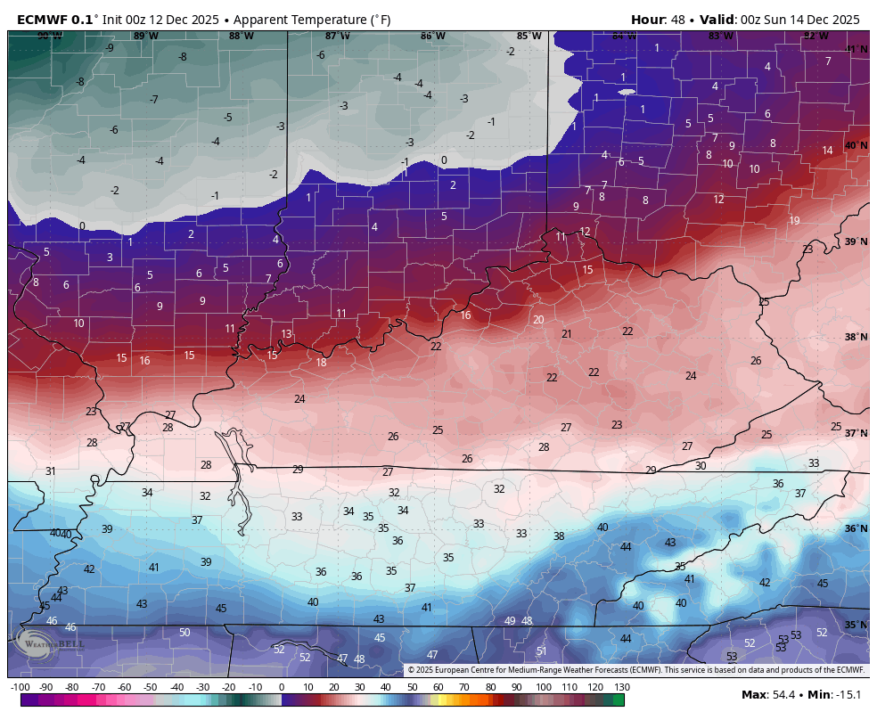
That’s absolutely wicked.
Actual air temps may reach -5 to 5 above for areas with the deep snowpack…
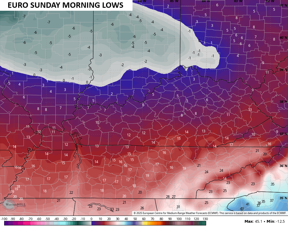
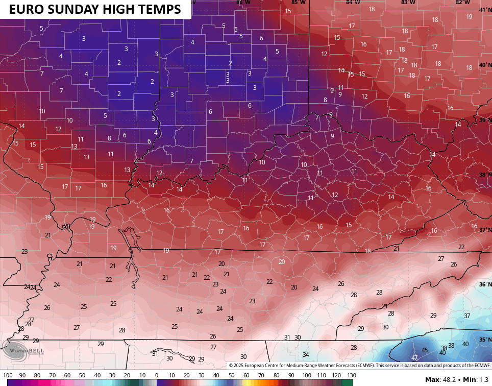
The EURO high temps on Sunday range from the high single digits and low teens over the deep snow, to the mid and upper teens for areas without snow…
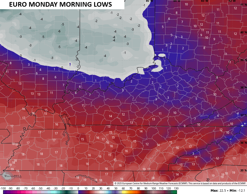
The brutal wind chills remain through Sunday into the start of Monday…
Actual lows on Monday may again reach -5 to 5 above…
We will finally break out of this harsh winter pattern by Tuesday as milder southwest winds kick in. The models had been showing wall to wall mild temps next week, but they’re already beginning to buckle with another cold front slated for arrival by Thursday…
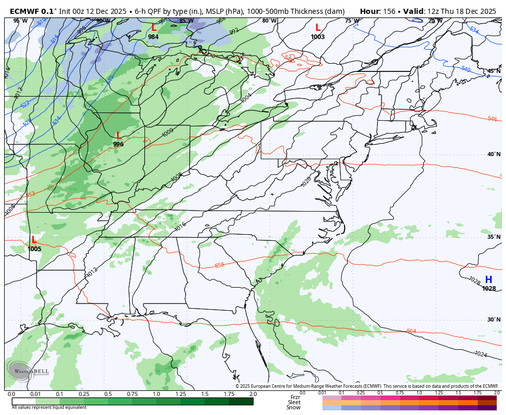
The EURO takes the temps right back below normal for a few days behind that boundary…
Updates will come your way throughout the day, so keep checking back. I’ll also have a few updates on my Meteorologist Chris Bailey Facebook Page
Until then, here are your tracking tools for the day…


Make it a fantastic Friday and take care.

Great job in your forecasting Chris. I already viewed your weathercams this morning, and I found the Snows gave me a peaceful feeling, as well as being beautiful. I can’t tell yet, but it looks like we have about an inch on the ground, Northern Taylor county.