Good evening, everyone. A Winter Storm Warning is out for parts of central and northern Kentucky with a Winter Weather Advisory out for many areas. This is the first of two winter storms to impact our region over the next few days.
Here’s a look at the current Winter Weather Alerts…

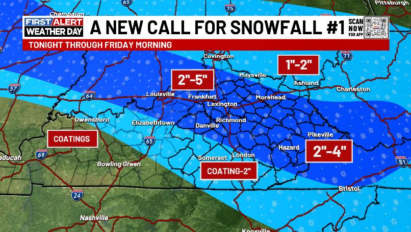
I’m still concerned about this thing coming in a bit farther south as that high pressure to the north is just a tad stronger than the models have been thinking. Given that, I tightened up the band of best snows and gave more wiggle room for some snows farther south. Here’s the Latest Call for Snowfall…
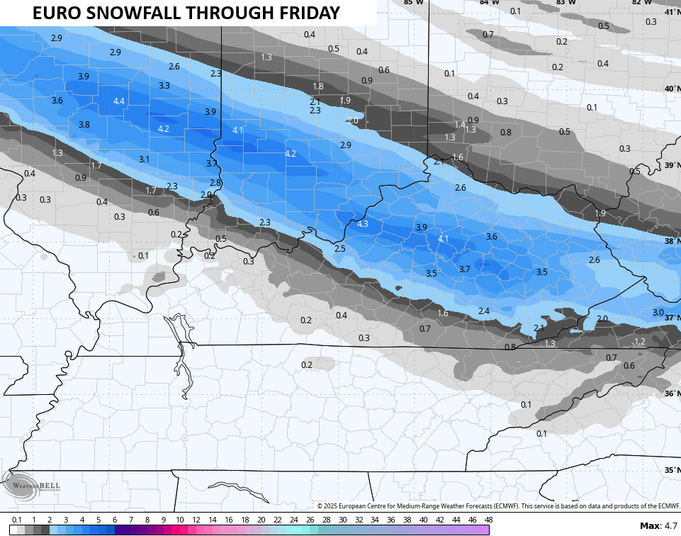
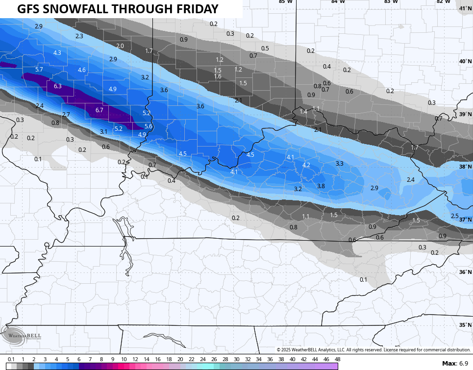
Many of the forecast models are picking up on this southward trend…
The area from Covington to Ashland may wind up with lighter snows as the best banding sets up to your south.
This isn’t a major winter storm by any means, but roads will be a mess tonight and early Friday for many. That goes for areas getting an inch of snow or the local areas that push the higher end of the envelope.
I’m also out with a First Call for Snowfall on the weekend system…
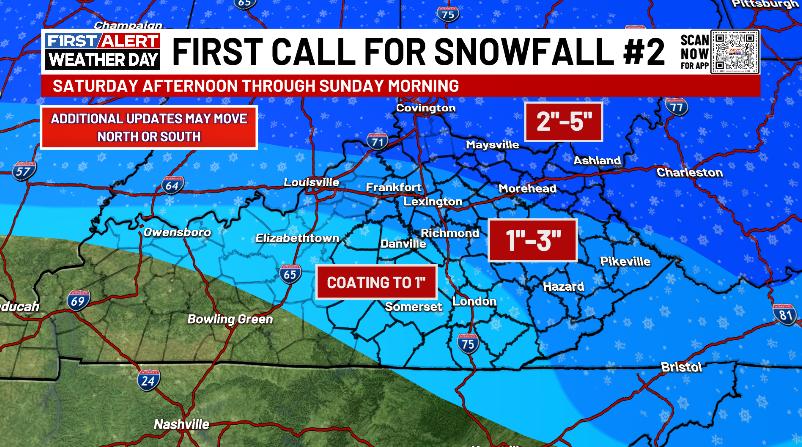
The north and northeast should do the best in this scenario with lighter amounts the farther south and southwest you go. I like what the Euro is doing with this…

Bitterly cold temps follow that up Saturday evening as arctic air surges in. This wind chill animation starts at 7pm Saturday and goes through Sunday morning…
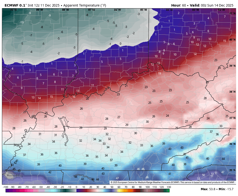
That’s brutal and those brutal wind chills hang around the rest of Sunday into Monday morning…
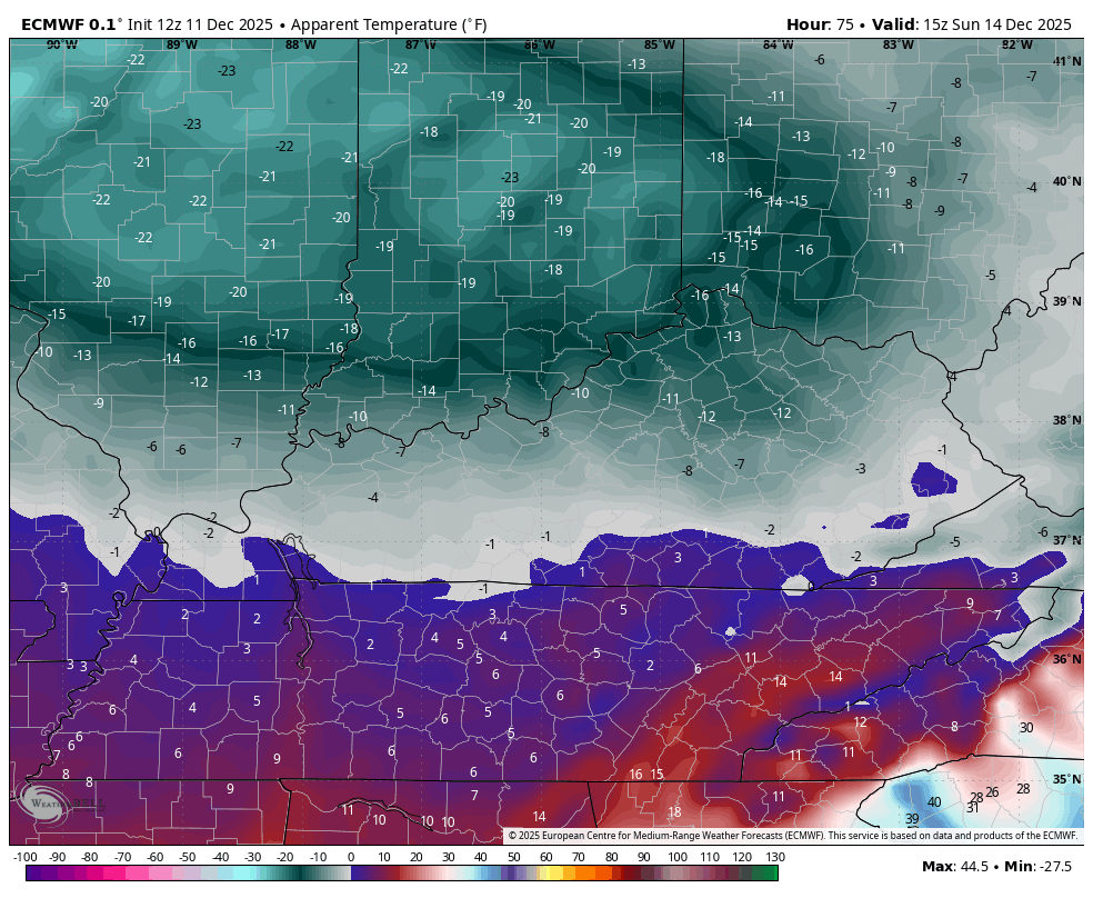
Actual low temps Sunday and Monday can drop to -5 to 5 above. Highs Sunday are mainly in the teens.
Updates will come your way throughout the day, so keep checking back. We will have full team coverage on WKYT-TV starting at 10pm tonight. I’ll also have a few updates on my Meteorologist Chris Bailey Facebook Page
Until then, here are your tracking tools for the day…


Make it a great evening and take care.

Thanks CB! It’s coming down at a pretty good pace here in Woodford county right now (10:13)! I hope the road crews can keep up with it, so the commute for everyone in the morning isn’t too bad! Please everyone, Slow down!
With how far south this current storm has deviated, I’m wondering if the next system doesn’t do the same as well.