Good afternoon, everyone. The issues you’re experiencing with Kentucky Weather Center being slow to load are related to an apparent targeted bot attack designed to slow the load times. We are working to trace the source. If we find those responsible, I’m going to make them famous.
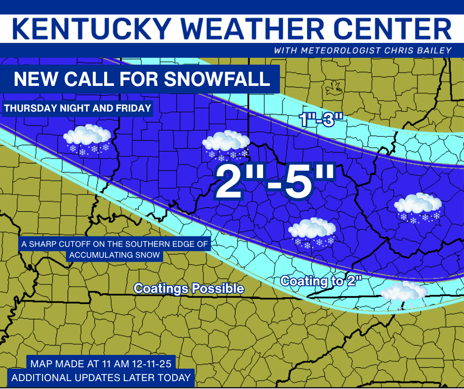
The current Winter Storm ALERT continues from this evening into the first part of Friday. I pretty much have the same exact forecast from yesterday in terms of what this system is capable of. Here’s the New Call for Snowfall…
A Winter Weather Advisory is out for much of the region, but the NWS in Charleston WV apparently decided to take the day off…

I do expect a swath of counties from roughly Jefferson to Pike to receive the heaviest snows and likely be placed under a Winter Storm Warning. 4″ is the criteria and 4″ amounts are actually being forecast by the NWS with the potential for up to 5″, matching my forecast.
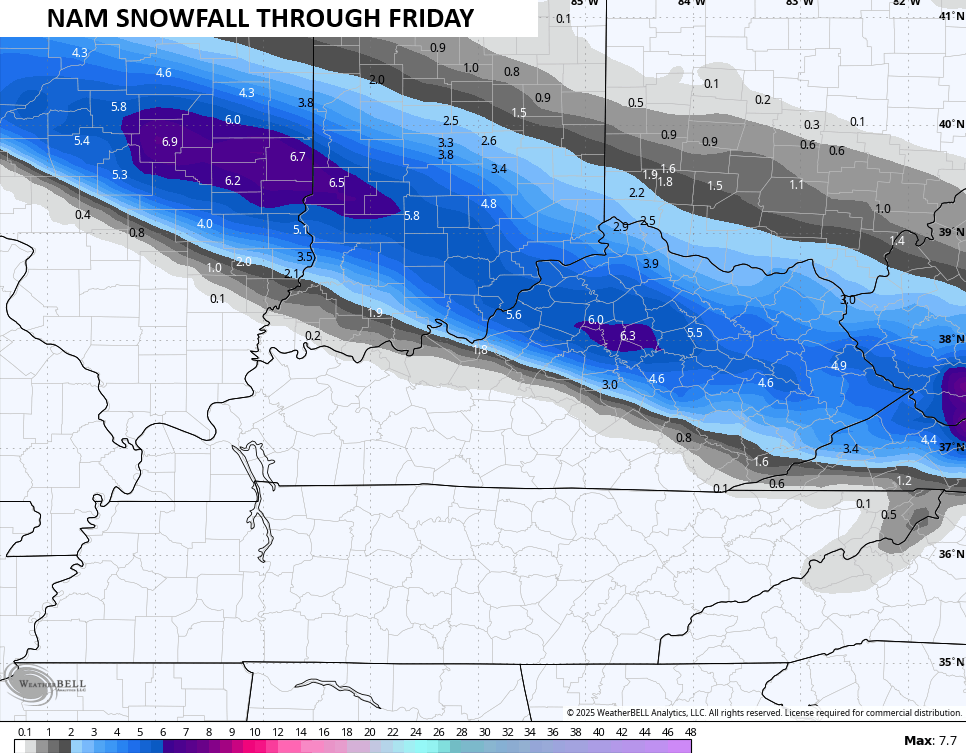
The NAM Fam went BAM…

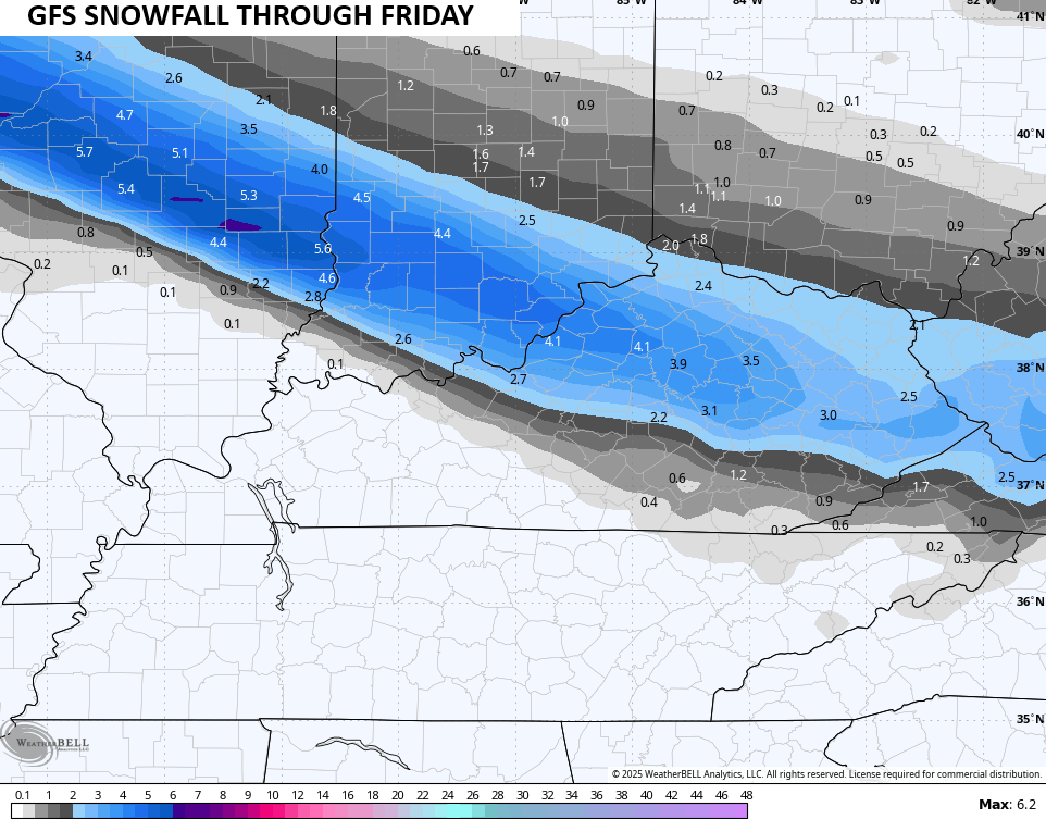
The GFS isn’t quite as juiced and is a touch farther south…
I have no changes to the weekend Winter Storm THREAT. This system rolls along on the southern edge of an arctic boundary so it will have much more of a fluff factor. Gusty winds will create blowing and drifting snows.
The main impact from this continues to be across the northern half of the state with lighter impacts all the way to the southeast…

Brutally cold temps come in behind this Saturday night through Monday with the chance to hit 0 or below. Wind chills may bottom out in the -10 to -20 degree range.
Updates will come your way throughout the day, so keep checking back. We will have full team coverage on WKYT-TV starting at 4pm today. I’ll also have a few updates on my Meteorologist Chris Bailey Facebook Page
Until then, here are your tracking tools for the day…


Make it a great Thursday and take care.

As of 4:00 central time by looking at my local radar looks like the snow line has shifted west right smack here in WKY instead of east.
I hope it fizzles out.