Good Saturday, everyone. Our Winter Storm ALERT continues for the north and northeast as the second winter storm in two days blows into the Bluegrass state. This unleashes dangerously cold temps starting tonight and going through early Monday.
Let’s break it down:
WINTER STORM ALERT THROUGH TONIGHT
- The greatest impact from this storm is along and north of a rough line from the Louisville Metro through the Lexington Metro to the Big Sandy Valley in the southeast.
- Impacts within this area will vary from north to south with the heaviest snows across northern and northeastern Kentucky.
- Areas to the south of the line will deal with lighter snows with lighter accumulations that can still cause travel issues.
- In the overall scheme of things, this will be a high impact event for travel.
- Snows develop this afternoon across northern Kentucky then slowly sink to the south and southeast from late afternoon into the evening.
- Winds will gust up as the arctic boundary comes through and may create a little blowing and drifting snow for some.
- Snow showers will continue across the east and southeast overnight into Sunday morning.
I’ve made no changes to my Call for Snowfall…

I will be updating that today to better home in on where the area of heaviest snows target.
Winter Storm Warnings and Winter Weather Advisories continue for much of the area. I suspect we find more counties added to each of those as the day wears on…

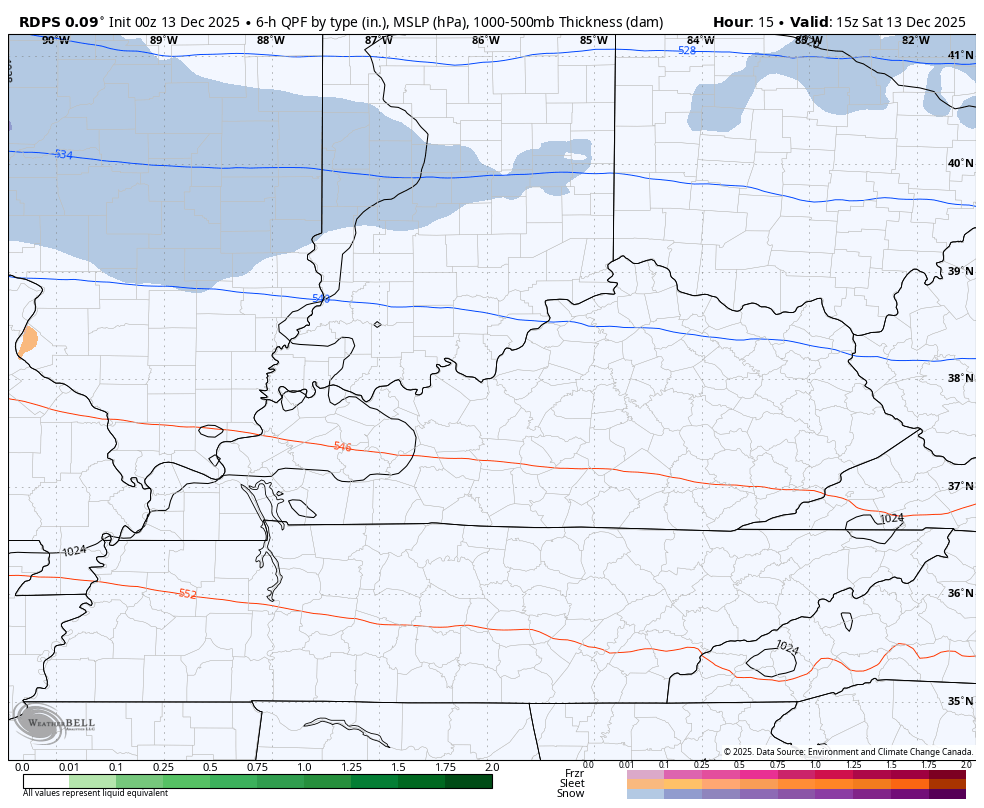
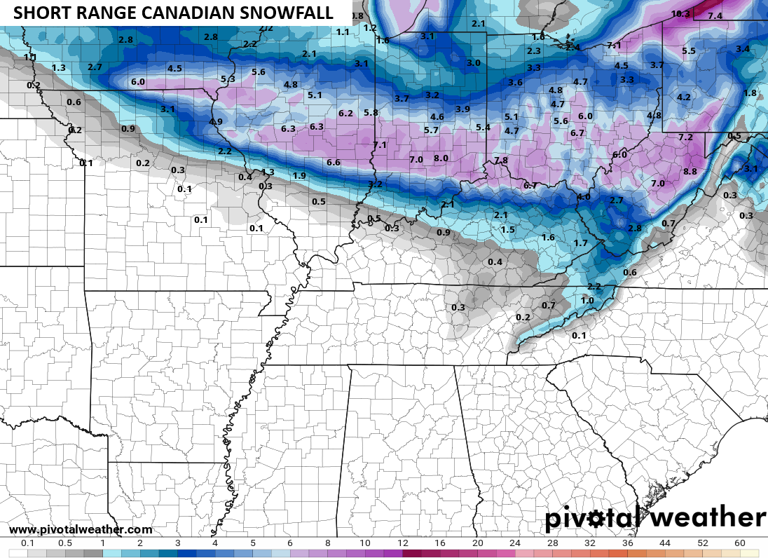
In terms of the models, the Canadian fam really looks like more snowfall forecast. Here’s the Short Term Canadian…
You can clearly see that northwest to southeast movement that brings the heavier snows fairly far south…
The Canadian looks almost exactly the same…
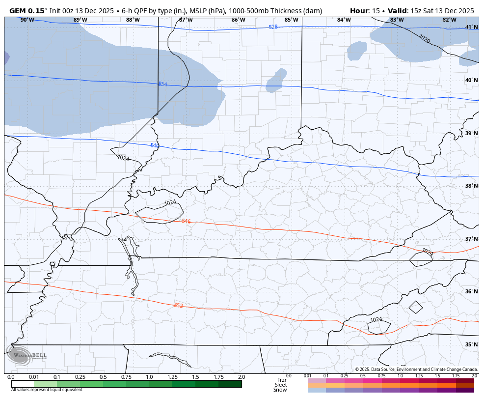
It’s actually a tad snowier…
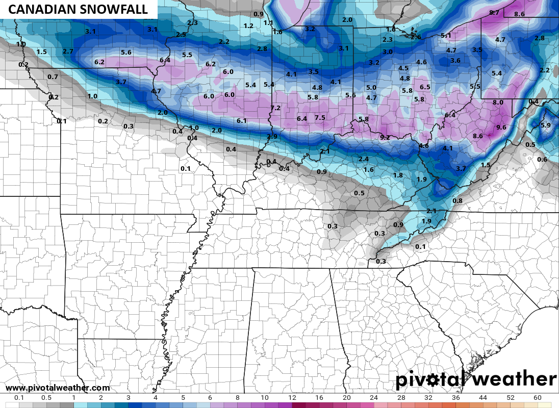

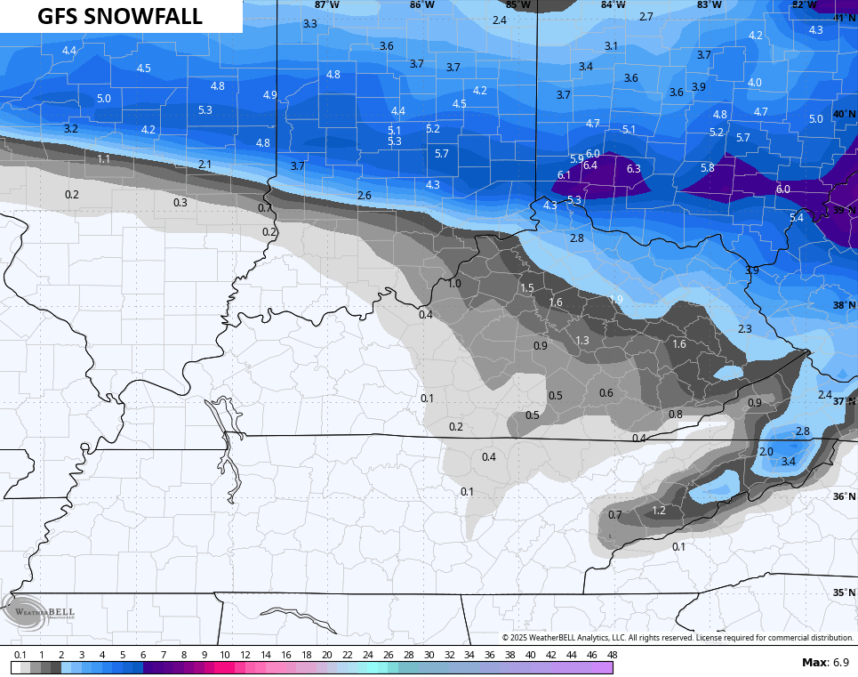
Notice where the best snows are? Along and north of a line from the Louisville Metro through the Lexington Metro to the Big Sandy Valley in the southeast.
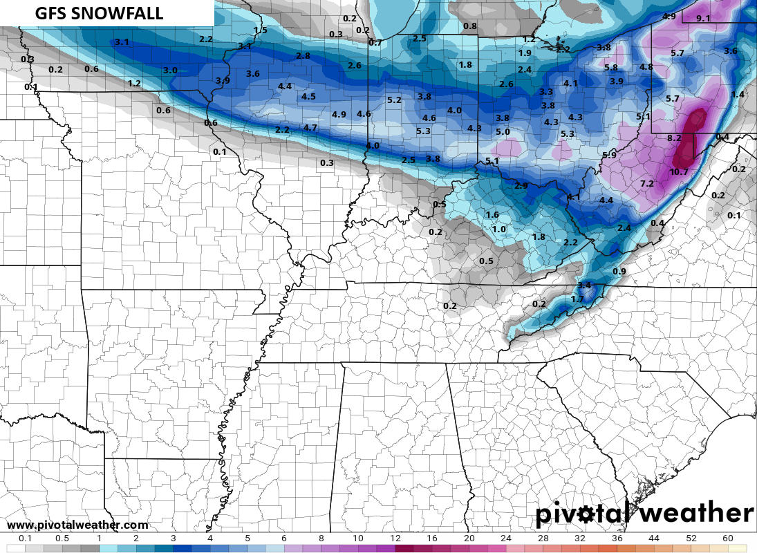
The GFS isn’t quite to that extent, but the model is certainly tending that way when compared to earlier runs…
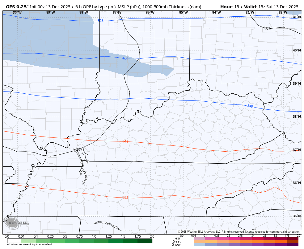
Here’s the snow map from that run of the GFS…
I would have shown the new EURO but it hasn’t updated tonight.
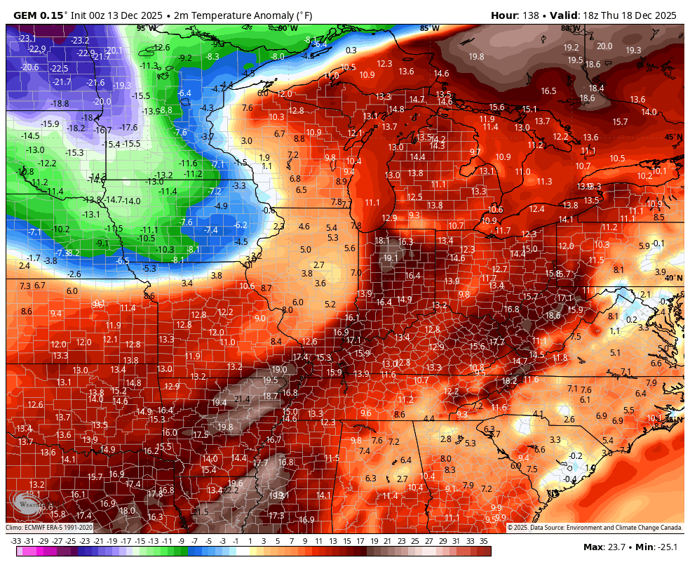
BITTERLY COLD TEMPS SATURDAY NIGHT THROUGH MONDAY MORNING
- This is a dangerously cold air mass.
- Wind chills can drop to -10 to -20 at times by Sunday morning.
- Wind chills stay around zero or as low as -10 through the day into Sunday night and Monday morning.
- Actual air temps will range from -5 to 5 above in several areas for Sunday lows and then again for Monday lows.
- High temps Sunday may barely get into the low and middle teens for areas with snow on the ground.
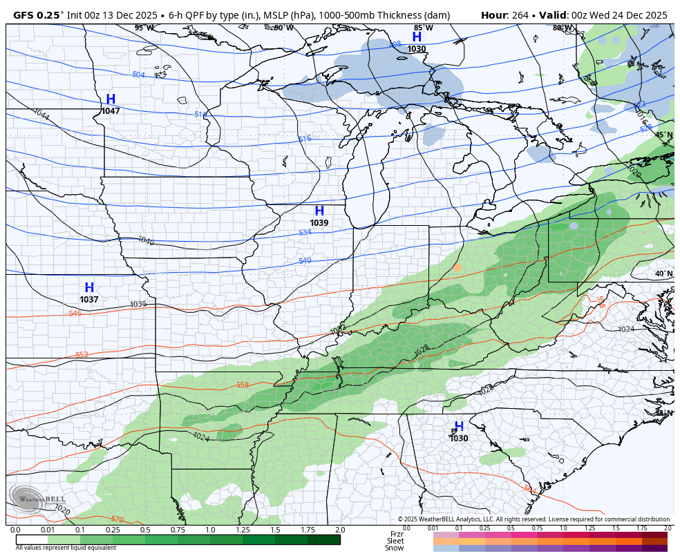
This brutal start to December has been one for the books with record snows with temps well below normal. Thankfully, this pattern will relax some by the middle of the week, but we are already seeing signs the winter setup does not want to just die off.
A cold front moves through here with rain for a change on Thursday. Much colder air sweeps in behind that with the chance for some snow showers and flurries by Friday…
The Canadian Model is even seeing some Barney behind it…
The pattern setting up is indeed a warmer one but it looks to me more like a gradient pattern with lots of cold still available in Canada and into the northern tier of the United States. We will have some warmer shots in the run up to Christmas, but I’m wondering if that cold air to the north presses more to the south. We are actually seeing some of the operational models picking up on this gradient with a potential storm system or two…
Your full update comes later tonight. I’ll also have a few updates on my Meteorologist Chris Bailey Facebook Page
Until then, here are your tracking tools for the day…


Make it a great Saturday and take care.

I hope it doesn’t press south.
Don’t worry Jeff it wont. It wont be much of a winter for some including WKY.
Thanks Chris. Yesterday, we had an inch and a half of wet Snow. It was beautiful, but was all melted and gone by late afternoon. Not liking the brutal, dry and frigid Arctic Air that’s on the way. Just adds to my heating bill. ( UGH ! )
Here’s the latest from the Climate Impact Company : )
https://climateimpactcompany.com/u-s-week-2-4-outlook-warm-u-s-pattern-ahead-while-frigid-weather-is-locked-in-canada-2-2/
Why is the coming pattern flip to warmer weather being ignored? No white Christmas to come.