Good afternoon, everyone. Our northern Kentucky winter storm is kicking into high gear as it pushes to the east-southeast through tonight. This will unleash bitterly cold air across Kentucky from tonight through early Monday.
A Winter Storm Warning continues into the far north with a Winter Weather Advisory for a large chunk of real estate south and southeast of that…

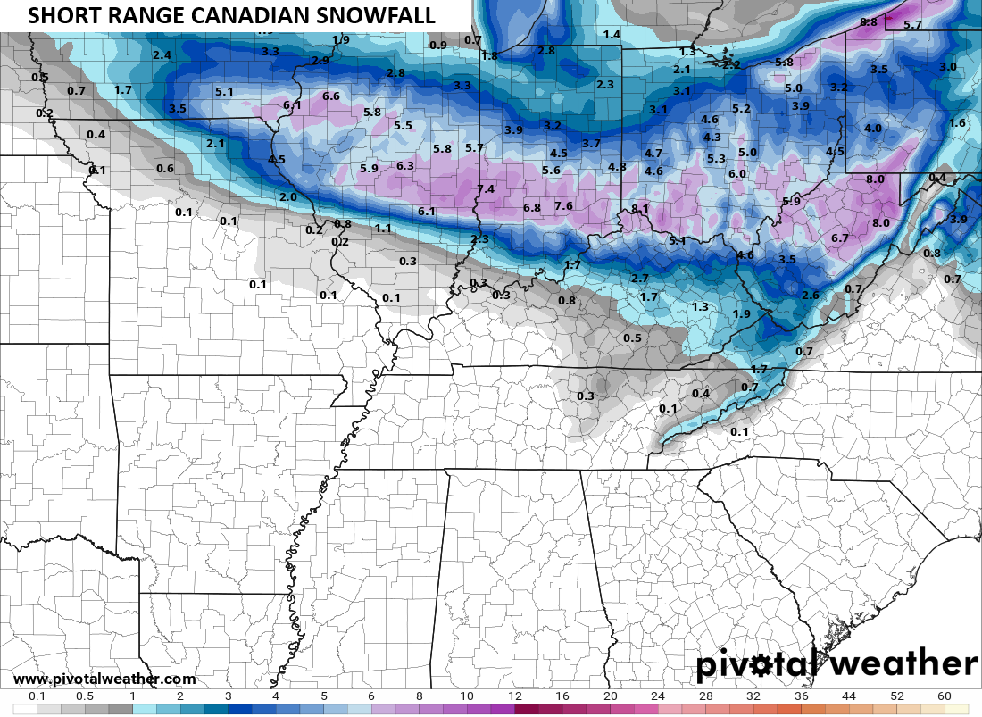
Most of the morning model runs took a turn toward the Canadian Models of the past few days. The Short Range Canadian and the regular old Canadian continue to show a healthier snow shield farther south…

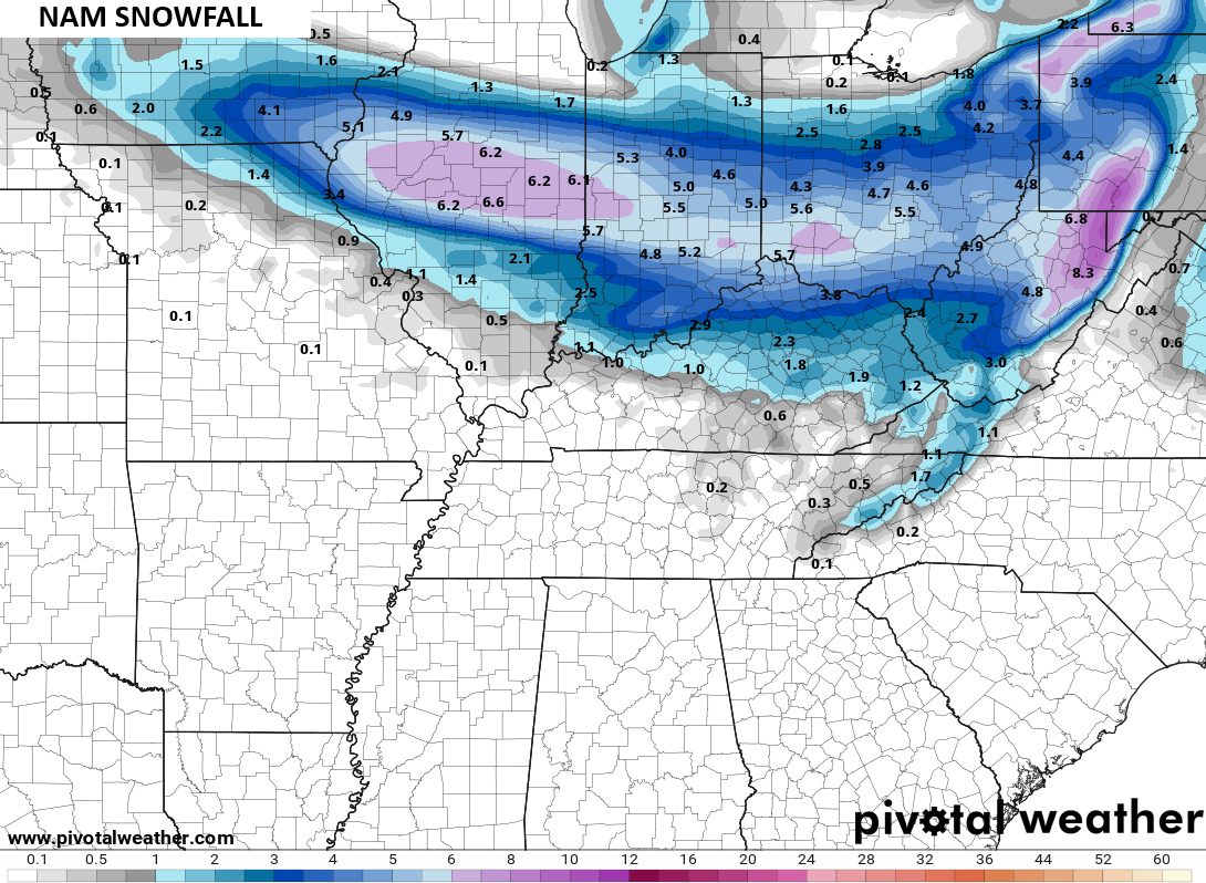
The NAM may be even a smidge south of that with the southern edge of the snow…
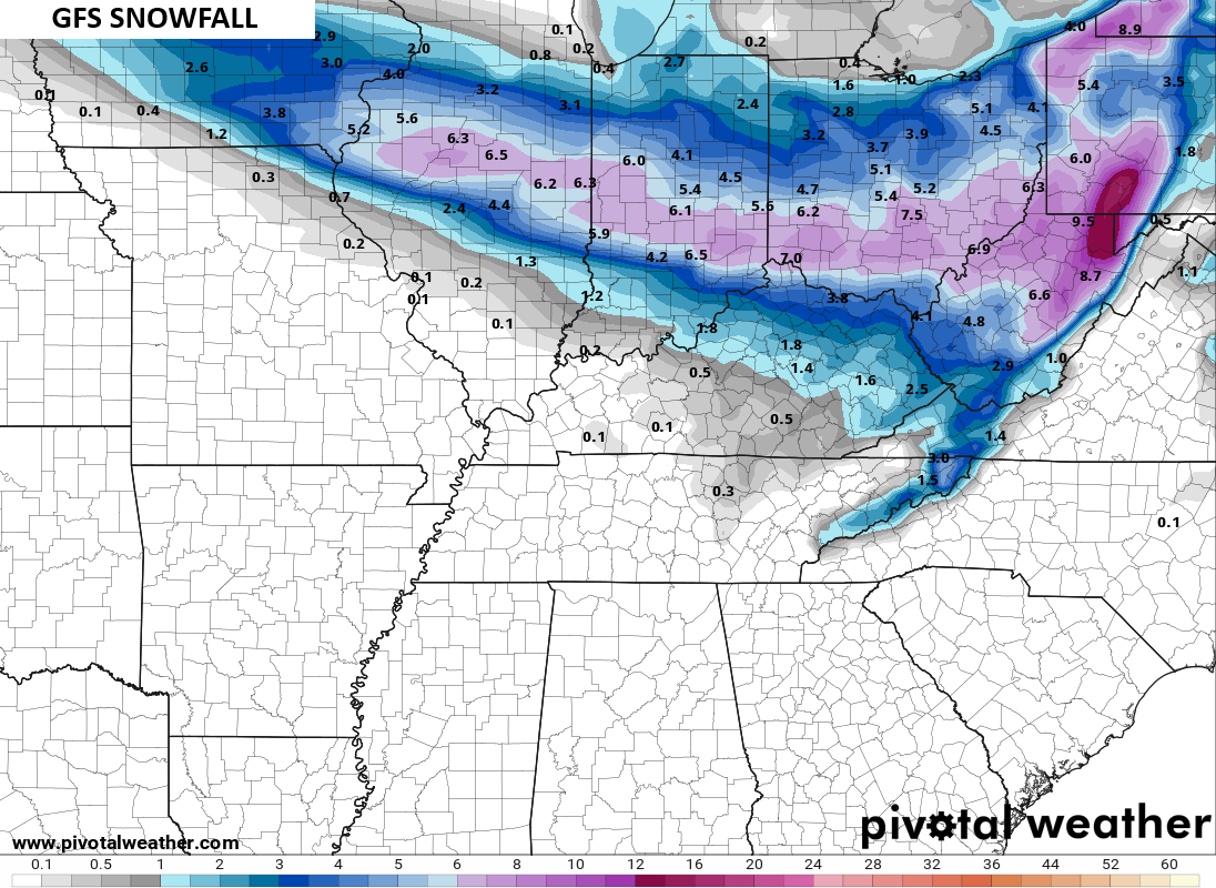
Even the GFS went a bit south…
The RPM was barely grazing Kentucky with any snow but it went south too…
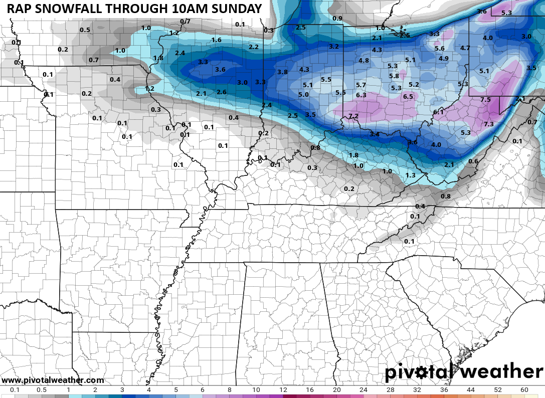
Much of that matches the original call for snowfall…

Still, I’ve decided to tighten that up given what I’m seeing now…

Now, watch the original map work out better than the updated one.
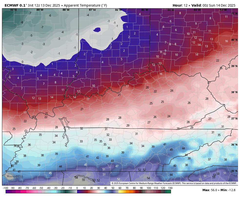
The bitterly cold air crashing in behind this system takes lows into the singles tonight with dangerously cold wind chills. Here are the Euro Wind Chill temps from 7pm this evening through 9am Sunday…
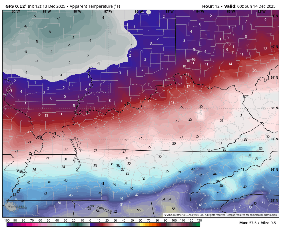
The GFS during the same time…
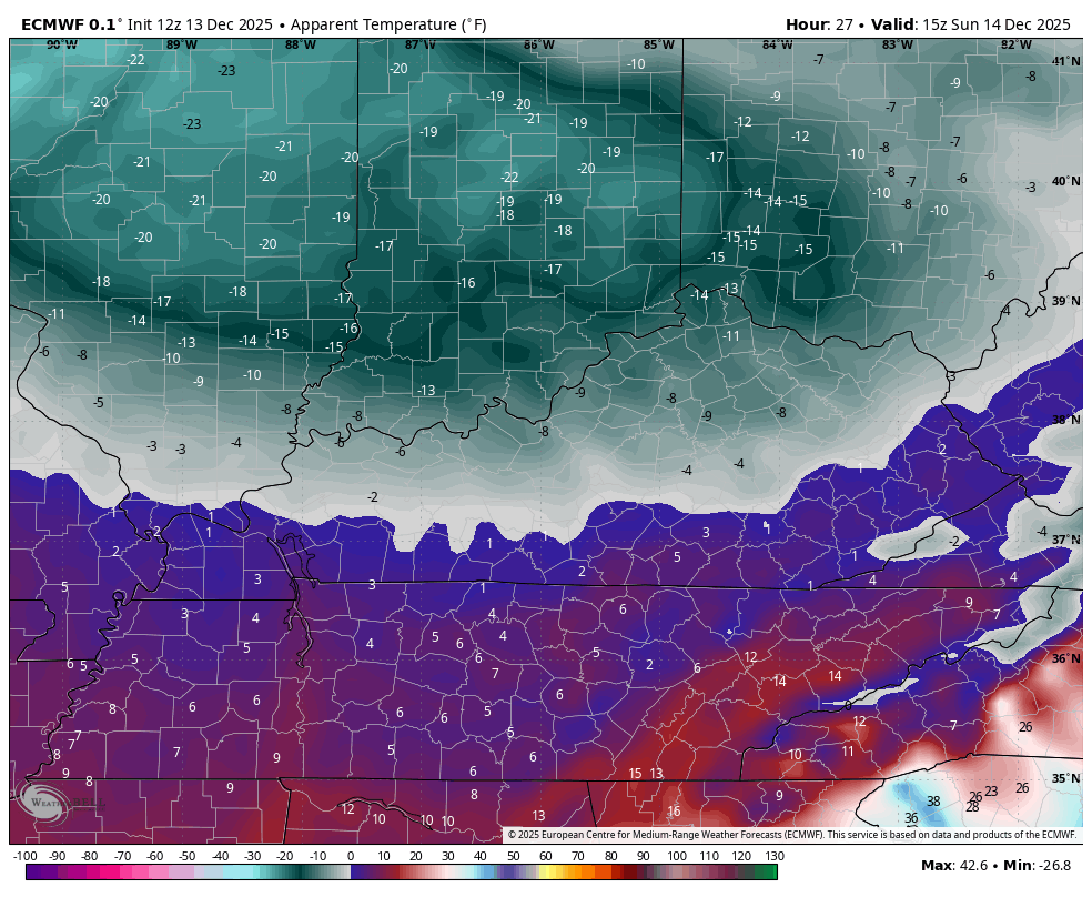
The EURO Wind Chill numbers from 10am Sunday through 7am Monday…
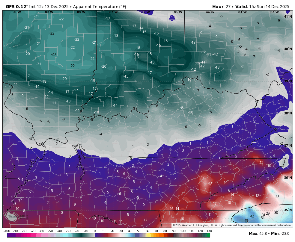
The GFS during the same time…
Another update or two comes your way later today. I’ll also have a few updates on my Meteorologist Chris Bailey Facebook Page
Until then, here are your tracking tools for the day…


Make it a great Saturday and take care.
