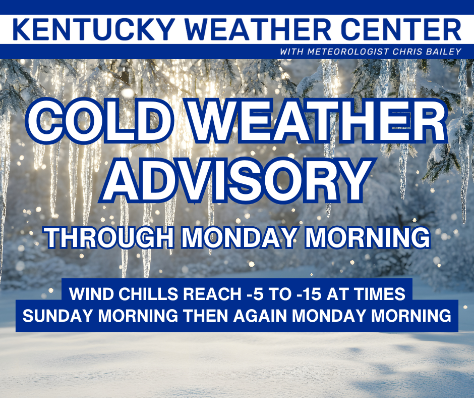
Good evening, everyone. Our winter storm continues to lay the smackdown on northern Kentucky as the impact spreads farther south and southeast this evening. The brutal cold coming in behind this will be life-threatening for anyone caught outdoors for a prolonged period of time.
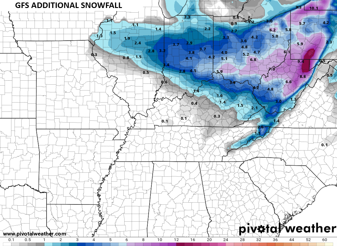
It’s late in the game for model-watching, but it is noted the GFS came quite a bit south with the late afternoon run. Here’s the additional snowfall from the time the model was run…
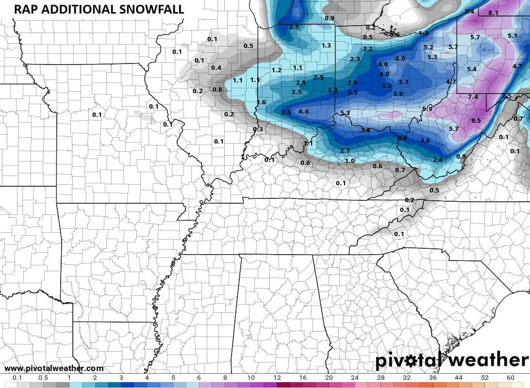
The RAP updates every hour so it has better information in it. It REALLY came farther south into the Bluegrass Region …
Here are your Winter Weather Alerts…

You can track also catch the light snowfall playing out on our Kentucky Weather Cams .
The bitter cold is taking hold and continues through the weekend into Monday morning…
Another update may come your way later today, so check back. I will also have a few updates on my Meteorologist Chris Bailey Facebook Page
Until then, here are your tracking tools for the day…


Make it a great evening and take care.
