Good Sunday, everyone. Our high impact travel winter storm is pulling away and it’s leaving a bitter taste in our mouth… Bitterly cold that is. This is a brutal blast of cold out there today into Monday before we thaw out for a few days.
The impact from this latest winter storm was about what I thought as this system did indeed bring snow way farther south than many models and forecasts were showing. The weather community has got to stop relying on some of these new Hi Res forecast models. They are unproven to begin with and they have truly been awful with each snow event so far. And this new Blend of Model thing that’s out there? No. Just no.
Here’s a breakdown of the weather through Monday:
- Many roads are snow-covered this morning and will stay that way for a while as temps make it tough on road crews.
- A few snow showers and flurries will linger early today across the central and east.
- Temps this morning range from near -5 to 5 above for areas with snow on the ground.
- Wind Chills are DANGEROUS as they reach -5 to -15 in many areas. Slightly colder numbers may show up in the north.
- Highs this afternoon generally range from 10-15 degrees for areas with snow on the ground.
- Wind chills today stay in negative territory for much of the day.
- Lows tonight and Monday morning are back to -5 to 5 above with a wind chill from 0 to -10 to start Monday.
- Temps stay frigid but aren’t brutal for the rest of Monday.
- I expect we see widespread snow/cold days for Monday.
This arctic blast is the coldest this early in December since around this same time in 2010. If you recall, 2010 was one of my top analog years for this year’s winter forecast.
The first half of December will go down as one of the coldest and snowiest starts we’ve ever had to Meteorological Winter here in Kentucky. Yes, it’s been THAT extreme compared to normal.
We are coming out of this extreme pattern, but it’s only a relaxation in my eyes and we are already seeing the models backtracking on the extent of this break.
For instance, several days ago, the deep trough diving in here by late next week was nowhere to be found. Instead, most models had a huge ridge across the east. This trough keeps looking deeper and colder as we get closer. Stop me if you’ve heard that one before over the past month or so.
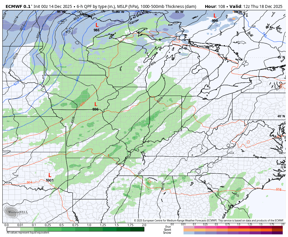
The surge of milder coming by Wednesday and Thursday gets wiped out with this system. Here’s the EURO…
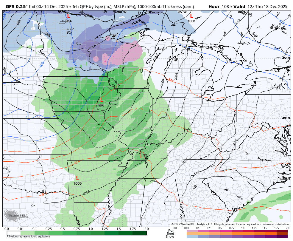
The GFS sees it and another system right behind it late next weekend…
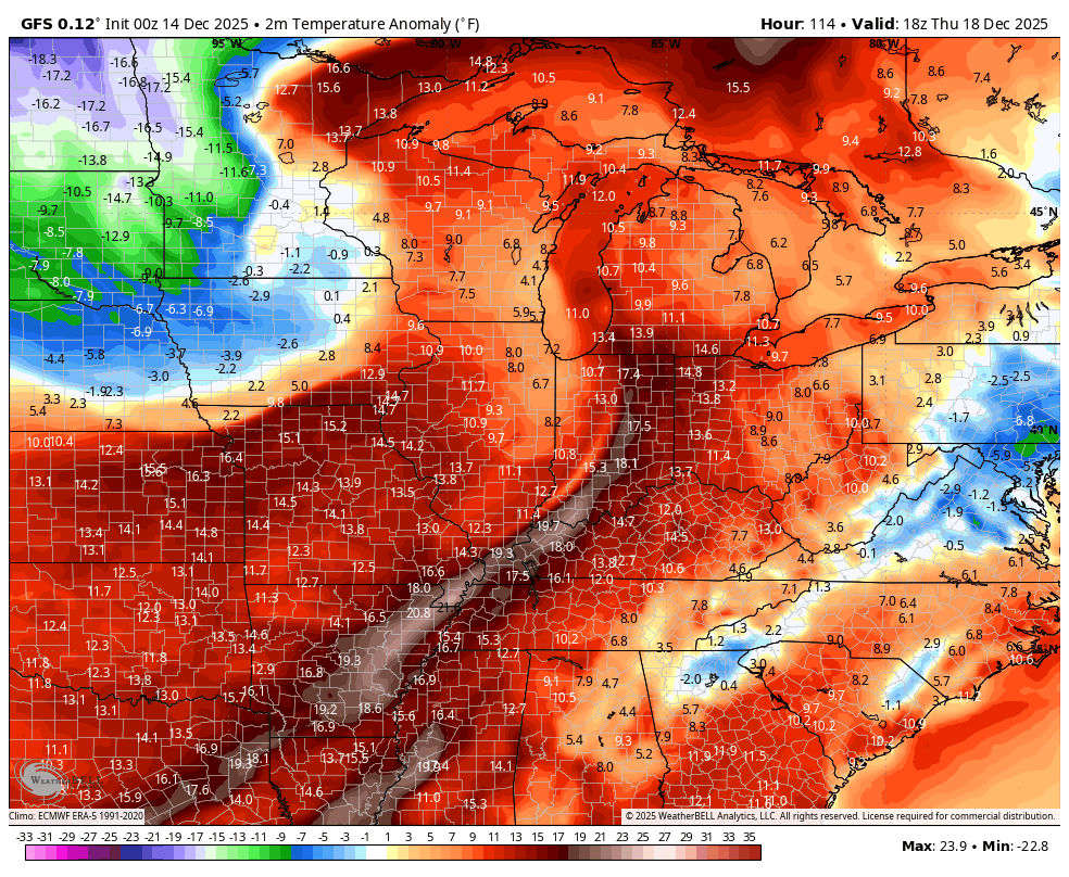
Big temp swings show up with those…
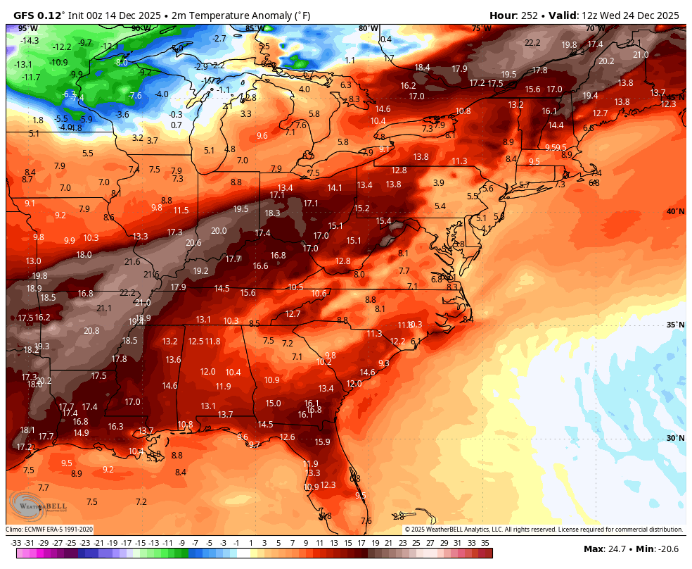
While this relaxing pattern will skew much warmer, some of the models continue to suggest winter tries to fight back. Here’s Christmas Eve through Christmas Weekend on the GFS…
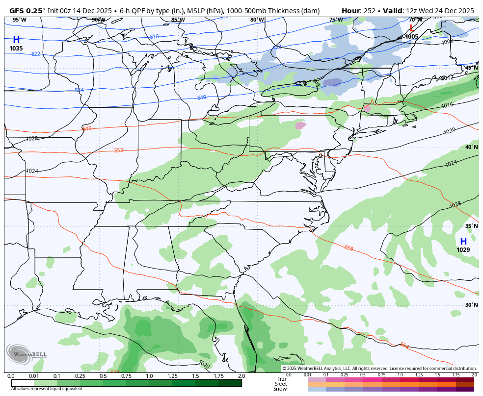
Temp anomalies during that time…
Now, we are seeing all the models suggesting something similar on a run or two before flipping. Typically, when I see that, it gets me intrigued about the potential for a nice little fight.
Another update may come your way later today, so check back. I will also have a few updates on my Meteorologist Chris Bailey Facebook Page
Until then, here are your tracking tools for the day…


Make it a great evening and take care.

Bowling Green missing ALLLLL the snow!
The “bubble” has been working overtime.
Meh. The mild will win for longer than you want to believe.
Right Jeff, I read about this in today’s article from the Climate Impact Company. A pattern shift is about to take place over the CONUS. Cold and Snowy over the Northwest, down towards the Rockies. Warmer, drier weather in the Ohio Valley, and Southeastern areas through January 2026. Colder, Snowy events will return only to the Northern states, and the Northeast maybe in late Winter. After this week, is the chances for a Snowy pattern over for our area ? If so, it was a very short Winter weather pattern, and Winter hasn’t even started yet. Astronomical Winter. Our Spring looks to be stormy,as we phase to ENSO / neutral sometime late this Winter. Maybe we could have one of those Heavy wet Snow events ? Here’s the link : )
https://climateimpactcompany.com/u-s-daily-feature-mjo-is-now-quiet-stratosphere-colder-therefore-milder-u-s-pattern-ahead-but-there-are-caveats-2/
You seem to be having a lot of trust in anything long range when we’re lucky to be able to trust any model even 3 days out.
I agree with Chris regarding those blended models. Long range and mid-range forecast accuracy for the individual models has been horrendous, which is why hoping to increase forecast accuracy by combining those suspect models is doomed to failure. Sort of like trying to bake a cake using all the wrong ingredients.
I also agree that after a brief respite, we’ll be dealing with another arctic outbreak, courtesy of a stretched polar vortex.
Lake effect Snow Scene : )
https://www.ventusky.com/webcam-313167075