Good evening, everyone. The coldest blast of air this early in winter in 15 years continues to keep Kentucky in the ice box. This brutal cold hangs into the start of the week before we come out of the extreme pattern and go into more of a back and forth setup for a spell.
Temps out there this morning were as cold as we thought. Keep in mind that the actual lows for today will likely occur this evening before midnight, but here’s what we woke up with on our Sunday…
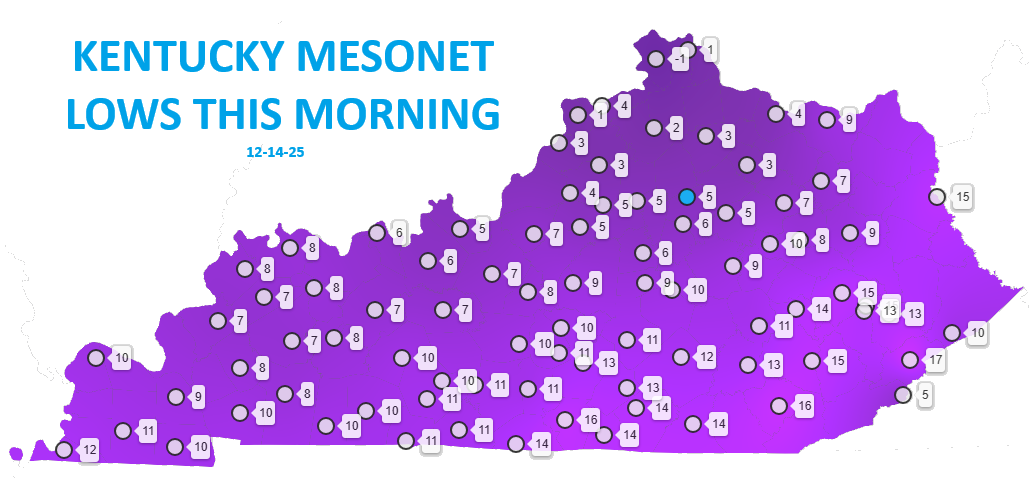
Lows tonight will be back into the -5 to 5 above range with wind chills from 0 to -10 into early Monday.
Temps start to rebound later Monday and then really jump for the middle of the week. Winds are going to crank from the southwest with gusts topping 40mph by late Wednesday into Thursday. Temps spike ahead of a strong cold front dropping in from the northwest. That has showers and some thunder ahead of it for Thursday with crashing temps and some Friday flakes.
The Canadians are all over this…
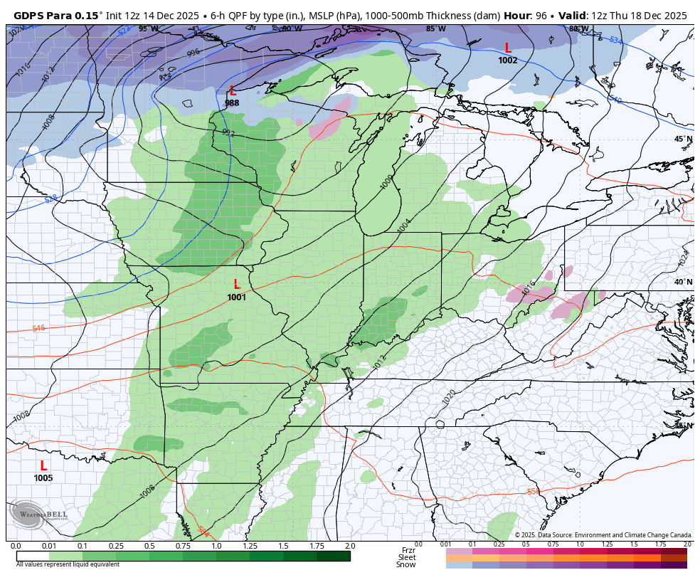
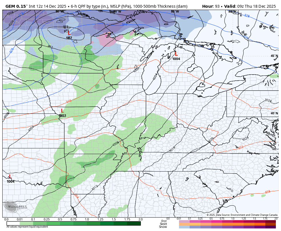
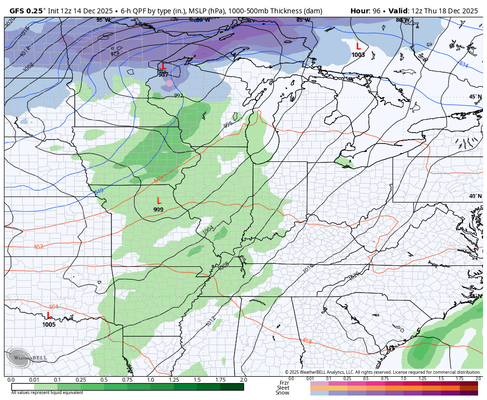
The GFS has a similar look with a quick rebound in temps for Saturday and another cold front and temp drop by Sunday…
A few days ago, the forecast models didn’t see wither of those fronts and cold blasts. Caution is strongly advised going forward as this is only a relaxation to a back and forth pattern. Winter may come crashing right back in to flex before the month is over and into January.
I’ll get into all that later tonight. Have a great evening and take care.
