Good Sunday to one and all. Arctic cold wind chills are back in the Bluegrass State and we have more of these cold numbers in the next few days. Once into the middle of the week, we find our next winter weather threat with a much bigger system possible next weekend.
Wind chills are flirting with zero this morning and stay in the teens all day. We have a mix of sun and clouds for much of the day with some early flakes in the east.
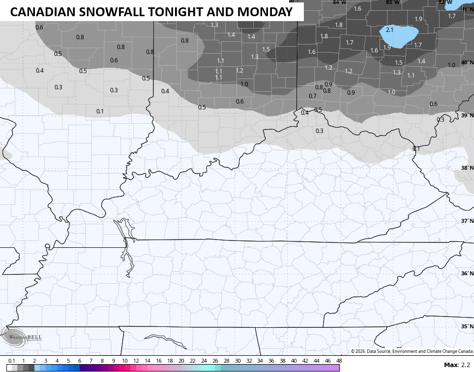
Another arctic cold front moves in later tonight into MLK Day Monday. The majority of light snow stays to our north, but a quick-hitting batch of light snow may sweep across northern Kentucky. The Canadian sees this…
Bitterly cold wind chills come in behind this with the chance for negative numbers showing up. This wind chill forecast goes from 7am Monday to 7am Tuesday…
The next system moves in Wednesday and Thursday and may come at us in two different waves. This can bring snow and a mix back into the region with the chance to put some snow down in our region.
You can see these two waves on the Canadian…
The system coming in after that next weekend has the potential to be a widespread winter storm that stretches from the southern Plains through the Ohio Valley into the Mid-Atlantic. The setup features brutally cold air across the northern tier of the country with low pressure riding from west to east underneath it.
Given this is almost a week away, all the models are jumping around but they have the signal.
Here’s the Canadian…
The EURO and the one behind it…
That bitterly cold air then settles into the eastern half of the country to end January. The EURO Ensembles are about as they can get from this far away. This is a lot of Barney for the average of 50 members…
The average snowfall from the same run isn’t shy…

Looking toward the second half of winter, it’s likely to turn out colder and snowier than my winter forecast had. The EURO weeklies continue to love the idea of significant blocking over the high latitudes and along the west coast of North America. Here’s the average 500mb height anomalies that go through the middle of February…
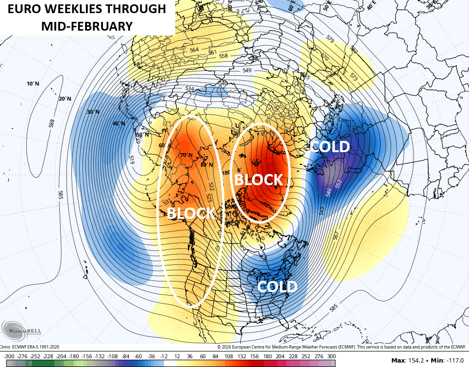
Notice the deep trough into the eastern half of the country with another deep trough over Europe. Cold waves for two major population centers of the world at the same time could make for some significant disruptions.
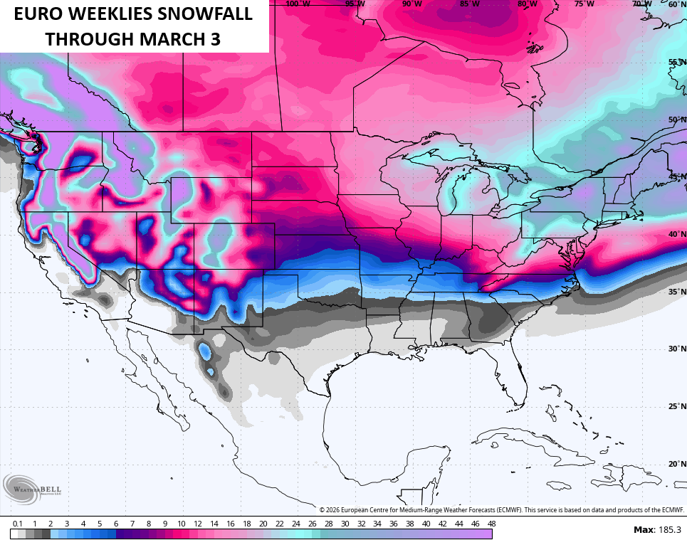
In terms of snowfall, the EURO Weeklies continue to be pretty jazzed up…
Another update or two comes your way later today.I’ll also have a few updates on my Meteorologist Chris Bailey Facebook Page
Until then, here are your tracking tools for the day…


Make it a wonderful Sunday and take care.

Those EURO weeklies won’t verify.
Probably Not. The European Model Is Or Was The most Accurate For Predicting Snowstorms Across The CONUS. This La Nina Winter Has Really Confused All The Models, Except the Canadian Model, As Chris Pointed Out Yesterday. Maybe Our Snow Chances Will Increase Later This Month Into Mid – February, But I Still Expect A ” Yo Yo ” Effect With Temperatures Through The Period.
It’s going to be freezing cold with snow for the Bears/Rams playoff game at Soldier Field tonight. Gametime temps are expected to be near 15 degrees, with a wind chill of below zero and snow falling. Around an inch of snow is expected. It will only get colder and windier as the game progresses. Definitely Bears weather!
What will the Bears do for an encore after their amazing, spectacular comeback win over Green Bay last week? Go Bears!
Enjoy The Games Mike. I Don’t Think I Would Be Able To Take The Frigid Temperatures. This Is The Coldest Day We Have Had. Right Now, The Temperature In Maple Is 19 degrees, With Clear Skies. Looks Good From The Inside. Winter So Far Has Been Disappointing In The Way Of Accumulating Snows In My Area Of The State.
Rams for the win.
https://dknetwork.draftkings.com/2026/01/18/nfl-playoffs-parlay-trends-los-angeles-rams-vs-chicago-bears-1-18-26/
https://climateimpactcompany.com/u-s-early-notes-high-wind-event-western-great-plains-to-texas-today-some-northeast-u-s-snowfall-and-expected-snow-cover-expansion-2/
And we wait to see if next weekend pans out we are at risk of some snow
Hopefully We Will This Time ?
Me too Schroeder winter isn’t no fun with no show snow. Lol.
Amen Winterlover