Good evening, everyone. Snow showers continue to push across Kentucky as arctic air pours in from the northwest. This brings in bitterly cold wind chills for the next few days before snow chances show back up by the middle of the week.
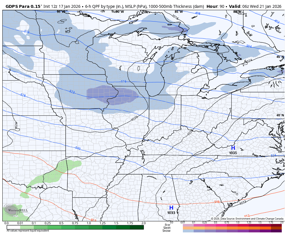
The Parallel Canadian is in and shows the Wednesday/Thursday system coming at us in two pieces with another showing up under that over the weekend…
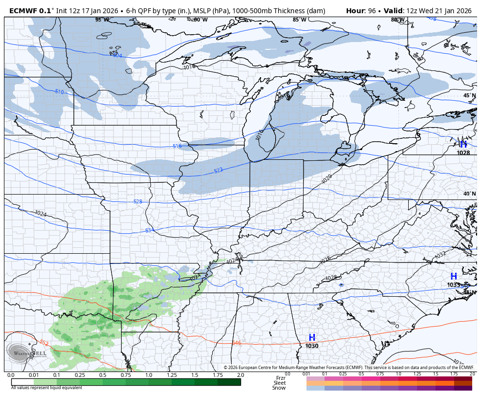
The EURO has a lighter Wednesday/Thursday system but has two stronger systems behind it next weekend into early the following week…
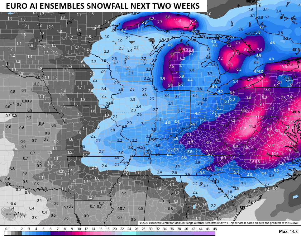
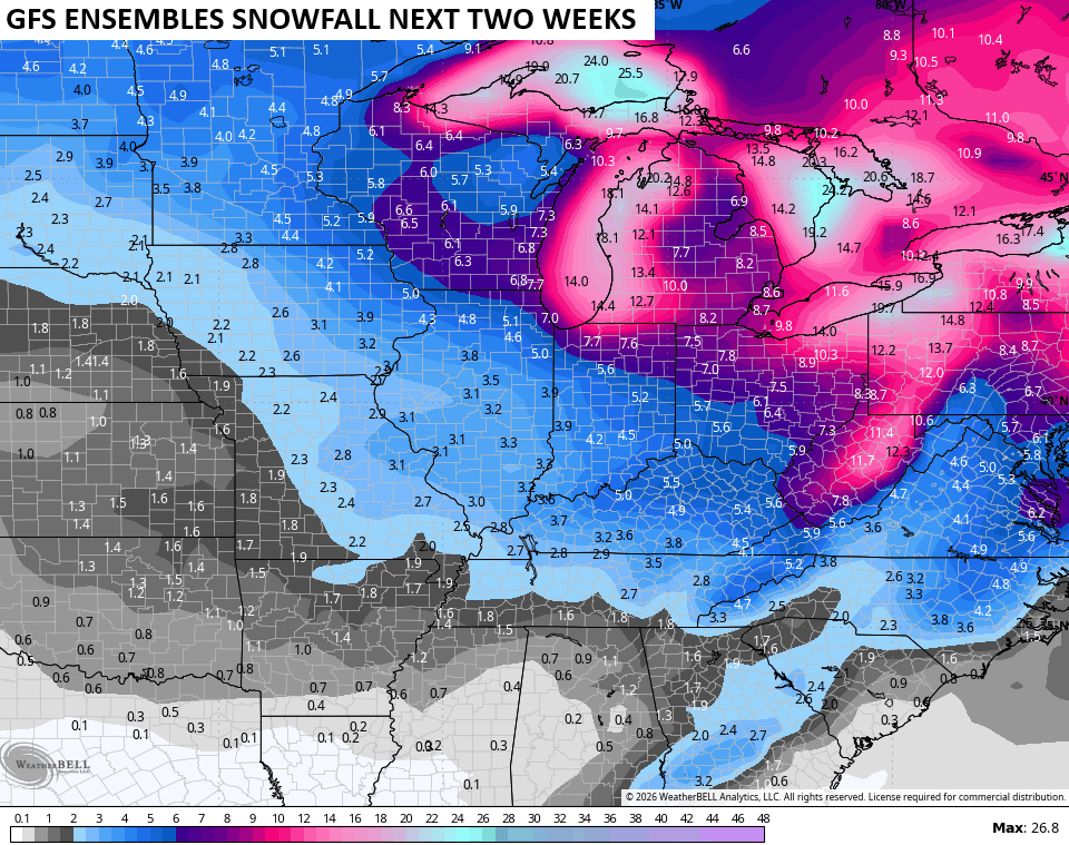
The various ensembles like the snow chances over the next two weeks…
I will dive into all that later tonight. I’ll also have a few updates on my Meteorologist Chris Bailey Facebook Page
Until then, here are your tracking tools for the day…


Make it a sensational Saturday and take care.
