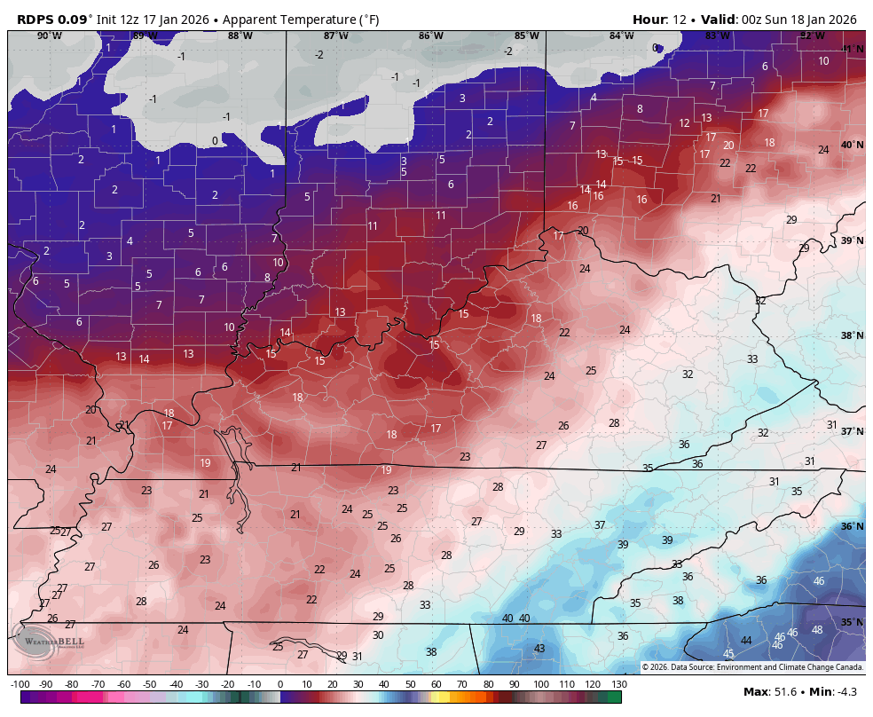
Good afternoon, everyone. I wanted to stop by for a quick update on the arctic front slamming in from west to east today. This is set to bring snow showers, snow squalls and bitterly cold wind chills for the next several days.
The family of the Canadian Model are on one of the hotter winter weather streaks I’ve seen from a model. You guys may remember how it nailed every snow system back in December and it just did it again with the stuff Friday and last night.
While the American Models were going all in on a big snow event for many, the Canadian fam said nope, keeping some rain going long enough to prevent that. I even said the Canadian is why I’m not going toward all the other models and sure enough, it was spot on again.
Until it shows me otherwise, unless it’s a hiccup run that corrects itself quickly, we will ride the Canadians within 2-3 days of an event.

With today’s arctic front moving in, the Canadian is firing up some decent snow showers and snow squalls for central and eastern Kentucky. These show up from late afternoon into the wee hours of Sunday morning…
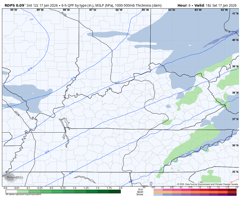
This unleashes bitterly cold air with wind chills flirting with 0 by Sunday morning…
Another push of arctic air arrives on MLK Day with brutal wind chills coming in behind it. This animation starts are 7am Monday and goes through 7am Tuesday…

The setup after this brings our next snow threat in here Wednesday into Thursday. That’s followed up by a bigger potential next weekend. The aforementioned Canadian…

Another update or two comes your way later today.I’ll also have a few updates on my Meteorologist Chris Bailey Facebook Page
Until then, here are your tracking tools for the day…


Make it a sensational Saturday and take care.

“The Future : A Hybrid Approach : )”
” Intergration, Not Replacement : )”
“Organizations Like NOAA Are Intergrating AI Models ( Like Google DeepMind’s ) Alongside Physics – Based Systems, With Forecasters Using Whichever Tool Performs Best For Specific Situation. ”
” Enhanced Capabilities : )”This Combination Allows For Better Handling Of Everything From Seasonal Outlooks To Short -Term Severe Weather Warnings, Creating A New Era Of Forecasting. “
Hearing our snow potential for statewide is next weekend again we shall see