Good Monday, everyone. It’s a frigid MLK Day across the Commonwealth as even colder wind chills settle in through early Tuesday. From there, this pattern turns harsh as much of the country goes into the deep freeze with the potential for a major winter storm to impact a lot of people this weekend.
Does that include our region? We are certainly in the game.
We have some action before we get to that storm, so let’s focus on this first.
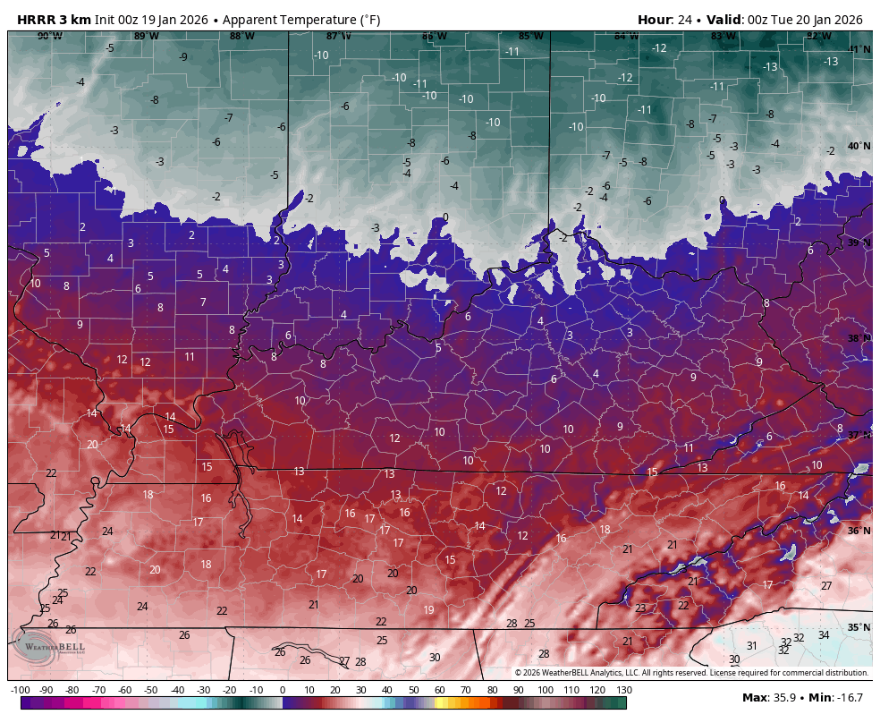
Another arctic front sweeps across the Ohio Valley today, bringing some early day flakes to the north and northeast. Temps may actually drop some through the morning with te numbers generally staying in the upper teens and low 20s for many. Wind chills today are brutal, and this animation shows what I’m talking about. This runs from 7am to 7pm…
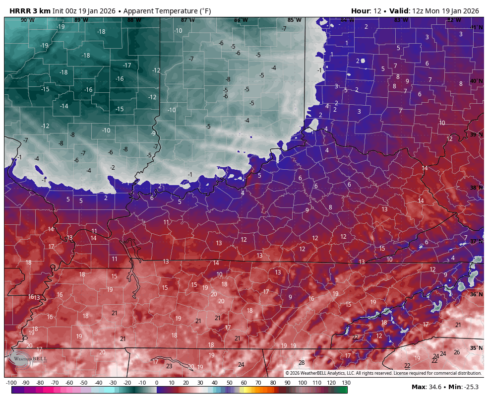
Those wind chills then hit the 5 below to 5 above range tonight and Tuesday morning…
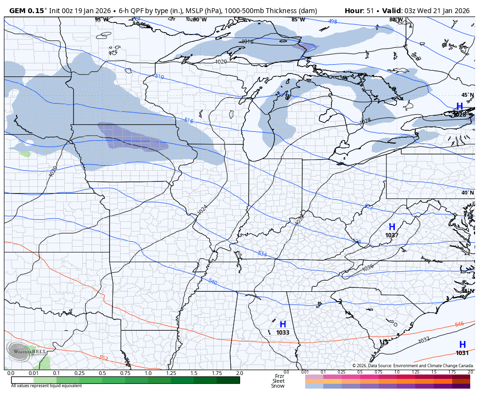
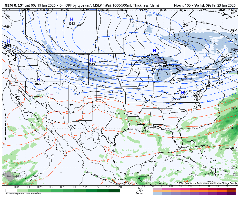
A couple of light systems sweep through here Wednesday into Thursday with the chance for some snow and a mix, depending on where you are. The Canadian shows the light stuff…
This brings us to the part of the weather program that will feature a headline making winter storm and brutally cold air. Here are a few things to know:
- The timeline on this is late Friday through early Monday with the exact arrival and departure times a work in progress.
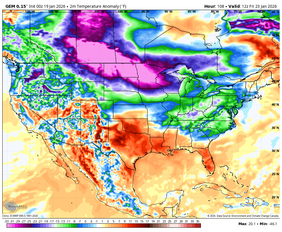
- Brutally cold air sweeps into the northern half of the country later this week and slowly presses south and southeast.
- The exact positioning, strength and timing of this brutal cold will be the main player on where a southern storm system tracks.
- The arctic boundary is active with a low pressure or two rolling along it from southwest to northeast, pulling up a tremendous amount of moisture.
- This is a setup we haven’t seen in a while and may very well feature a massive amount of snow and ice showing up continuously from Texas to the east coast.
- Areas getting in on snow from this may experience snowfall ratios off the charts as temps right behind this boundary will be in the single digits and teens.
- Low temps can go below zero over the weekend and early next week with dangerously cold wind chills possible.
- Given the POTENTIAL magnitude of this system, a Winter Storm THREAT may be required soon.
The signal continues to be there on all the models with the usual variations from run to runs. Some runs will be north, some south, some stronger, some weaker… All that’s to be expected for the next few days before things settle into place.
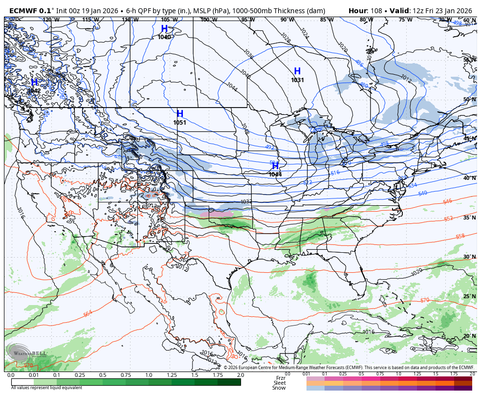
You know it’s a massive system when the only way I can show it is by using a map of the lower 48 for the models…
EURO
The Canadian Models aren’t even seeing eye to eye with the regular Canadian pushing farther south…
While Parallel Canadian runs a lead low to the southern Appalachians, resulting in major ice and snow…
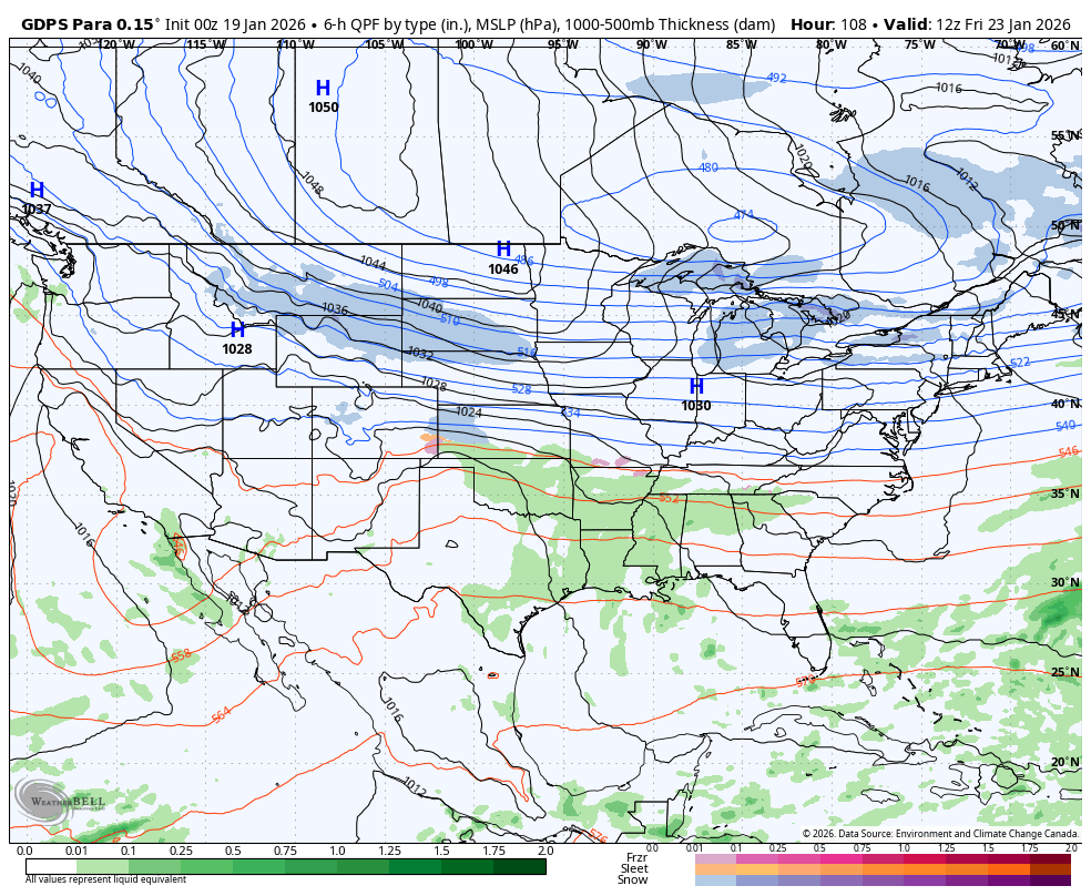
The GFS AI is trying something similar…
The setup on those last two models looks like a colder version of the system that hit us in early January last year and shut us down for a bit.
Several updates come your way today. I’ll also have a few updates on my Meteorologist Chris Bailey Facebook Page
Until then, here are your tracking tools for the day…


Make it a magnificent Monday and take care.

OLD SCHOOL!!!!!I SAY coming.
It’s sad that some people down south gets some snow while western ky is in snow drought. Lol Maybe this weekend its our turn.
My thoughts exactly Winterlover….Hopefully this breaks the WKY snow drought and it doesn’t go south. That’ll really make me unhappy if it goes south and we get nothing.
Back In December, 1977 The Pacific Decadal Oscillation was A negative 0.06. In January, 1978 The Pacific Decadal Oscillation Was A Positive 0.58. We Were In A Weak El Nino, And Those That Were Around ( Not Many On The Weather Blog ) In January, 1978 Experience One Of The Worse Blizzards In Indiana History. The Wind Driven Snow Was The Most I’ve Ever Experience In My Life Time. One Couldn’t See Hardly Anything 5 Feet Ahead. The Next Morning, The Temperature Was A – 16 Degrees Below Zero, And About A 20 foot Snow Drift In Our Driveway. A Lot Of My Greenhouses Were Destroyed In My Nursery, And It Took Me Two Years To Recover.
Last Month’s Pacific Decadal Oscillation Was A Negative 1.01. If This Month’s Reading Of The Pacific Decadal Oscillation Reads Positive, Then We May Be In For A Winter Storm Later This Week. The Precipitation Type Is Undetermined At This Time. Kentucky Is In The ” Ice Belt, ” So An Ice Storm May Be In Our Future ?