Good afternoon, everyone. A Cold Weather Advisory is out for parts of Kentucky tonight and early Tuesday. Wind chills drop to below zero as the Northern Lights try to make an appearance here in Kentucky.
That’s what you guys are here for, right? There’s nothing else you could possibly be stopping by for. No? Ok, I’ll get to that in just a bit.
There’s a chance to see the Northern Lights with the naked eye tonight with a better chance to see them through a camera…
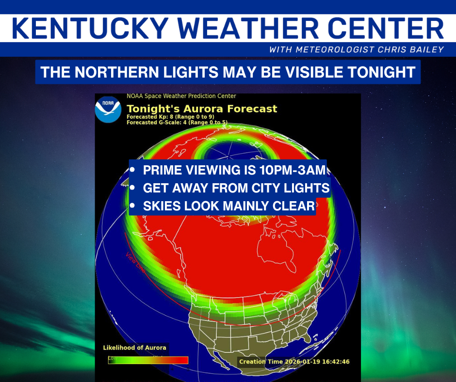
Wind chills will be brutal, so happy viewing!
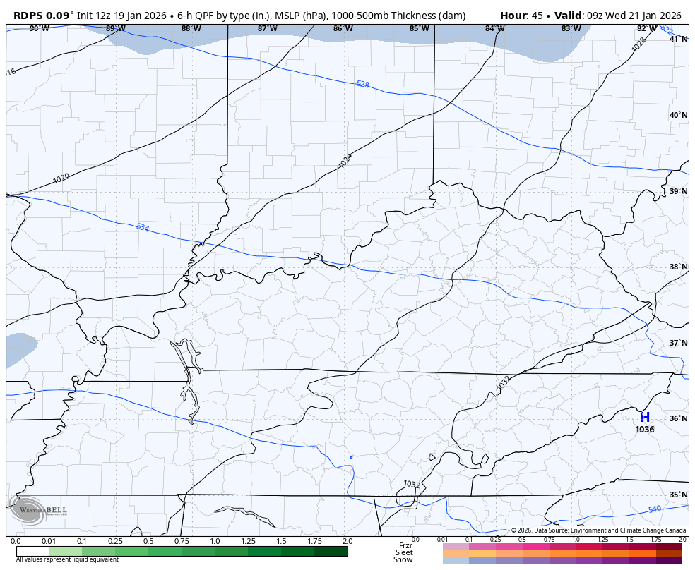
I continue to watch a light snow and mix maker rolling in here for Wednesday and early Thursday. Some light accumulations are possible from this…
Ok, let’s get to the increasing chance for a winter storm hit this weekend. Here you go with some updates thoughts:
- It’s becoming apparent this will be a major winter storm for much of the country.
- The exact location of this wide-reaching winter storm is still a work in progress.
- Looking at this, I think we get two actual storm systems.
- The first lead low likely rides into the southern Appalachian Mountains before the big daddy low takes over right behind it.
- If this is indeed the setup, look out. Significant snow and ice accumulations would show up from Friday night through Sunday.
- How much and exact details are a ways away from being known as that will all depend on the exact track of each low.
- The movement, timing and spatial orientation of the brutally cold air across the northern half of the country will be the determining factor in how much winter weather we get.
- If you want snow around here, you don’t want that high to be so fast that it crushes this storm to our south. That is NOT the favored scenario right now.
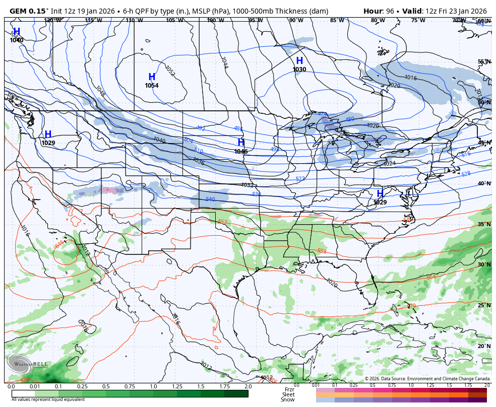
The Canadian Model is essentially showing what I just outlined. To see that strong of an arctic high pressure showing up at the exact same time as an active subtropical jet stream across the south is wild. Those two together is how legendary winter storms are made.
Here’s the Canadian from Friday through Monday morning…
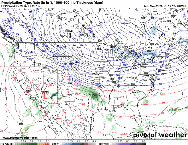
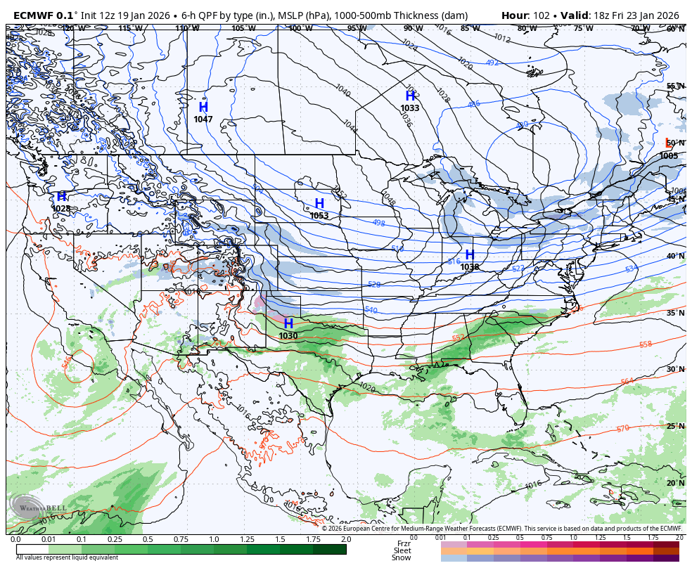
The UKMET is similar…
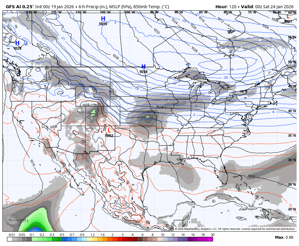
The GFS AI doesn’t show precipitation types, but you can see a similar track with the AI showing another potential storm right behind it…
That matches up well with the EURO AI…
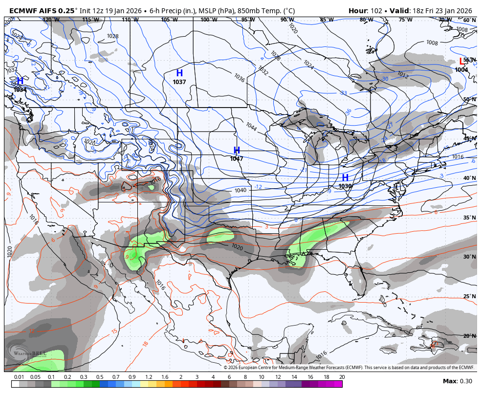
The EURO is likely a bit too slow as the bias is to be too slow ejecting energy out of the southwestern part of the country. Still, it has the overall major winter storm look…
A few more updates come your way later today. I’ll also have a few updates on my Meteorologist Chris Bailey Facebook Page
Have a great rest of your MLK Day and take care.

old school bailey……..
Thanks Chris. Back In The Early Spring 1967, Up In South Central Indiana, We Had A Brilliant Display Of The Aurora Borealis. In That State, The Flat Terrain Allows One To See For Miles Into The Horizon. The Event Took Place About Two Hours After Sunset. The Next Day We Had A Power Failure, that Was Widespread, So We Were Out Of School For That Day. Electromagnetic Pulse From Solar Flares ? By The Way, The Winter Of 1966 -67 Was Very Mild With No Major Snowstorms.
As With The Impending Snowstorm Or Ice Storm. Confidence Is Very Low On It’s Occurrence. We Shall See How This All Pans Out In The Coming Days.
Looks Like More Ice Than Snow At This Point : )
https://climateimpactcompany.com/u-s-mlk-holiday-report-arctic-air-snow-and-ice-cold-blast-east-finishes-january-2/
That’s what I am afraid of SCHROEDER in the east it’s usually cold rain or ice and I sure don’t want the ice a thumping snow would be nice and someone will get it i just don’t think it will be in my neck of the woods but I might get surprised we all might. We are overdue for a good one. Why is it when a possibility of a big winter storm shows up ice is always thrown in and not just all snow is it the low is it the temperature usually 4 or 5 degrees here makes all the difference??? That question is for anyone.
It’s Like This Crystal. We Are Still In A La Nina Like Pattern. That Means We Have Low Pressure To Our North And High Pressure To Our South. Kentucky Is Located In – between, So any Precipitation Type Is Possible. Low Pressure Over High Pressure ( La Nina ) Means that The Precipitation Type Would Be Ice ( Shallow Cold Air At The surface Only. ) High Pressure Over Low Pressure ( El Nino ) Means That The Precipitation Type Would Be Snow ( Deep Cold Air At The Surface And Aloft. ) Energy From The Negative North Merging With Positive Energy ( Moisture Bearing Gulf Low. ) Results Would Be A Snowstorm If The Merging Occurs To Our South.
Makes sense I just don’t want to be in the ice rather have cold rain thanks Schroeder
In what im getting a good chance of snow here in western ky. The problem is the system hasn’t developed yet what the data can give us exactly what’s going to happen
Jesus..Euro models are laying the smack down on ky..
PLEASE, Don’t Use The LORD NAME In Any Negative Discusion.
Spelling Correction And Sentence Restructure : OUR LORD’S NAME And Discussion.