Good evening, everyone. Bitterly cold wind chills are out there tonight as we focus on a pattern that includes a mid-week light snow system and the potential for a winter storm impact this weekend.
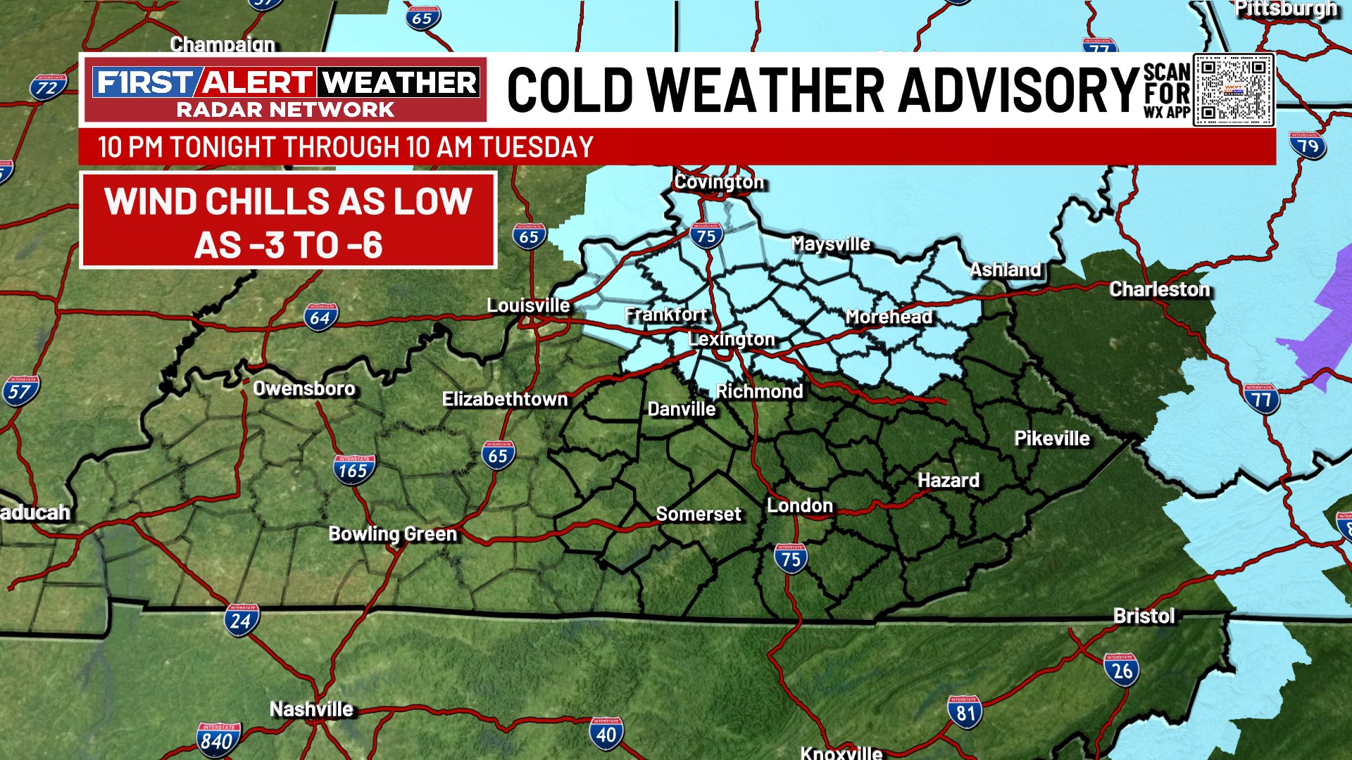
Our Cold Weather Advisory continues tonight into Tuesday morning for much of north central Kentucky. This includes the Lexington Metro north and northeast…
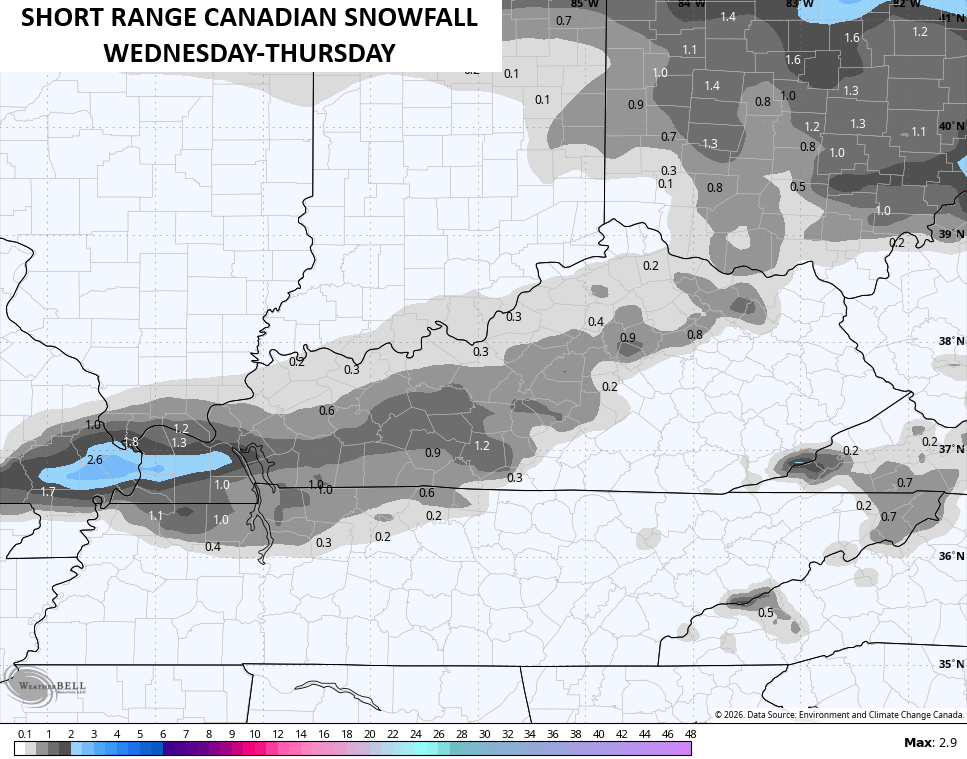
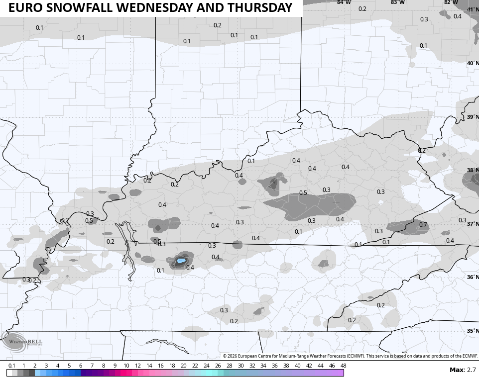
The system moving in for Wednesday and Thursday is light, but it’s likely to spit out a period of light snow and some rain, depending on where you are. As we get closer, there’s a little better signature for light accumulations, especially western and central Kentucky.
The Short Range Canadian Model shows enough light snow to potentially impact roads on Wednesday…
The EURO is picking up on the light stuff, too…
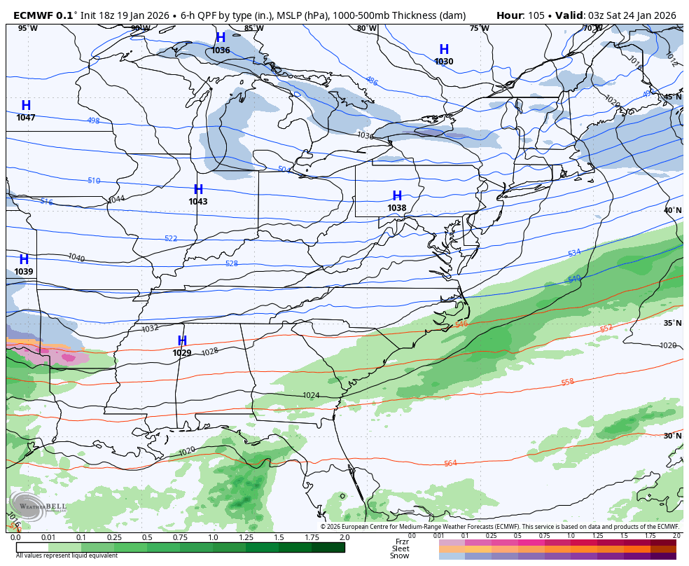
In terms of the weekend winter storm that’s set to blast much of the country, it’s still too early for specifics as the models continue to flip around enough to prevent getting the best track on this system.
The Parallel Canadian is showing one of my biggest concerns and that’s for the lead low to reach all the way into central West Virginia before the main low takes over. That kind of track brings significant snow, sleet and freezing rain into our region. Here’s what that run looks like…
The late afternoon EURO looks a lot like the earlier run of the model and is farther south with the lead low, resulting in all snow around here. This run is also much slower with the movement, but this run only goes out through 1pm Sunday…
The EURO AI doesn’t show precipitation types and is very similar. It does have more precipitation around here…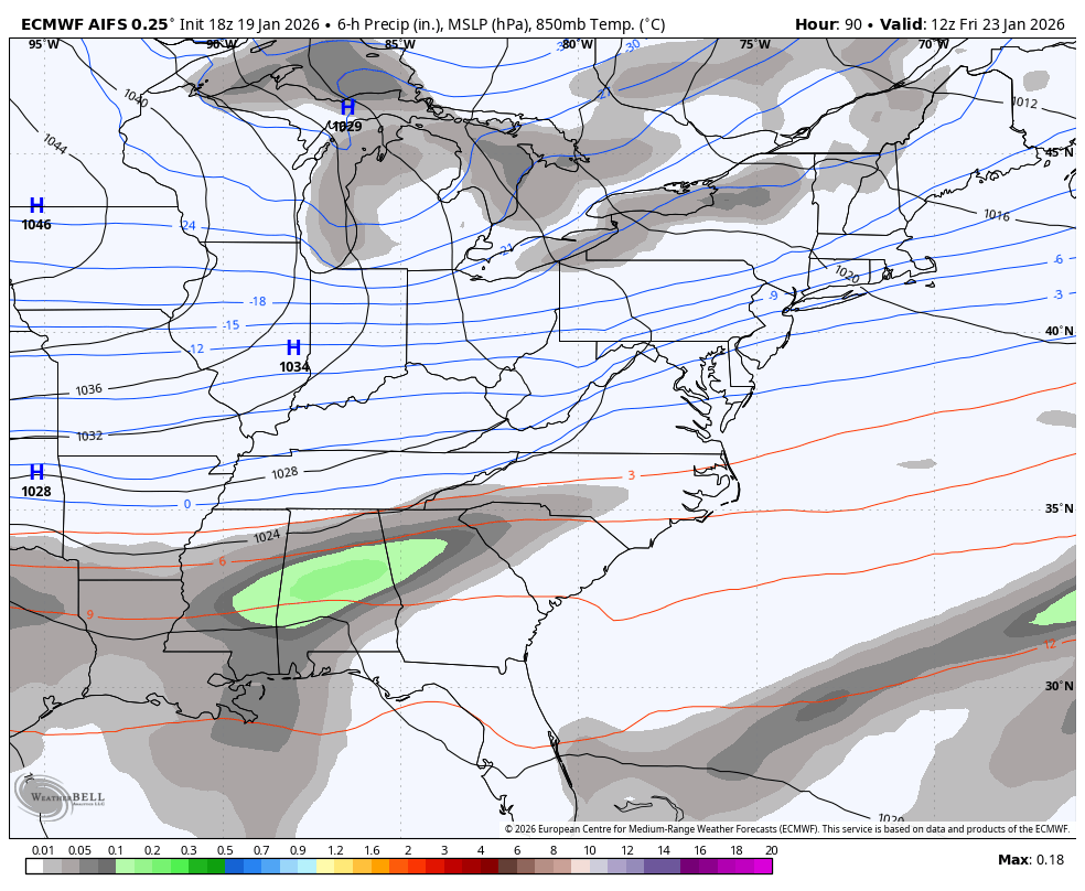
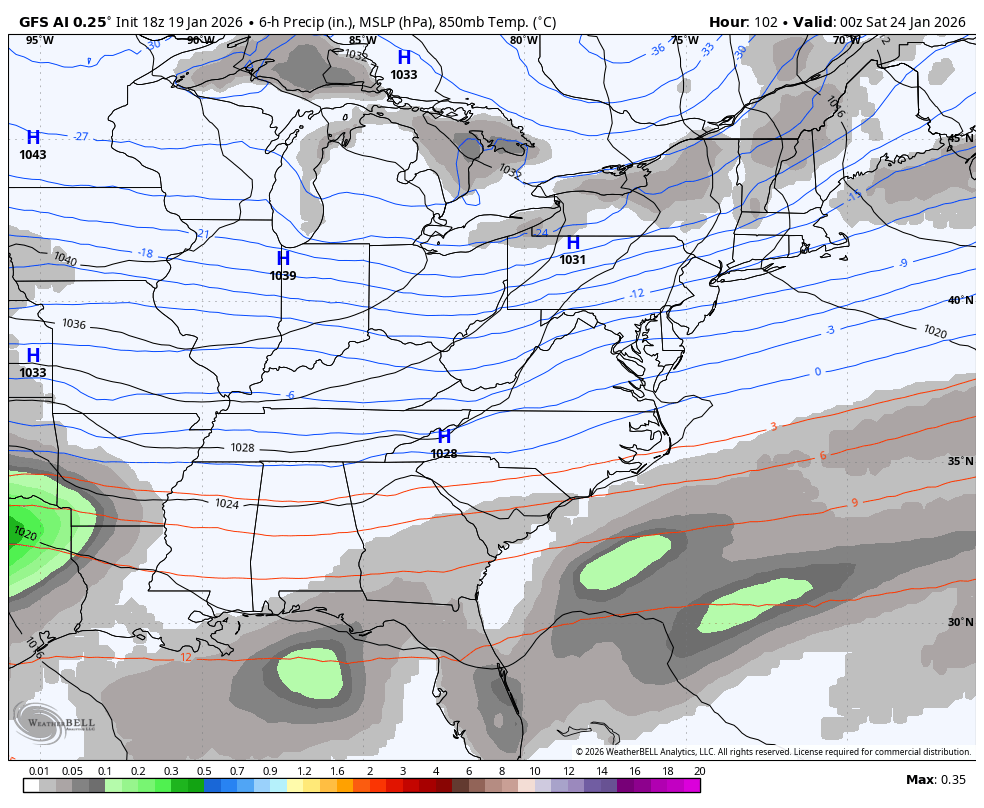
The GFS AI also doesn’t show precipitation types and is similar to the above, but it’s also in two waves…
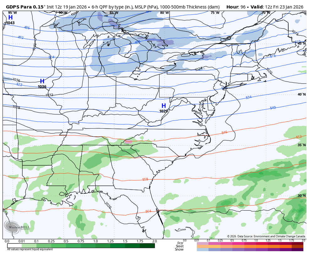
That brins us to the GFS which is always too far south and east with systems and this one is no different…
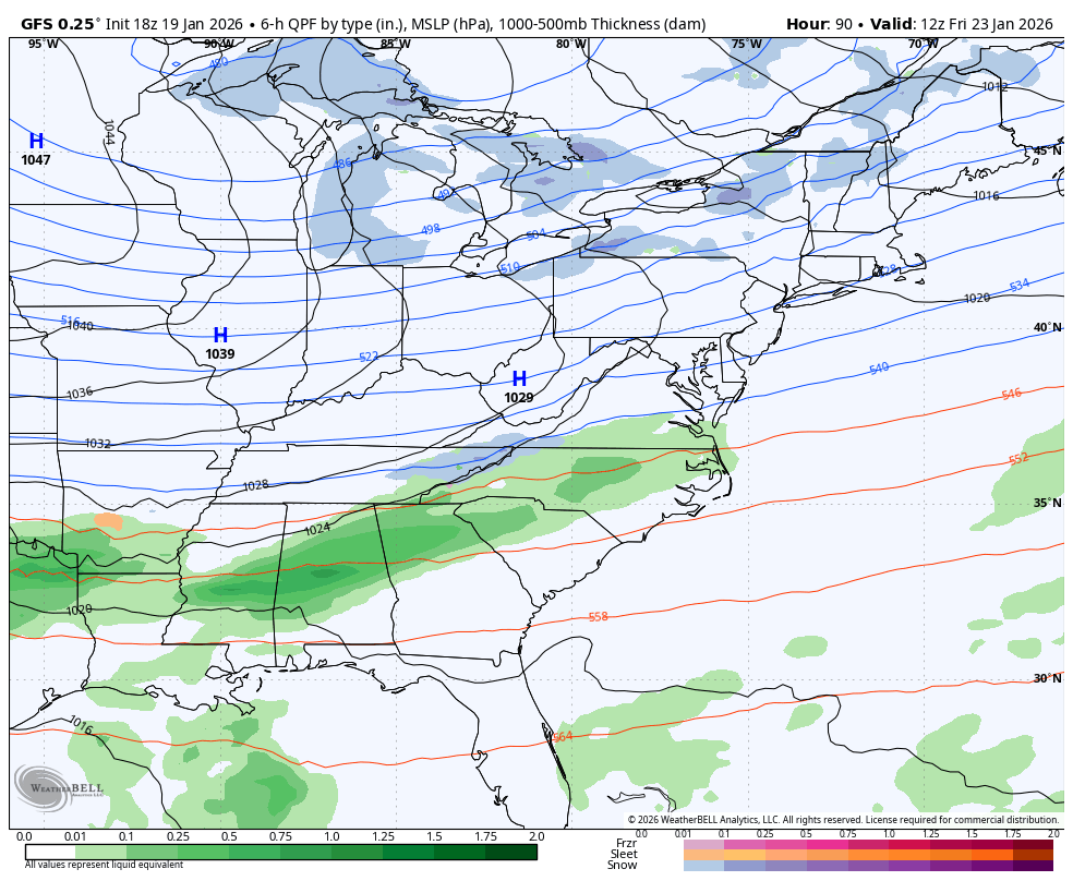
While it’s possible the GFS is right on this occasion, I’ll take my chances say it isn’t. I would be we see this model make a drastic change north in the next day or two.
The main update comes your way later tonight. I’ll also have a few updates on my Meteorologist Chris Bailey Facebook Page
Enjoy the evening and take care.

hope aGFS is right, i dont want alot of snow or ice.
Bring on the snow WKY but you can keep the ice.
Hey all! What is the world is wrong with that GFS?? It was always my champion! Most all models have come together, why not it? Is it whoever is entering the data or what? I guess we’ll see when it all comes together!