Good Sunday, everyone. A quick-hitting light snow maker is pushing across eastern Kentucky early today as we get set for a different pattern to finally take hold. This means we’re gonna melt some snow and ice in the coming days as this pattern grows really active.
The light snow today zips from northwest to southeast across the eastern half of the state. This will put down up to 1″ of new snow in a few spots with the best chance in the northeast.
Much milder air overspreads the region Monday and Tuesday, setting up one heck of a north-south temperature gradient. Areas of the south and west can reach the 60s while areas with snow on the ground come in much cooler. Still, it’s melting time.
From there, we see a front slide in and slow down just to our south Tuesday night and Wednesday. That front is active with waves of low pressure along it. The wave coming in later Thursday and Friday can produce rain and snow around here. The one by next weekend can do the same.
The models continue to exhibit a lot of waffling, which is routine during such a pattern change to begin with. Throw in what looks to be a very busy setup, and you get your syrup ready for those waffles.
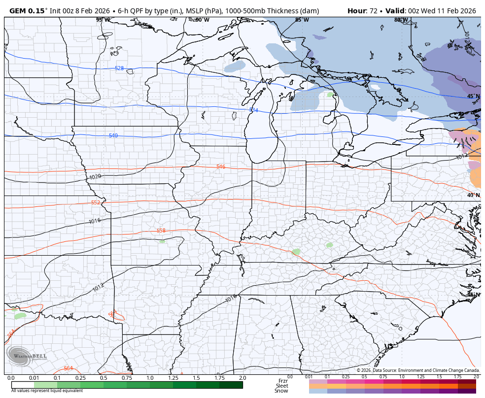
Here’s how the Canadian sees everything from Tuesday through next weekend…
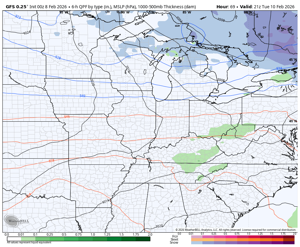
The GFS during the same time…
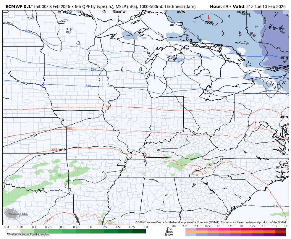
The EURO is snowier with the Friday system, which then suppresses the weekend system to the south…
The setup after that likely features a few major storm systems that can take us from severe storms to snow.
This is late winter pattern that’s loaded with potential as the pattern features a deep trough extending from near Alaska through western Canada into the midwest and Great Lakes. At the same time, a flat ridge looks to set up across the south and southeast.
This is the 30 day average 500mb height departures from the EURO Weeklies ending on the first day of spring…
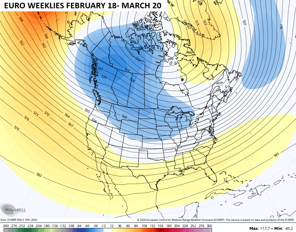
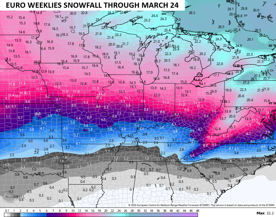
This sets up an active storm track across the Tennessee and Ohio Valleys as noted by the bullseye of heaviest precipitation totals…
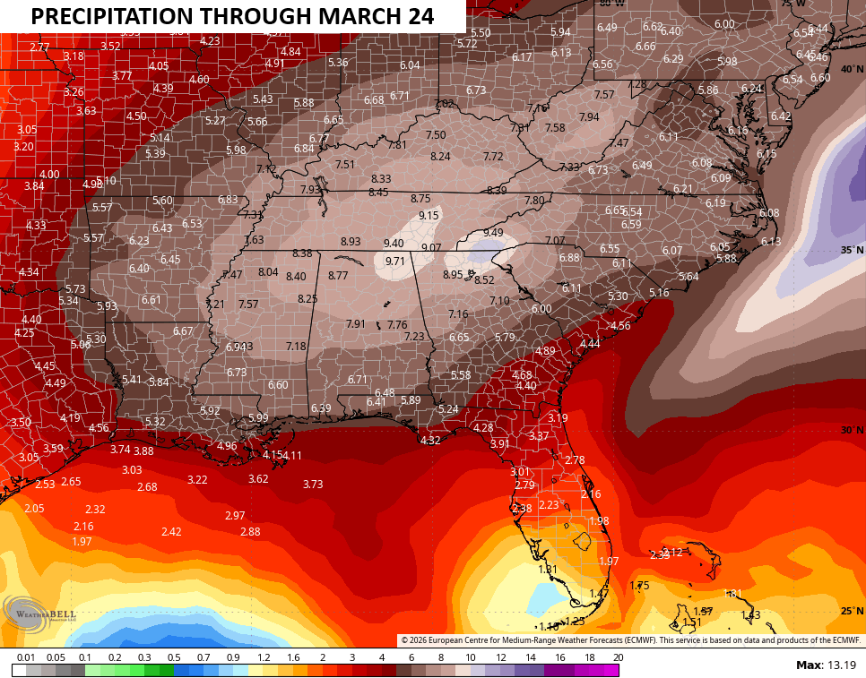
Heavy rain events would be noted along the track of those lows with severe storms possible south and southeast of the track of each system. These storm systems would also produce some healthy snow events north of the track.
This is a pretty good signal for late winter/early spring snows…
Updates come your way later today. I’ll also have updates on my Meteorologist Chris Bailey Facebook Page
Until then, here are your tracking tools for the day…


Make it a great Sunday and take care.

Thanks Chris. Hoping The Whole State Of Kentucky Remains North Of The Low Pressures Track. We Absolutely Don’t Want Any Part Of Severe Weather. ( Thunderstorms And Tornadoes )
I don’t think we get a bunch more snow this winter. We need to be on guard for flooding potential as the rains melt the thick ice.
Very Correct.
The Rest Of Winter And Into Spring Looks Really Wet And Stormy : )
https://climateimpactcompany.com/u-s-sunday-outlook-the-next-weather-and-climate-problem-in-the-u-s-pna-driven-storminess-2/
Above normal temps are coming and we will be right in the middle of the battle in Kentucky. Of course there is plenty of cold left.
Yep, Kentucky Is Always In The Battle Zone Of Weather Events.
Happy Super Bowl Sunday! Hope it’s a competitive and exciting game to watch.
Mike, I’m More Of A Basketball / Baseball Fan, But Like A Good Football Game, If I Follow The Team At The Beginning Of The Season. Enjoy The Big Game. Hope Your Team Wins.