Good Sunday to one and all. It’s another blast of winter surging back into the region today with snow showers and bitterly cold wind chills taking center stage. At the same time, a massive blizzard is hitting the east coast.
The setup today features rounds of snow showers and flurries targeting the eastern half of the state with light accumulations. This action continues tonight into the day on Monday. For that reason, a Winter Weather Advisory rolls on across southeastern Kentucky…

A few inches of snow will target those areas, with more along the high ground of the Virginia border counties. The rest of central and eastern Kentucky can see coatings up to 1″ of snow, especially after sunset today.
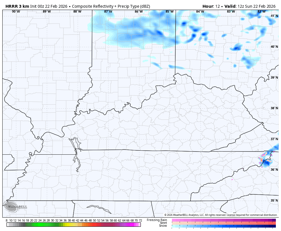
You can see all these snow showers and the few squalls on the HRRR Future Radar…
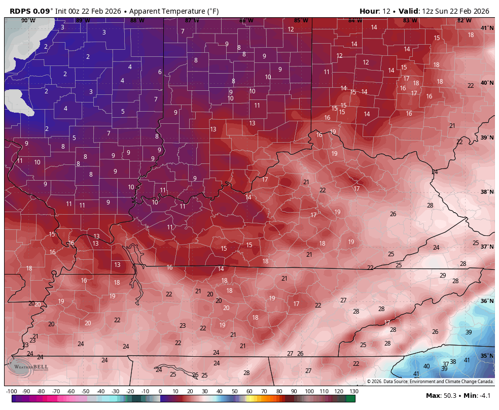
Wind chills today through Tuesday are wicked and a slap in the face after the recent 70 degree temps. Wind chills in the singles are likely tonight and early Monday. This animation shwos the wind chills from this morning through Monday morning…
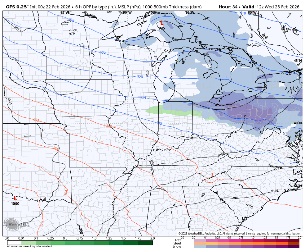
A monster of a blizzard is developing today and will absolutely crush areas from the Mid-Atlantic to New England. This system will pack hurricane force wind gusts and more than 2 feet of snow for many areas.
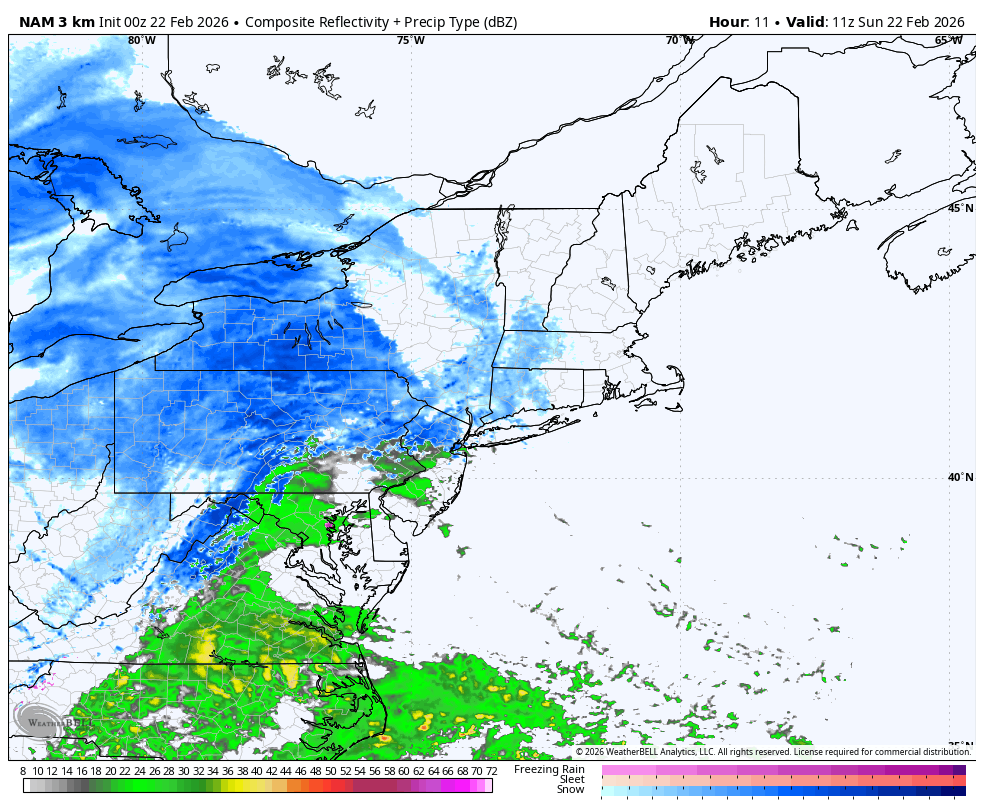
The look of the future radar is astounding…
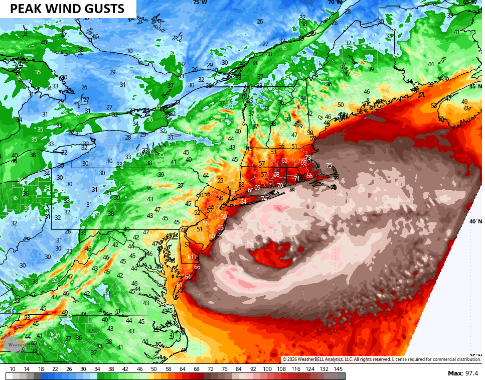
Peak wind gusts push 75mph along the coast with 90mph gusts over the ocean…
The snowfall numbers…
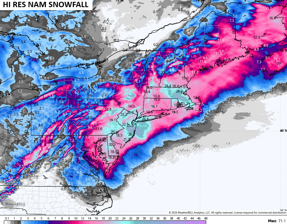
Imagine the drifts from that much snow with winds like that. This is a life-threatening storm that will paralyze one of the highest population centers on earth. Just incredible.
Back here in Kentucky, the cold eases Tuesday with a milder mid-week wind ahead of a potent system dropping in by Thursday…
Another update comes your way later today. I’ll also have updates on my Meteorologist Chris Bailey Facebook Page
Until then, here are your tracking tools for the day…


Make it a sensational Saturday and take care.

Just checked the forecast for my hometown of Long Branch, NJ:
A Blizzard Warning now calls for 20-28 inches of snow, wind gusting over 60mph, and snowfall rates of 2 to 3 inches per hour. A few miles offshore there’s a Hurricane Wind Warning with sustained winds of 75mph, and 15 to 30 ft seas!
That’s as much snow as we’ve gotten the entire snow season here in the SW Suburbs of Chicago (24 inches)!
Mike, the power of a nor’easter is something to behold and every so often, one will achieve bomb cyclone status. I’ve experienced that twice in my lifetime, once at the seashore, and the second time from Allentown, PA, about 80 miles from the ocean, and my home at the time. Despite the distance, I ended up with 32 inches of snow, with 9 foot drifts