Good evening, everyone. Our light rain and light snow system is zipping through here as cold air rushes in. This is an arctic blast that brings snow showers and single digit wind chills at times over the next few days.
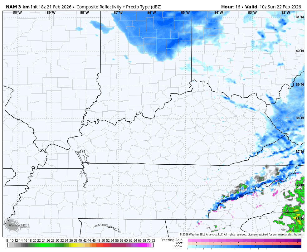
That strong northwest wind flow will bring all kinds of snow showers and a few snow squalls across the eastern half of the state Sunday into Monday. The future radar from the Hi Res NAM gives us a good look at all this…
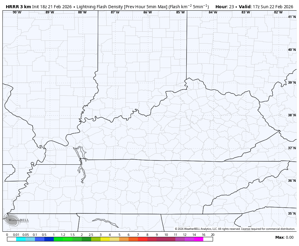
There’s the outside chance for a little thundersnow in one of these heavier bands. The lightning forecast from the HRRR briefly hints at this in the northeast Sunday afternoon…
Light accumulations are likely with coatings to up to an inch for many. Areas of southeastern Kentucky have the best chance to see a few inches of snow out of this. A Winter Weather Advisory is out for a number of counties down here…

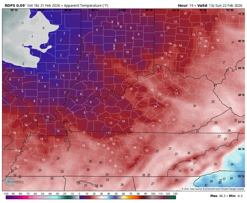
Bitterly cold wind chills will be with us later tonight through Tuesday morning. The coldest numbers show up Sunday night and Monday morning with wind chills hitting the singles in many areas. This animation goes from 7am Sunday to 7am Monday…
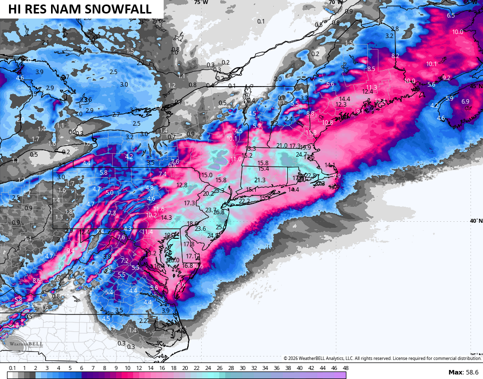
This same system helps fuel a massive blizzard that shuts down the Mid-Atlantic to the northeast. Look at this thing…
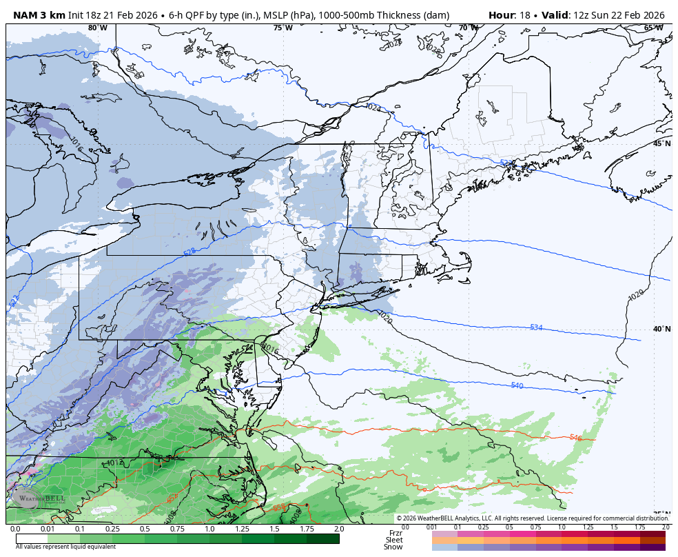
The snow numbers from this are stupid high…
Tropical Storm to Hurricane force wind gusts are also being forecast for many areas here…
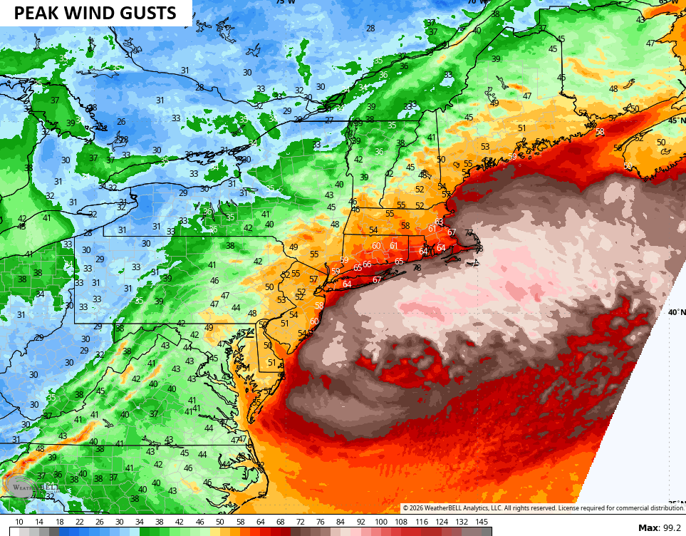
That’s truly a life-threatening blizzard that will shut down the highest population centers of the country.
The full update comes your way later tonight. I’ll also have updates on my Meteorologist Chris Bailey Facebook Page
Until then, here are your tracking tools for the day…


Make it a sensational Saturday and take care.
