Good Saturday, everyone. We have a wintry weekend taking shape across Kentucky with a light accumulating snowfall and borderline brutal cold wind chills. This latest surge from Old Man Winter puts a quick end to our recent spring fling.
A wave of low pressure looks to zip from southwest to northeast today, bringing a quick hitting band of light rain and light snow this afternoon and evening. This is something the GFS has been showing for the majority of the past several days but didn’t have much support. Now we find most of the models showing this.
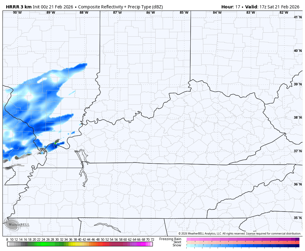
The future radar from the HRRR shows a streaking area of light accumulating snows from this…
Frigid winds then kick in overnight and Sunday with snow showers and a few snow squalls becoming widespread across central and eastern. This northwest flow is strong and will pick up some moisture from Lake Michigan and throw it into the eastern half of the state.
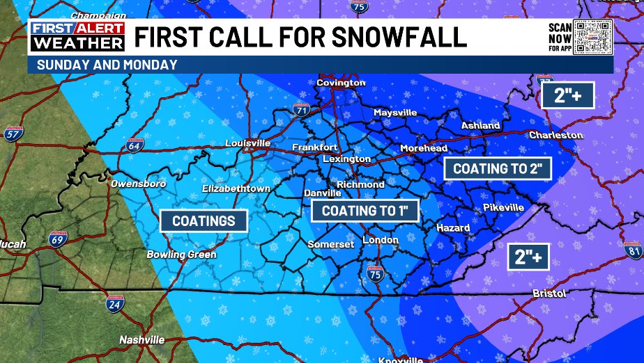
My First Call for Snowfall looks like this…
Now, there’s a chance for this to become a bit of an overachiever as these are some potent snow showers and squalls…
High temps Sunday into Monday may not get out of the 20s for most of the state. Given those cold temps, slick roads will be a possibility with some delays and cancellations a good bet Monday morning.
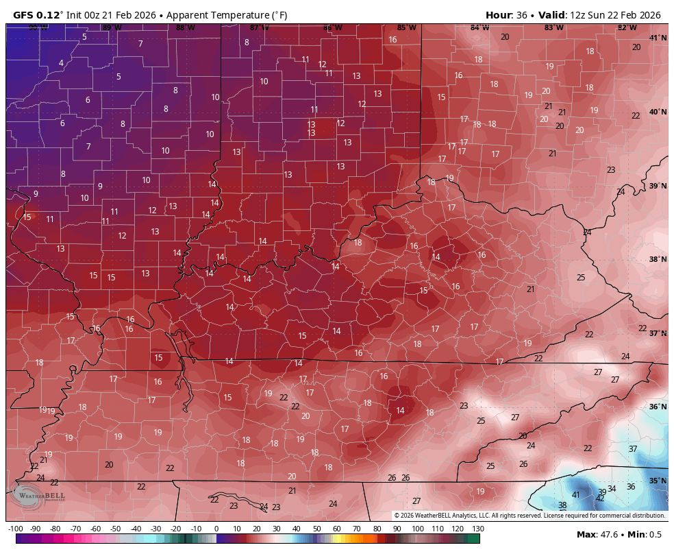
Wind chills likely reach the single digits Sunday night and early Monday. Check out the wind chill forecast animation from 7am Sunday through 7am Monday…
While this is happening across Kentucky, a monster winter storm will slam the Mid-Atlantic into the northeast…
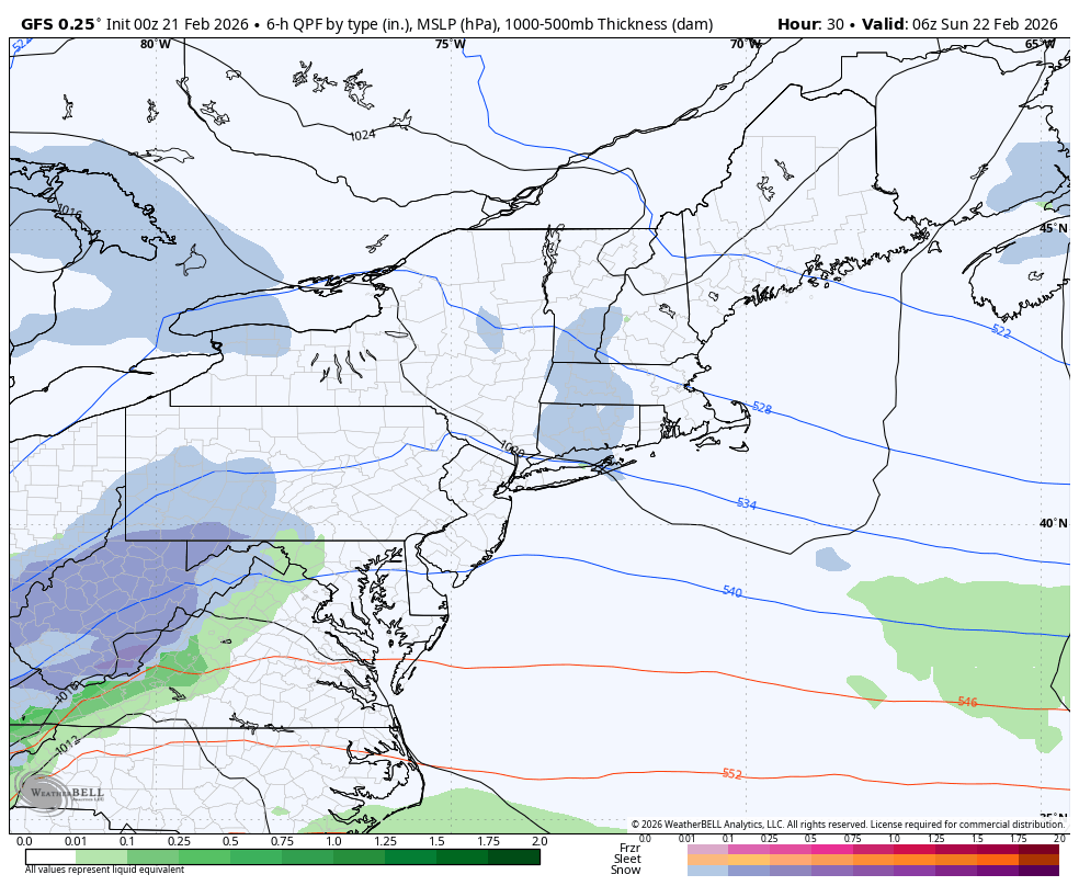
This has a chance to become a shutdown blizzard for many of the big cities. Road trip?
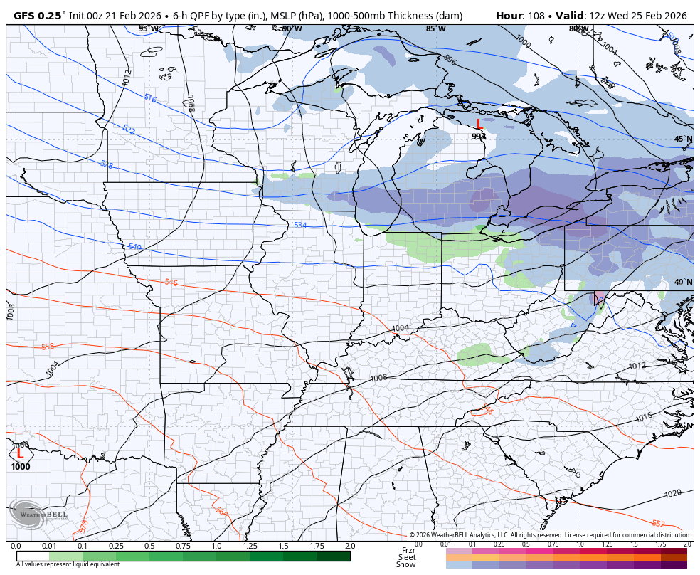
Temps bounce back by the middle of the week ahead of the next system dropping in from the northwest. Rain with the chance for some flakes at the end look to show up…
Another update comes your way later today. I’ll also have updates on my Meteorologist Chris Bailey Facebook Page
Until then, here are your tracking tools for the day…


Make it a sensational Saturday and take care.

I won’t be fazed by the last wimpy bits of winter.
Thanks Chris. It’s Been A Longtime Since A Nor’easter / Blizzard Has Been In the Forecast. Something In The Atmosphere Must Have Changed. My Thoughts Are, The Warmer Waters Of The Atlantic ( Positive Charged )
Will Phase With The ( Negative North ) To Make This Potential Snowstorm. Otherwise, It Will Be Interesting To Track.
In Order For This Scenario To Happen In Our Area Of The CONUS. It Would Take A Low Pressure Trough In The North Pacific ( Negative Charged ) Phasing With A ( Positive Charged ) Subtropical Jet Stream Over The Southern Rocky Mountains, And Moving Eastward Through The Tennessee Valley. In Other Words, A Weak El Nino, With A Positive PDO. A Lot Of Meteorology Scientists Are Puzzled That The PDO Has Been Negative Since 2019. This Is Why We Haven’t Had Any Major Snowstorms In Our Area In Many Years.
Adding To The Above : ) I Read That The Weather Pattern We Are In Now, Happened 174 Years Ago. It’s A Solar Cycle. I’m Tired Of The False Statements Made By AI That It’s ” Climate Change, ” Climate Change Is A Change Made By Solar Cycles Period !
Just left the New Jersey shore where there is a blizzard warning for 15″ to 20″ of snow and 40mph winds.
Enjoy The Nor’easter Joe. I Wish That Could Happen Here.