Good Saturday to one and all. We have a pretty nice weather day taking shape across the region today but the nice stuff is on borrowed time. We have a major storm system ready to blast us with severe storms and snow showers from late Sunday into Monday.
This will be one of the wilder rides we’ve seen around here in a long time.
Here’s the breakdown:
- Sunday features a mix of sun and clouds with highs deep into the 70s.
- Winds Sunday and Sunday night crank to 40mph to 50mph as our storm system moves in.
- Gusty showers and storms move from west to east and some of the storms may be strong or severe.
- The prime time for strong storms is late Sunday evening into the wee hours of Monday morning.
- Temps drop 30 degrees in an hour or so as the front passes through any one location.
- With temps going below freezing behind the front, some wet snows will be noted from west to east Sunday night and early Monday.
- Sunday night may feature strong storms and snow separated by less than 100 miles or so.
- Snow showers and flurries will be around on Monday and Monday night.
- Some light slushy accumulations will be possible on the grass and elevated surfaces.
- Temps Monday night and Tuesday mornings will reach the teens.
- Wind chills Tuesday morning hit the single digits.
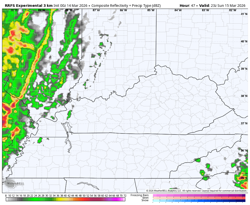
The future radar from the RRFS shows the squall line well but is likely lacking a bit with the snow showers coming behind it…
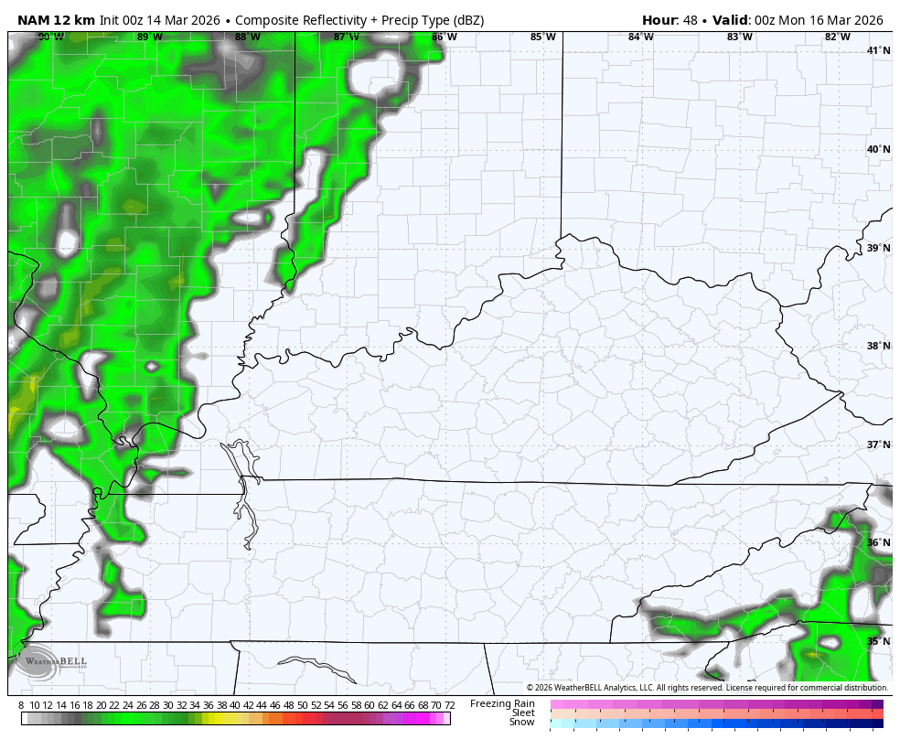
The NAM future radar is more robust with the flakes…
The Storm Prediction Center shows the growing concern with a significant severe weather event for parts of our region…

The risk is there for a few tornadoes to develop along our line of severe storms as it races eastward. The Tornado Outlook from the SPC shows the increased risk across the western half of the state…

The Damaging wind threat is healthy on the Severe Wind Outlook…

The hail threat is there, but not as high as the potential for damaging wind…

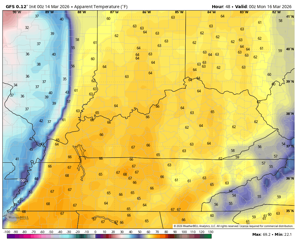
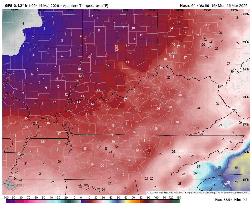
The temps change behind this is about as dramatic as you will ever find. Watch the “feels like” temps drop from Sunday evening through Noon Monday…
Those numbers totally tank from there with wind chills in the single digits Monday night and Tuesday morning…
That’s pretty wild to see this time of year, but it still stinks for those of us ready for true spring.
In true extreme fashion, we are likely to be back into the 70s by Friday and Saturday with the chance for that heat in the west to take a shot at us with some 80s shortly thereafter. Unfortunately, we will likely have one more potent cold blast before true spring kicks in.
Another update comes your way later today. Until then, here are all the storm tracking tools you need to start the week…


Current watches

Possible Watch Areas

Make it a sensational Saturday and take care.

These remaining cold shots will not last long.
Non-thunderstorm wind gusts reached over 60 MPH here in the Chicago Metro Area on Friday. O’Hare Airport recorded a 64 MPH gust, while Midway Airport recorded a 60 MPH gust. The winds finally died down well after sunset.
Another high wind event is on the way for later Sunday into Monday for the Metro Area, along with a slight risk of severe thunderstorms on Sunday and accumulating snow with blowing snow Monday, as our eventful March continues.
Mike, Sounds Awful. I Would Like The Snow Event, Just Not Thoses High Winds. Here In Maple, We Would Welcome The Rain. Getting Very Dry, With All This Dry Southwest Wind, Due To Strong High Pressure Here In The Southeast. La Nina is Still Dominating Our Climate.
But, Jeff The Frigid Temperatures Will Be Long Enough To Freeze Plants That Have Already Broke Dormancy, But The Plants Will Recover, Just Won’t Bloom.
It won’t be that bad.
I Hope So Jeff.
The Arctic Region Looks Like Mid – January. Pan Up To See : )
https://www.ventusky.com/#p=12;111;0
Marine Heat Wave In The Pacific And Gulf Of Mexico : )
https://climateimpactcompany.com/cic-operational-research-are-marine-heatwaves-correlated-to-the-upper-air-pattern-causing-sensible-weather-2-2/