Good Monday, everyone. The severe storms part of this wild weather ride is a thing of the past and now it’s Old Man Winter’s turn. Snow and bitterly cold wind chills increase today and take us into early Tuesday.
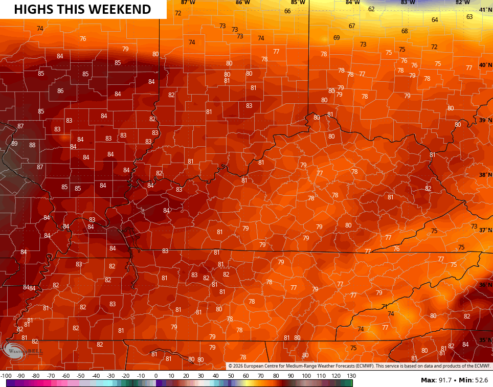
In true Kentucky weather fashion, our temps may hit 80 this coming weekend.
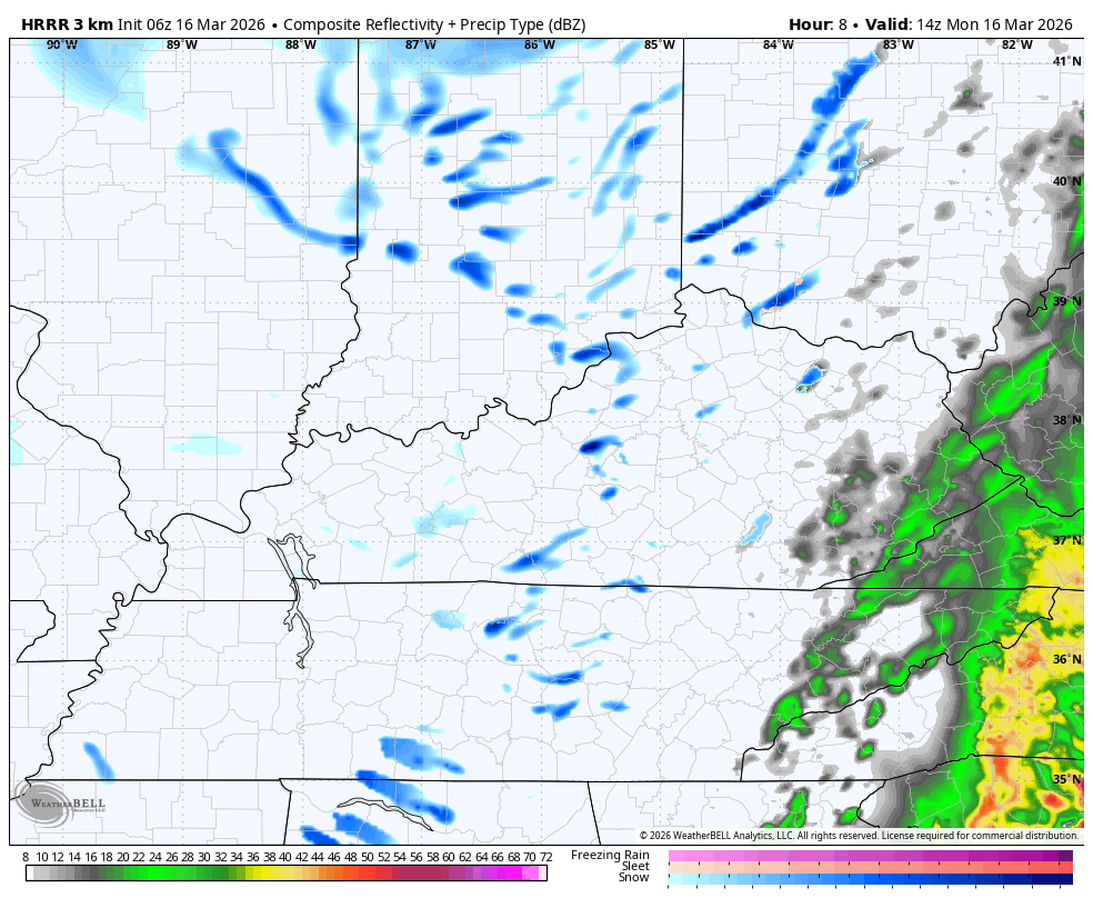
Snow showers and a few snow squalls will be common out there today with an increase this afternoon and evening. At the same time, an enhanced band of snow develops and rolls across eastern Kentucky. That band of snow can throw down an inch or two with the greatest chance across the Virginia border counties.
The snow showers and squalls can also put down hit and run accumulations and reduce visibilities, leading to some quick travel issues. I can’t even rule out some thunder with these.
The future radar from the HRRR shows all this with some lingering snowflakes into Tuesday morning…
Temps today drop into the upper 20s and low 30s with a wind chill in the teens by the afternoon. Temps hit the upper teens tonight with wind chills dropping into the single digits by Tuesday morning…

So much for the luck of the Irish.
There’s another system dropping in from the northwest that can spit out a few rain and snow showers Tuesday night into Wednesday morning…

That’s actually on the leading edge of milder winds kicking in. Those winds ramp up temps into the 60s by Thursday with 70 or better waiting on us for Friday…

Temps can surge into the 80s this weekend…
I’ll have an update later today and I’ll be on WKYT as needed. Until then, I have you all set to track today’s wild weather…


Current watches

Possible Watch Areas

Make it a magnificent Monday and take care.

Thanks Chris. The Cold Front Went Through My Area Of The State Around 12 : 00 AM, Or Thereafter Very Noisy Thunder, And A Couple Of Lightning Strikes, And The High Winds. Heavy Rains Amounted To 1.50. ” Right Now We Have The Forecasted Snow Flurries. Eighty Degrees Plus Will Feel Great ! Bring It !
There’s around an inch and a half of snow on top of a coating of sleet this morning here in the SW Suburbs of Chicago, and it’s cold, in the low 20s with a wind chill in the single digits. Light snow is still occurring, along with blowing snow. Much more snow fell in NW IL and North Central IL, where Blizzard Warnings were issued.
What a difference a week makes. Last Monday the high was 73 degrees at O’Hare Airport, breaking a record high for the date.
Mike, It’s Just The Usual Up And Down Temperature Changes. Characteristic Of A Midwest Climate, But Was Glad There Wasn’t Any Tornado Outbreaks, And We Received The Much Needed Rains. I Saw On The Snowfall Map, That Wisconsin Received A Lot Of Snow. Some Areas Up To 20. ” The Last Time I’ve Seen That Much Snow On The Ground Was On Christmas Day, 2004, But That Was Up In Indiana In Vanderburg, County.
Here’s A Weather Site, That Might Be Interesting To All : )
https://www.ventusky.com/37.464;-85.502