Good Sunday evening, folks. It’s all eyes on the first true severe weather threat of the entire month of May as we head into the start of Kentucky Derby Week. This threat arrives from west to east Monday evening with additional storms rolling in behind that.
First things first and that’s the Severe Weather Outlook from the Storm Prediction Center. The Enhanced Risk continues in the west with the Slight Risk into central Kentucky. The Marginal Risk is out in the east…

Damaging winds, large hail and a few tornadoes are all possible Monday and Monday night. The tornado risk is greatest across the far western part of the state…

The Damaging wind risk is way up there in the west…

The large hail potential is primarily to our west…

Even as storms diminish the farther east we get, our boundary slows down allowing for more rounds of showers and storms to develop along it later Tuesday into early Wednesday. The Storm Prediction Center is out with a Marginal Risk to Slight Risk for the entire state for Tuesday…

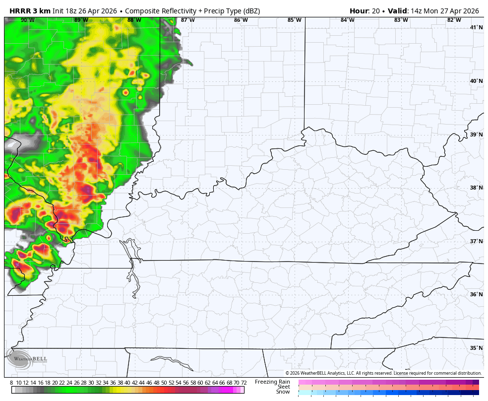
The future radar from the HRRR is a little faster with the arrival times of the severe storms, which come in waves. It shows the first wave in far western Kentucky mid-morning with the main waves arriving during the evening into the wee hours of Tuesday…
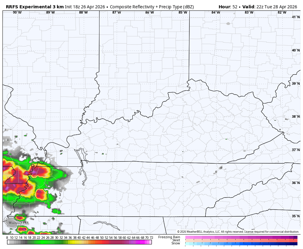
After the break on Tuesday, additional waves of strong to severe storms show up late Tuesday and take us through early Wednesday…
Chilly winds kick in behind all this and will then take us through Kentucky Derby Weekend.
A full update comes your way later tonight. Until then, I leave you with the tools you need to track any shower or storm going up out there today…


Current watches

Possible Watch Areas

Make it a sensational Sunday and take care.

Hoping this complex of storms can squeeze out some rain for a very parched Bowling Green area. The problem with relying on systems like this to affect drought conditions is that they punch through quickly, often with damaging winds and torrential downpours, and because the ground is so dry, much of that rain will runoff.
Looking at the warmer than normal ocean water off the western coast of South America on the latest Sea Surface Temperature map is proof that La Nina is gone and an El Nino is underway.
https://www.ospo.noaa.gov/data/cb/ssta/ssta.daily.current.png