Good Sunday, folks. It’s another winner of a spring day out there today, but major changes are on the way to end April and begin May. All of this start with a severe weather threat to begin Kentucky Derby Week with chilly air waiting in the wings.
Temps today are generally 75-80 in many areas with a few spots hitting the low 80s. Winds are increasing from the southwest with a mix of sun and clouds.
The southwest winds REALLY crank on Monday as temps surge into the 80s. This is ahead of a significant severe weather event targeting areas from the Plains into the Ohio Valley late Monday and Monday night.
The Storm Prediction Center continues to ramp up the threat with a Marginal Risk to Enhanced Risk across the state. The greatest threat continues to be across the western half of the state…

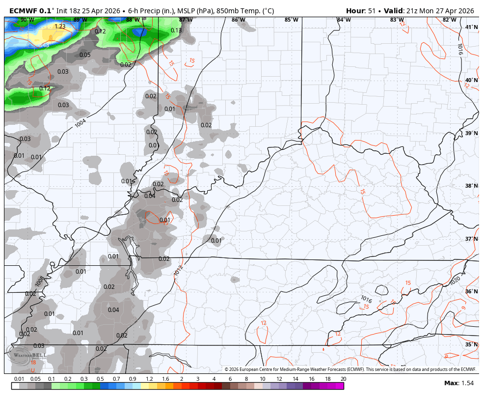
Damaging winds, large hail and a few tornadoes are all possible Monday and Monday night. Here’s a look at the individual severe weather threats from the Storm Prediction Center…


The prime time for severe weather across Kentucky is during the evening in the west with the threat moving eastward during the night and decreasing along the way. All of this will then be followed up another round of booming showers and storms Tuesday night and Wednesday.
This animation from the EURO runs from late Monday afternoon through Wednesday night…
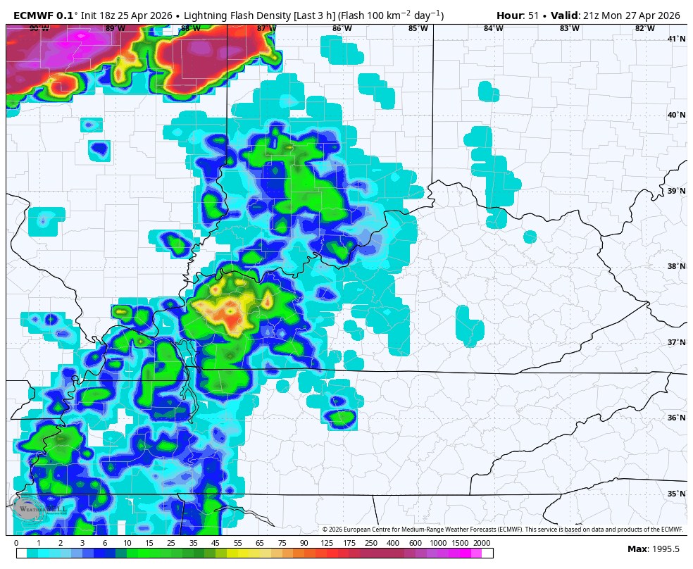
Here’s the lightning tracker during the same time frame…
Temps come way down behind that with even chillier air moving in for Kentucky Derby Weekend. While the main system likely stays to our south, it does so because of the anomalous trough dropping in from the north. This can bring a few upper-level systems that can deliver a shower or two…
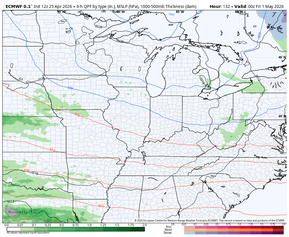
Temps with that are VERY chilly with the potential for some frost Derby Weekend and into the first week of May. Temps stay well below normal…
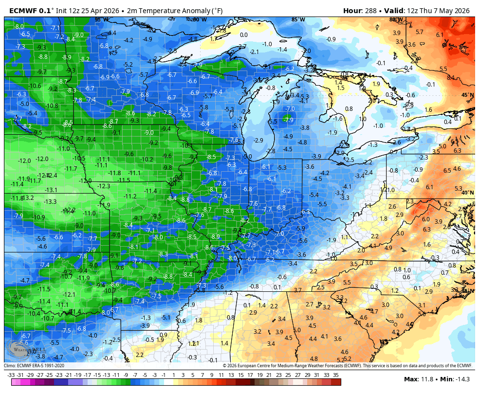
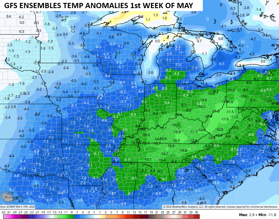
The GFS Ensembles for the first 7 days of May are super chilly with temps averaging well below normal for the 7 day span…
I may throw you guys another update later today. Until then, I leave you with the tools you need to track any shower or storm going up out there today…


Current watches

Possible Watch Areas

Make it a sensational Sunday and take care.

Severe storms and heavy rain are forecast for our area over the next couple of days of rain, but recently each time we have seen storms approach, they either split around the area, or fade before they get here. We’re still in April, yet the Bermuda High seems to have begun flexing its muscle, and with a 65 percent chance that El Nino will be established by end of May, the dry spell is almost certain to intensify, since a summer El Nino comes with a high probability of above normal temperatures and below normal rainfall. Over the first four months of the year, my PWS near Bowling Green has recorded 5.45 inches of rain; “normal” rainfall during that same four month period is 17.06 inches of rain, so as of today we are about 68 percent below “normal”. The word normal is in quotes, because it’s been a long time since we’ve experienced normal weather around here.
Chicago’s O’Hare Airport has received 13.32 inches of precipitation so far this year, with 9.43 inches being the norm. The NWS Forecast Office in the SW Suburbs has received 12.25 inches.