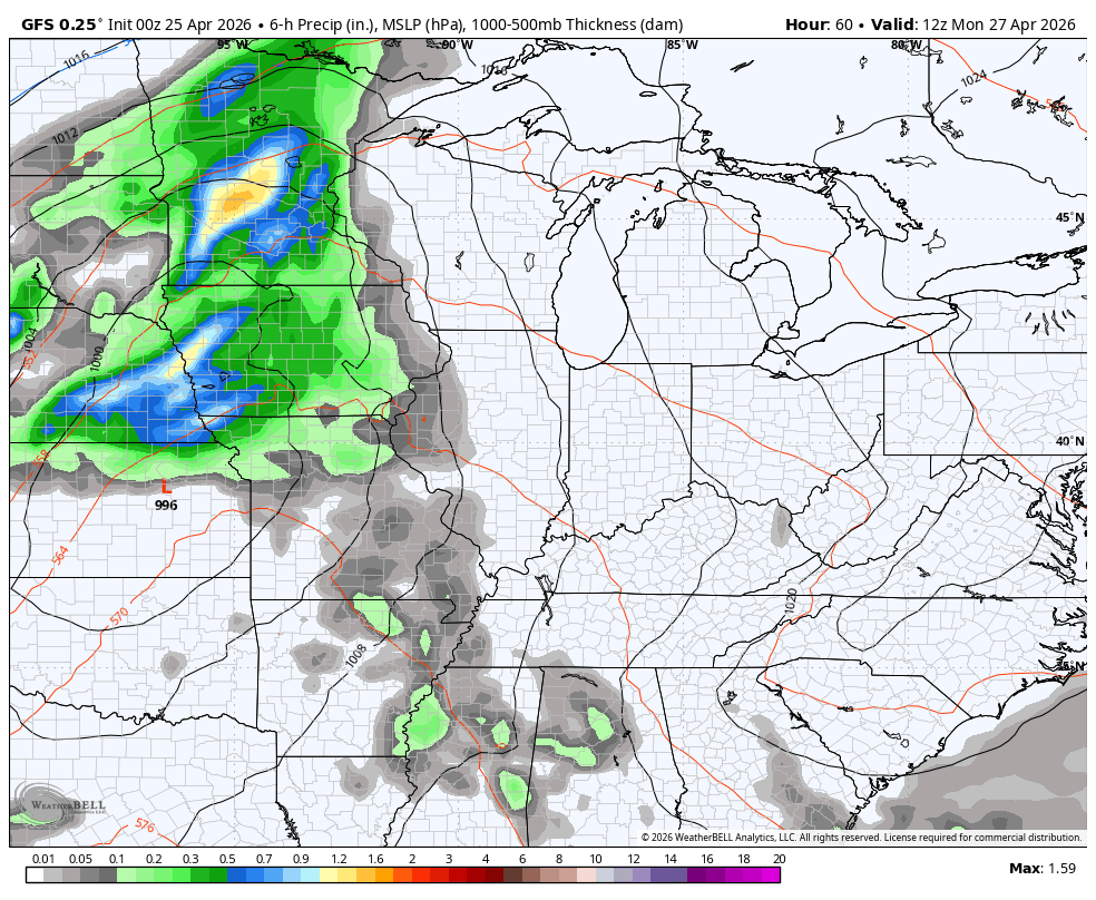
Good Saturday, everyone. Some much-needed showers and storms continue to push slowly across parts of the region today. This action is ahead of a wetter and much colder change on the way for Kentucky Derby Week. Once we settle into those changes, they may be here a while.
Today’s showers and storms are scattered across the east and southeast early today. This stuff pushes out of the state from northwest to southeast this afternoon as the sun returns for many. Highs are in the typical 70s.
Sunday is a spectacular spring day with 75-80 for many.
Monday turns windy and even warmer with highs deep into the 80s on a strong southwest wind. This is ahead of a potent spring storm system rollicking through the Plains toward the Great Lakes. The timing on this system is a touch slower, meaning much of the daytime on Monday is dry.
A big outbreak of severe weather is likely to our west Monday afternoon with some of that potentially getting into the western half of the state late afternoon or early in the evening. This is the area showing up in the Monday Severe Weather Outlook from the Storm Prediction Center…

The severe threat diminishes from west to east Monday night as the line of showers and storms moves across the rest of the state. This front slows down along and just to our south Tuesday as another low develops along it. The end result if another round of rain and some thunder into Wednesday…
Temps come way down and turn chilly Wednesday into Thursday.
This brings us to Kentucky Derby Weekend and a massive trough digging into the region. This will bring well below normal temps in here with the potential for a few showers. The models have jumped off the big storm system, but I’m not ready to write it off just yet.
Even without the big storm system, this is one out of the ordinary looking setup for the start of May…
GFS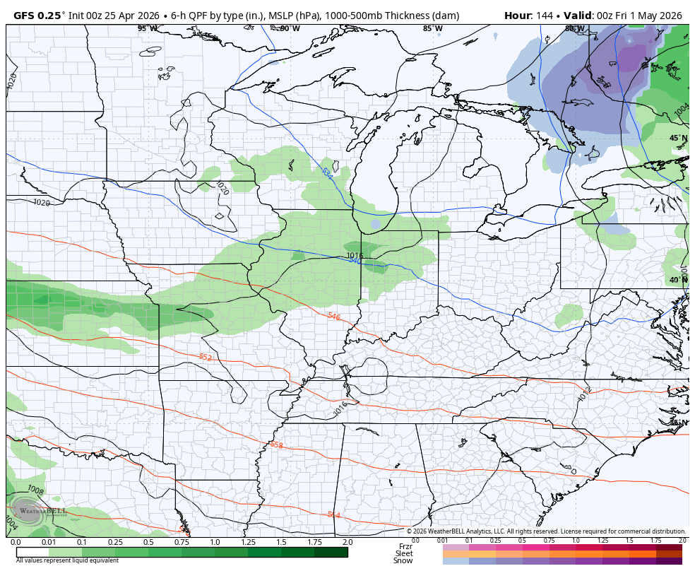
EURO
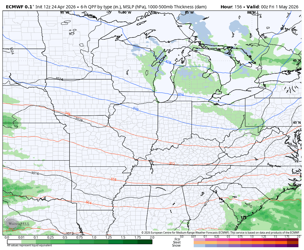
Notice all the blue on those maps across parts of the Great Lakes, northern Ohio Valley and the high ground of the Appalachian Mountains? Yep, that’s snow and that’s just showing you how cold the air on the way really is.
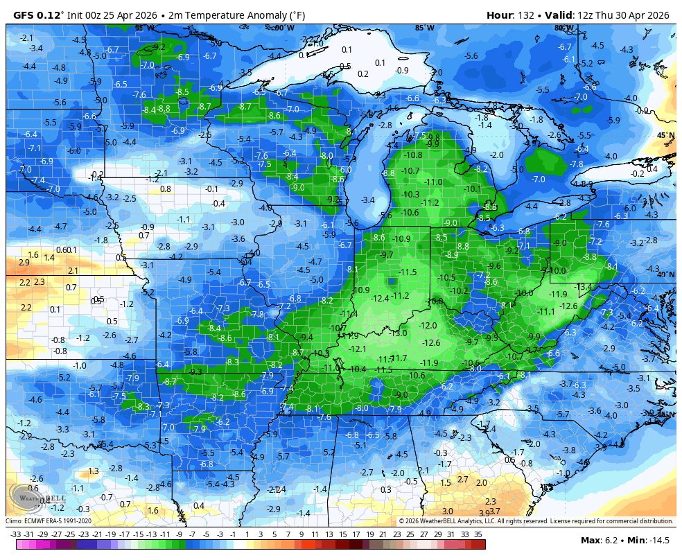
Barney is back in a big way on this temperature departure from normal animation that starts Thursday and goes through Monday…
If we don’t have rain for Oaks Day and Derby Day, highs are 55-60 for much of the region…
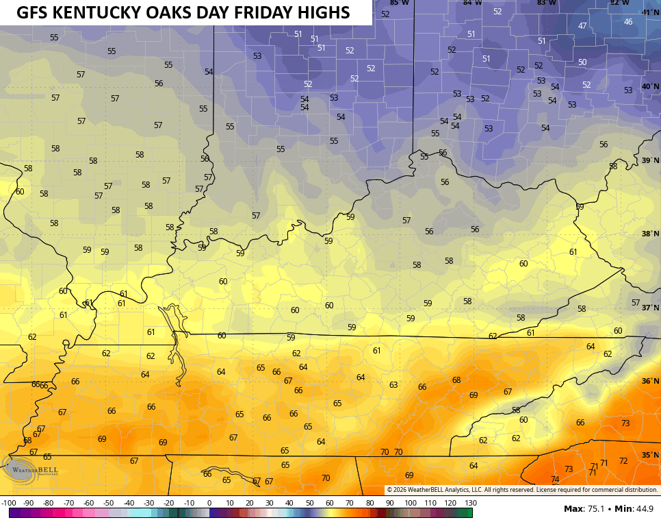
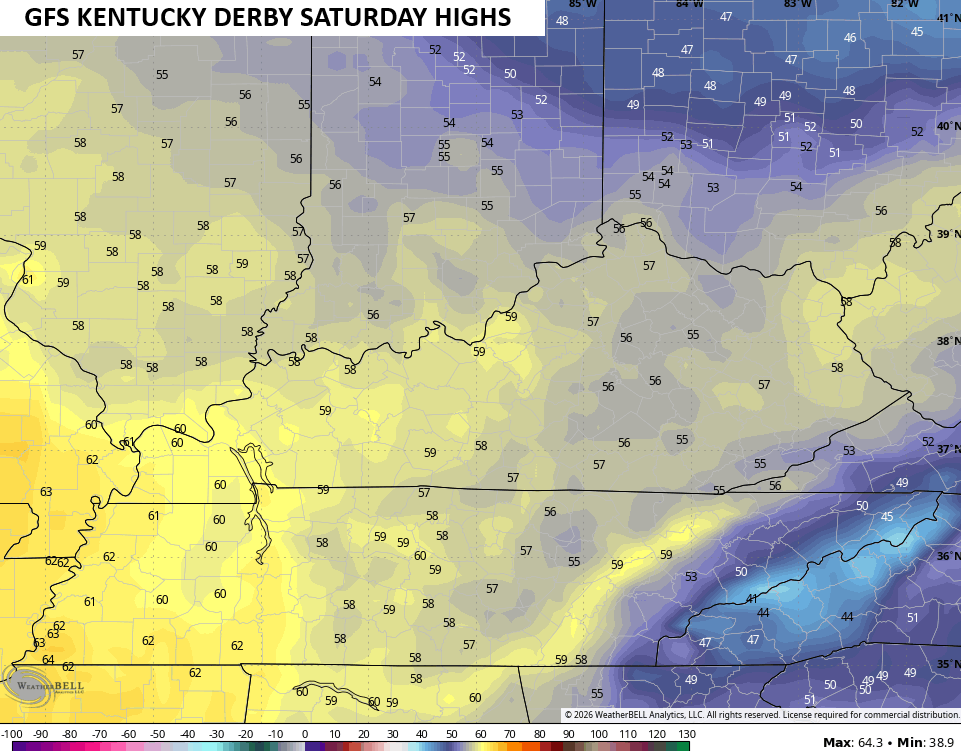
If there’s some rain in the area, trim those numbers back several degrees.
Oh yea, frost is a good bet on any night that’s clear from Derby Weekend into the first week of May.
I may throw you guys another update later today. Until then, I leave you with the tools you need to track any shower or storm going up out there today…


Current watches

Possible Watch Areas

Make it a sensational Saturday and take care.

I don’t see frost happening and this cool spell will be gone quickly. Nothing to see here.