Good Friday, everyone. It’s the last Friday for the month of April and this means we are just a little more than a week out from the Kentucky Derby. The weather pattern is changing as we get toward Derby week with an increase in storms and a decrease in temps.
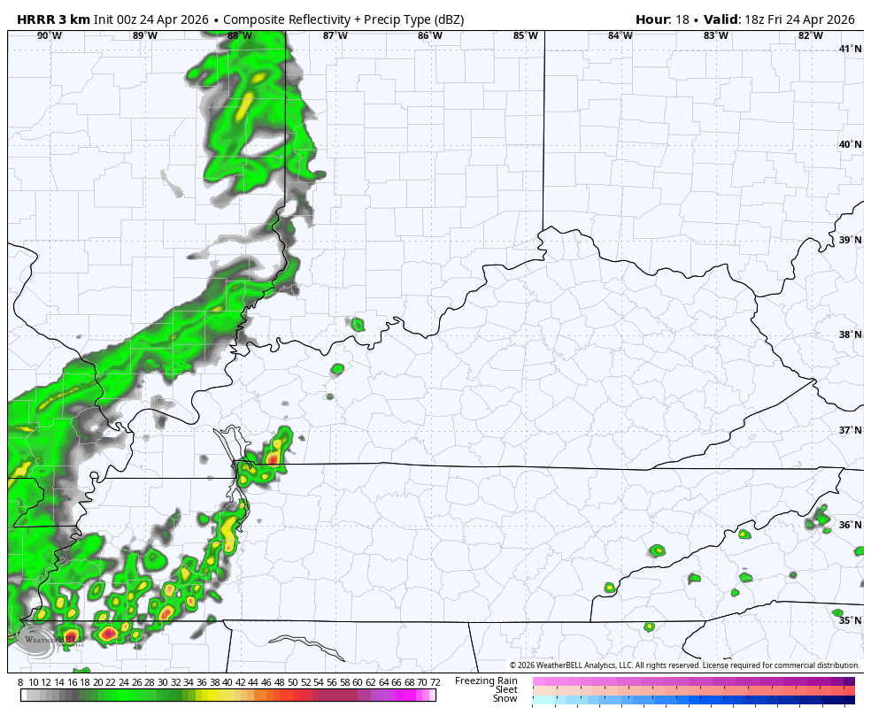
Temps today are warm again as some scattered showers and storms rumble in from the west. These will be slow to move eastward, meaning much of the day is dry across central and eastern Kentucky. The low-end severe weather risk continues to show up for parts of the west today…

The boundary bringing today’s action slowly moves into the central and east tonight and slows down into early Saturday. That brings an increase in showers and storms tonight and these may be slow to depart parts of eastern and southeastern Kentucky on Saturday. Here’s the future radar from this evening through Saturday evening…
Sunday looks like a nice spring day with highs mainly in the 70s. Temps should jump back toward 80 on a strong southwest wind kicking in on Monday. That’s ahead of a potent storm system rolling from the Plains toward the Great Lakes.
This boundary will be very active, bringing a daytime severe storms threat across the western half of Kentucky on Monday. Here’s the Severe Weather Outlook from the Storm Prediction Center…

Those showers and storms then race eastward across the rest of the state Monday night and early Tuesday, bringing the diminishing severe storms threat along the way.
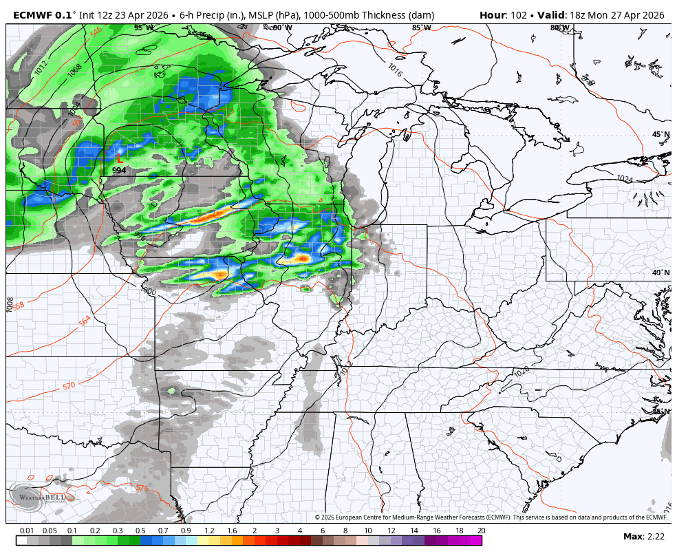
The boundary responsible for this slows down, allowing for a wave low pressure to move along it and into our region with more rain and storms on Wednesday. Here’s the EURO from Monday afternoon through Wednesday evening…
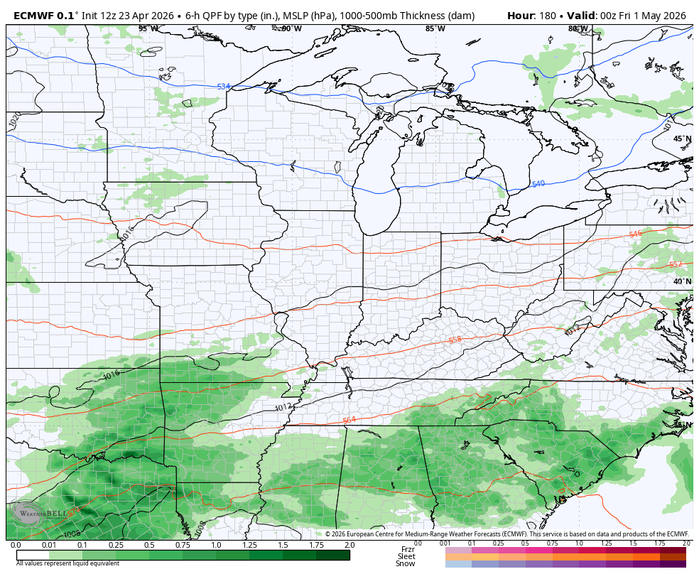
Another system targets the region later next week and will impact Kentucky Derby Weekend. The extent of that impact remains to be seen, but some chilly air appears to be on the weather race card. The latest EURO isn’t as stout with this system…
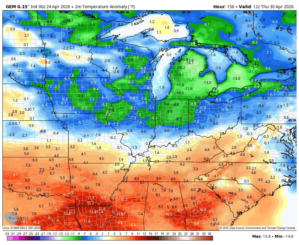
The Canadian still likes a stronger storm system that almost has a bit of a winter look to the track…
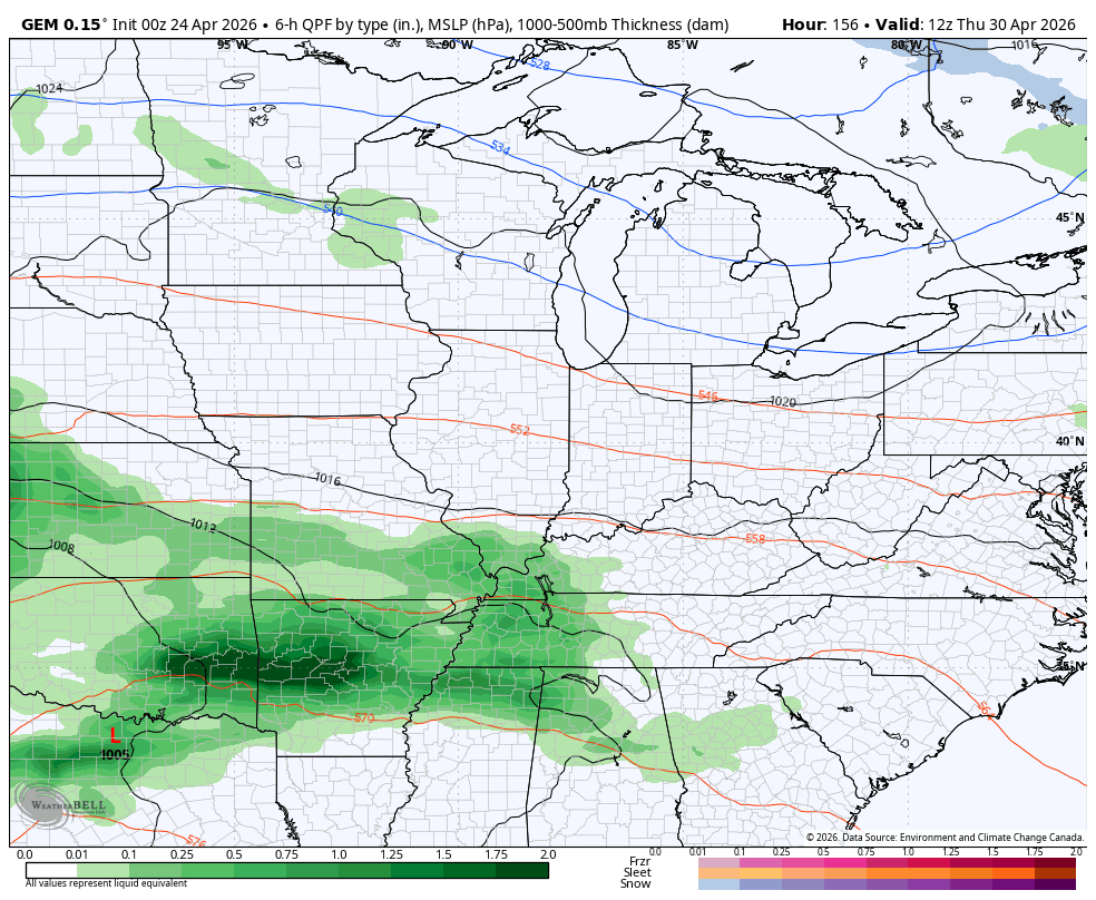
The cold on the Canadian is rather Barney…
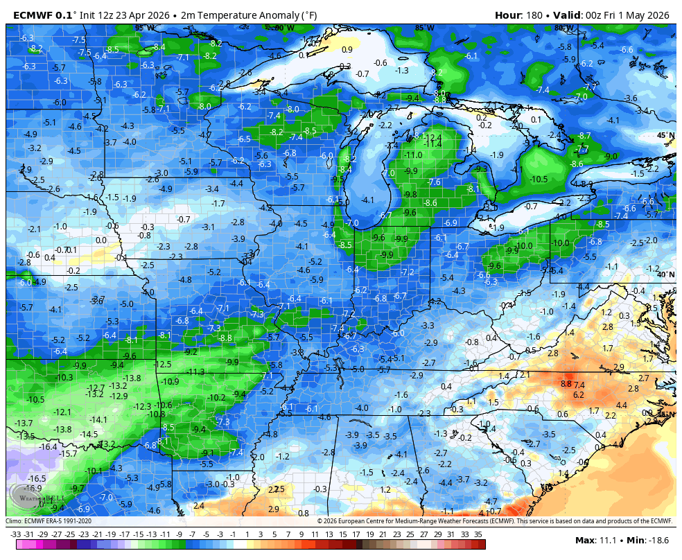
The Euro sees the colder than normal numbers very well and keeps those going through the first week of May…
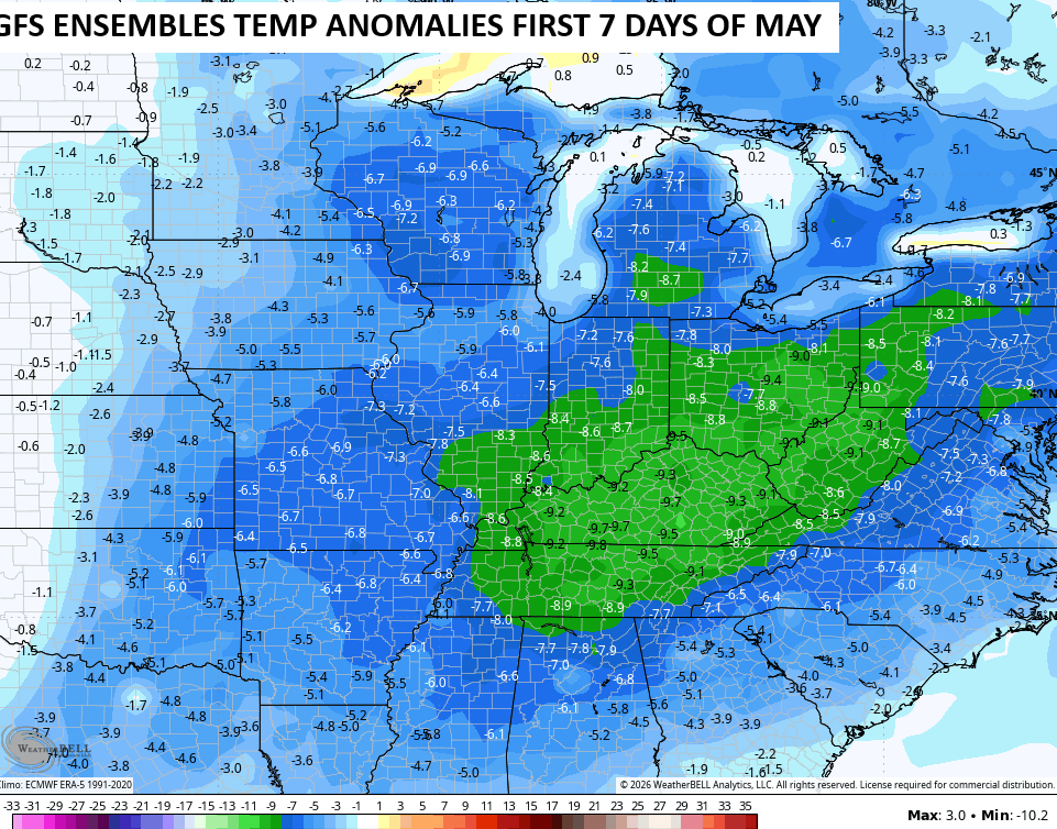
The GFS Ensembles are showing the first 7 days of May averaging well below normal…
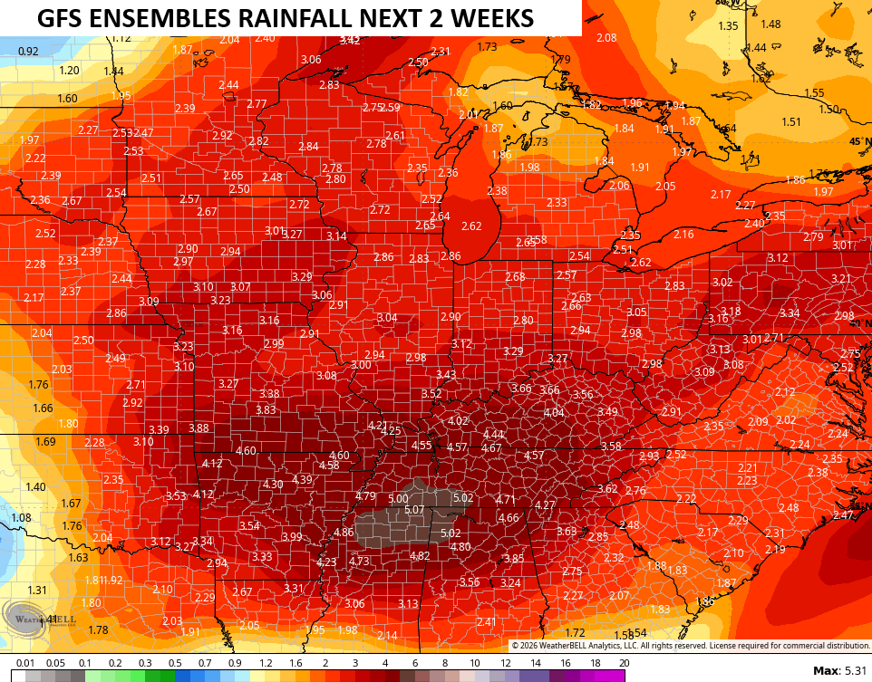
On the flip side, those same ensembles are showing some healthy rain amounts through the same time period…
I leave you with the tools you need to track any shower or storm going up out there today…


Current watches

Possible Watch Areas

Make it a fantastic Friday and take care.

The GFS ensembles will not verify.
Consistently disappointing.