Good Thursday, everyone. It’s another summer feeling day here in late April as we get set for a pattern change. This change takes us into a much more active setup with cooler than normal temps likely settling in during Kentucky Derby Week.
Temps today reach 80-85 in most areas on a strong southwest wind. Soak it up.
Temps are warm again on Friday as the threat for some showers and storms creeps into the picture. This action looks rather scattered across central and eastern Kentucky late Friday into the first part of Saturday.
The greatest concentration looks to be in the west and that’s where the Storm Prediction Center as a low-end risk for a few severe storms…

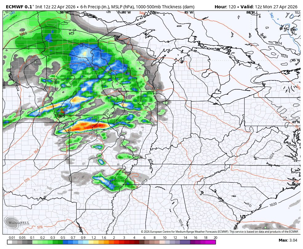
Some pretty nice spring weather takes hold late Saturday through Sunday. Winds will begin to crank late Sunday into Monday ahead of a potent storm system rolling our way. This brings the potential for strong to severe storms later Monday and Monday night…
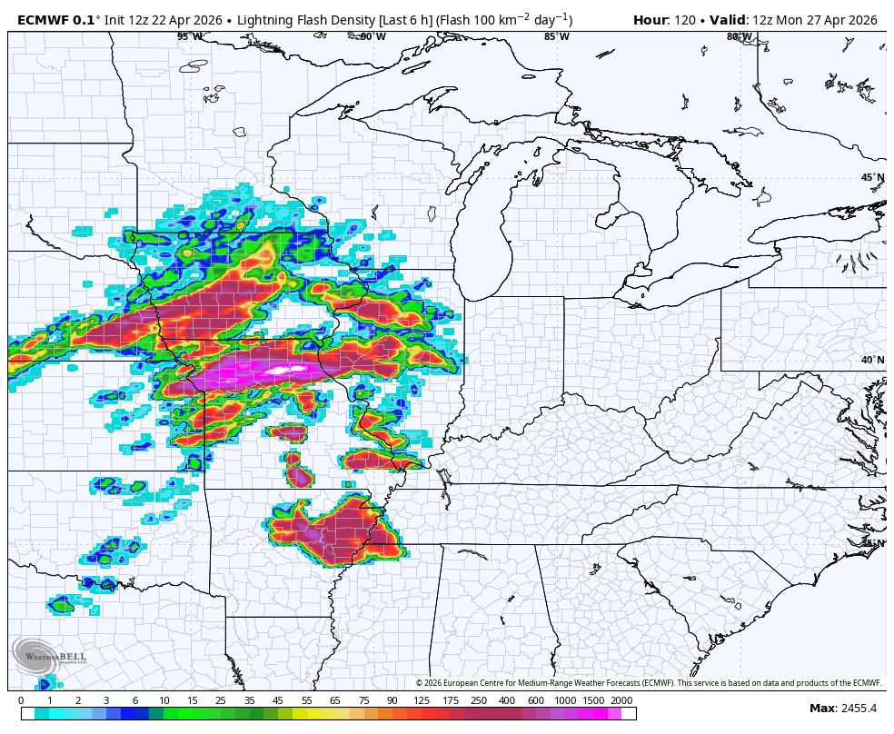
Check out the amount of lightning the Euro is spitting out with this system…
Here’s the general Severe Weather Outlook from the Storm Prediction Center for Monday…

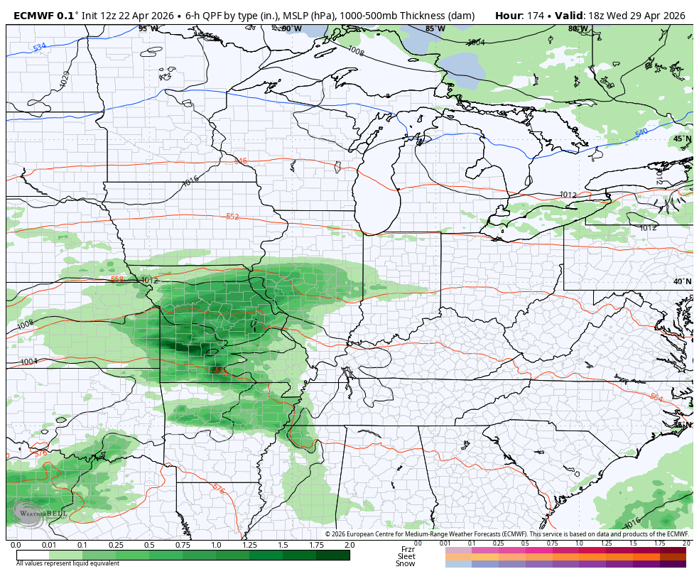
Temps come way down behind this system and look to REALLY come down behind the next system that may have a big impact on Kentucky Derby Weekend. The EURO has another potent system that as some serious chill behind it…
We still have a week or so to go and a lot can change in that amount of time. Here’s hoping that’s the case.
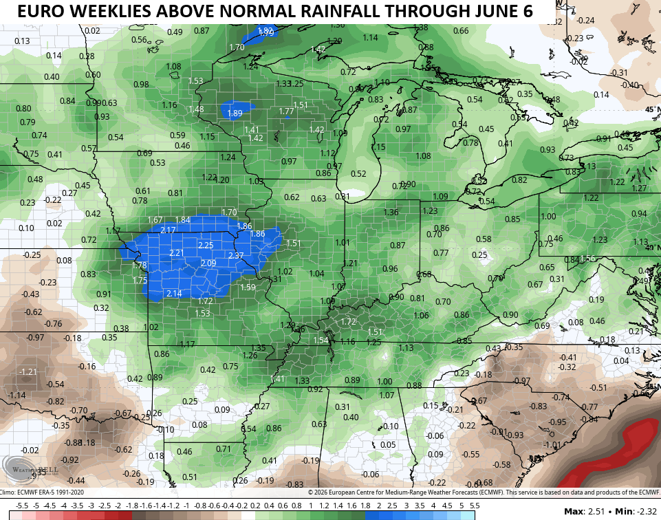
It is interesting to note the EURO Weeklies are all in on a pattern change to above normal rainfall through early June…
I leave you with the tools you need to track any shower or storm going up out there today…


Current watches

Possible Watch Areas

Make it a great Thursday and take care.

Those EURO weeklies will flop like they did earlier this season.
The Climate Prediction Center has updated their ENSO forecast. The weak La Nina is over, we are currently in ENSO-Neutral condition, and they anticipate a 65 percent chance for El Nino conditions to take over as early as mid-May. This is happening a lot sooner than what was forecasted at the start of the year, and it looks like this could be one of the strongest El Nino’s, ever. Historically, a strong summer El Nino in Kentucky results in above normal temperatures and below normal precipitation, and while many will welcome the heat, the lack of rain could amplify an already serious situation in south central Kentucky, where many of the lawns have taken on an appearance we usually see in mid August. Hopefully Kentucky won’t suffer the Georgia anf
Chris says most el niño summers here are cooler and wetter. We’ll see!
Sorry, I meant to say I hope that Kentucky will not suffer the same drought condition now being experienced in Georgia and Florida.