Good Wednesday to one and all. That warm wind continues out there today as our temps skew above normal through the rest of the week. Things start to change up a bit by the time we hit weekend and, especially, into Kentucky Derby Week. The pattern turns wetter, stormier and cooler.
Speaking of stormy, that’s one thing we have not seen this spring as it’s been one of the quietest spring severe weather seasons you’re ever going to see around here. This is especially true so far this April. Not a single tornado has been reported in the state with barely any kind of severe weather…
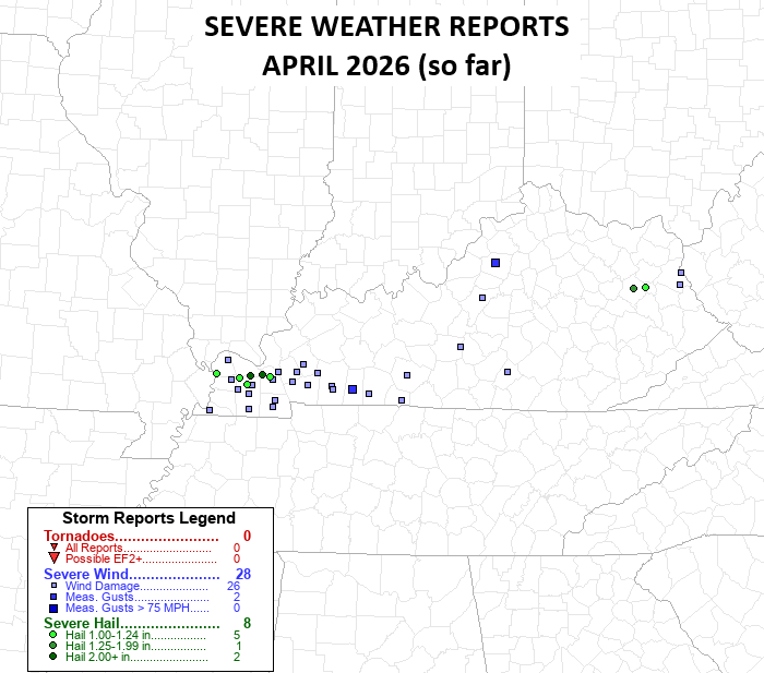
That’s wild to see and is a far cry from last April…
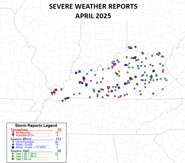
This April is on pace to be the warmest in recorded history for Kentucky and that’s pushed the severe weather well to our north. That doesn’t mean it stays there, however.
Isolated storms are out there today in the north and northeast as a weak front drops in. Temps are generally 75-80.
Highs reach the 80s for Thursday on a strong southwest wind. That’s ahead of a system set to bring showers and storms rumbling from west to east later Friday into early Saturday…
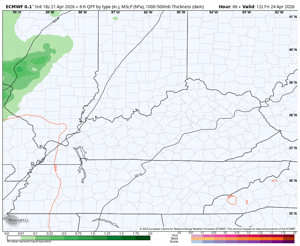
The showers and storms may linger into the start of Saturday with better weather blowing in throughout the day and that lasts into Sunday.
A more potent system targets the region Monday and Tuesday and may be our first true severe weather threat of April. That will be followed by another system later in the week, which may impact, at least, the start of Kentucky Derby Weekend.
The Euro and GFS are in pretty good agreement with the setup during this time…
EURO
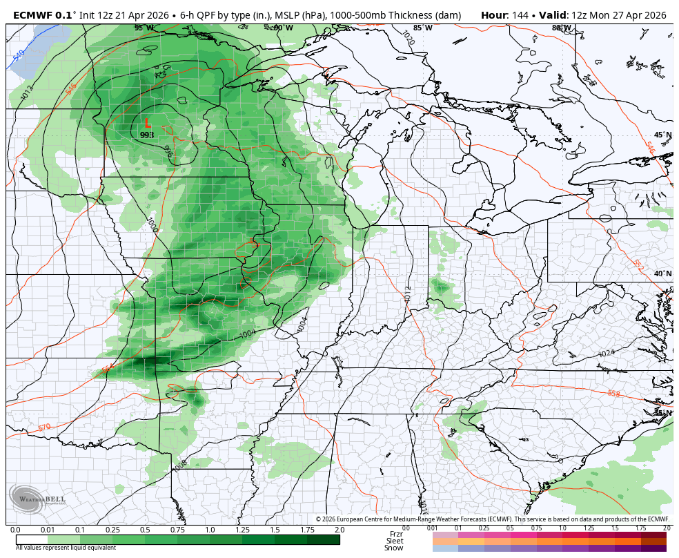
GFS
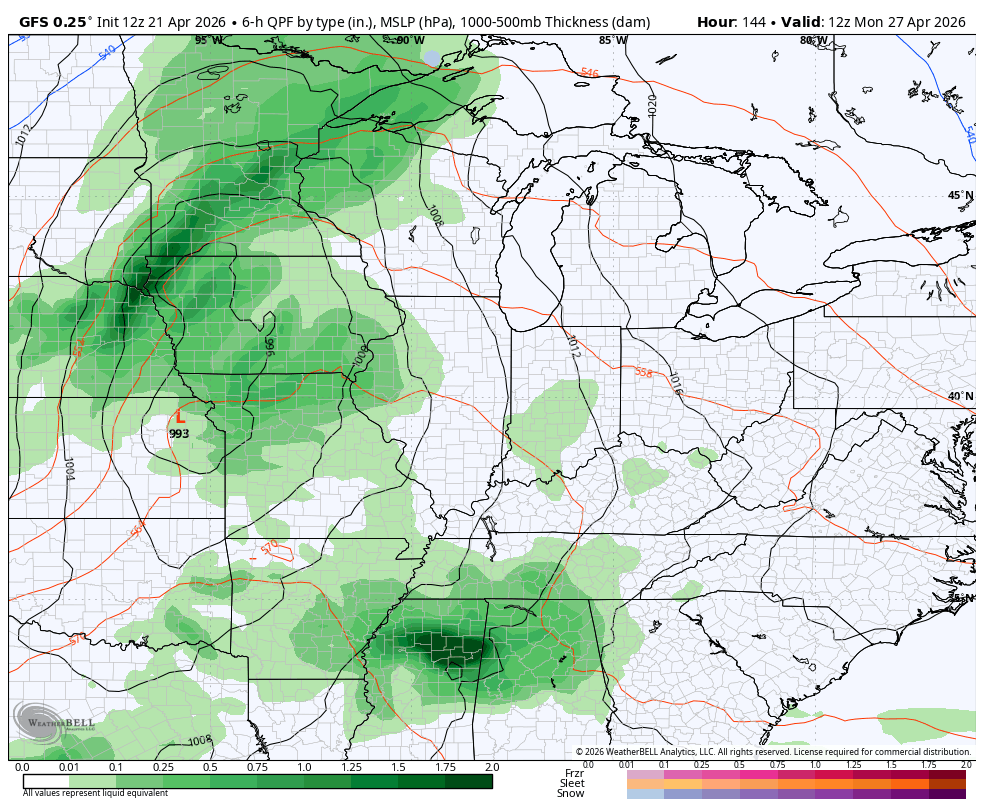
The Storm Prediction Center is already highlighting some of the region with the generic severe weather threat for Monday…

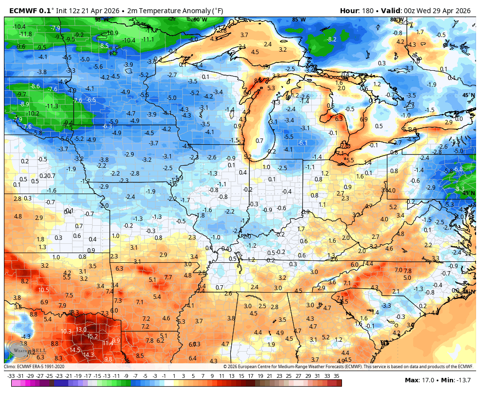
With the active setup comes the increasing potential for colder than normal temps to end April and begin May. This is something I’ve been talking about for a bit now as the blocking showing up continues to look pretty robust.
We, unfortunately, have some Barney colors showing up. Here’s the GFS temperature anomalies from early next week through May 7th…
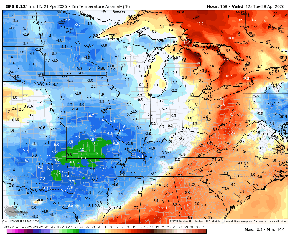
The EURO has a similar thought and look…
I leave you with the tools you need to track any shower or storm going up out there today…


Current watches

Possible Watch Areas

Make it a wonderful Wednesday and take care.

I still think it doesn’t cool off much.
May has been known to have chilly weather
So?