Good Tuesday to one and all. It’s an absolutely gorgeous weather day taking shape as our temps rebound into the 70s. Even warmer temps are on the way later this week as we eye an increasing chance for thunderstorms that lead us into a more active, and likely cooler pattern for May.
Temps are frosty cold this morning with 30s for most of central and eastern Kentucky. Afternoon readings reach deep into the 70s as a west to southwest wind kicks in.
Highs flirt with 80 Wednesday then into the low 80s for Thursday and Friday.
This is where the pattern really starts to change with significant blocking beginning to show up in the higher latitudes. The weekend still looks warm with the threat for some scattered storms, but the blocky pattern takes control for Kentucky Derby Week and into the opening days of May…
This kind of pattern can bring an extended stretch of below normal temps and above normal rainfall.
The GFS looks like this from this Friday through Kentucky Derby Saturday…

The EURO is similar…
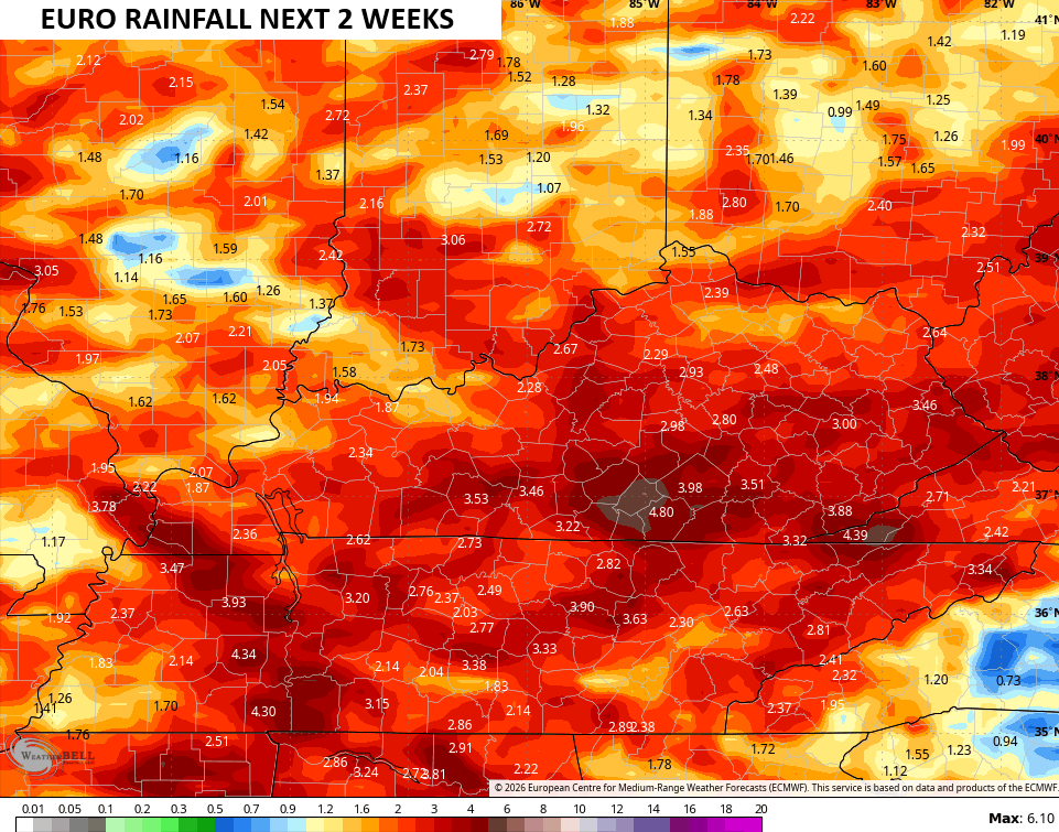
Here’s the rainfall numbers from the EURO over the next few weeks…
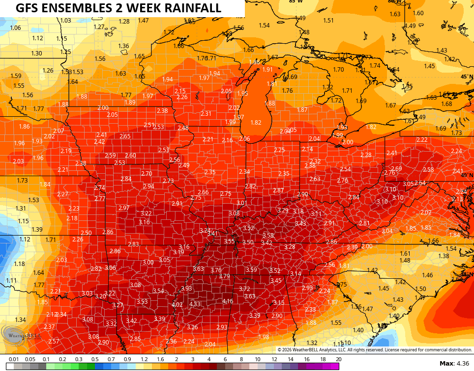
The GFS Ensembles for the same time period…
With a developing El Nino that should jump into the strong category later this year, wetter than normal summers and cooler than normal summers often show up. Will this one follow along the historical curve? Me thinks so.
Have a terrific Tuesday and take care.

This el niño will not result in a wet/cool summer.
patterns usually don’t last more than 3 months… so we’ve had dry boring spring which is usually reserved for summer. Since we’ve been in that pattern it would make sense to flip… who knows?
Patterns have been whacky forever, so nothing is happening as expected.
Ten tornadoes (the strongest of which was an EF-2) occurred in the NWS Chicago forecast area last Friday. Here is the link for the summary, along with some pretty amazing photos of a few of the tornadoes: https://weather.gov/lot/2026_04_17_severeweather
Also, the severe weather season has been very active throughout the Chicago Metro Area, with seven days of severe weather in March and five days in April, Here is the link for the summary: https://weather.gov/lot/2026_ActiveSevereStart