Good Monday to one and all. It’s another chilly day across the Commonwealth with a kiss of frost for some. As the week wears on, temps start to surge as we head into a more active setup to end April and roll into the month of May.
Temps today range from the 50s in the north and east to the 60s in the west.
Lows tonight can reach freezing or below in a few spots in the north and east, so green thumbs are on alert.
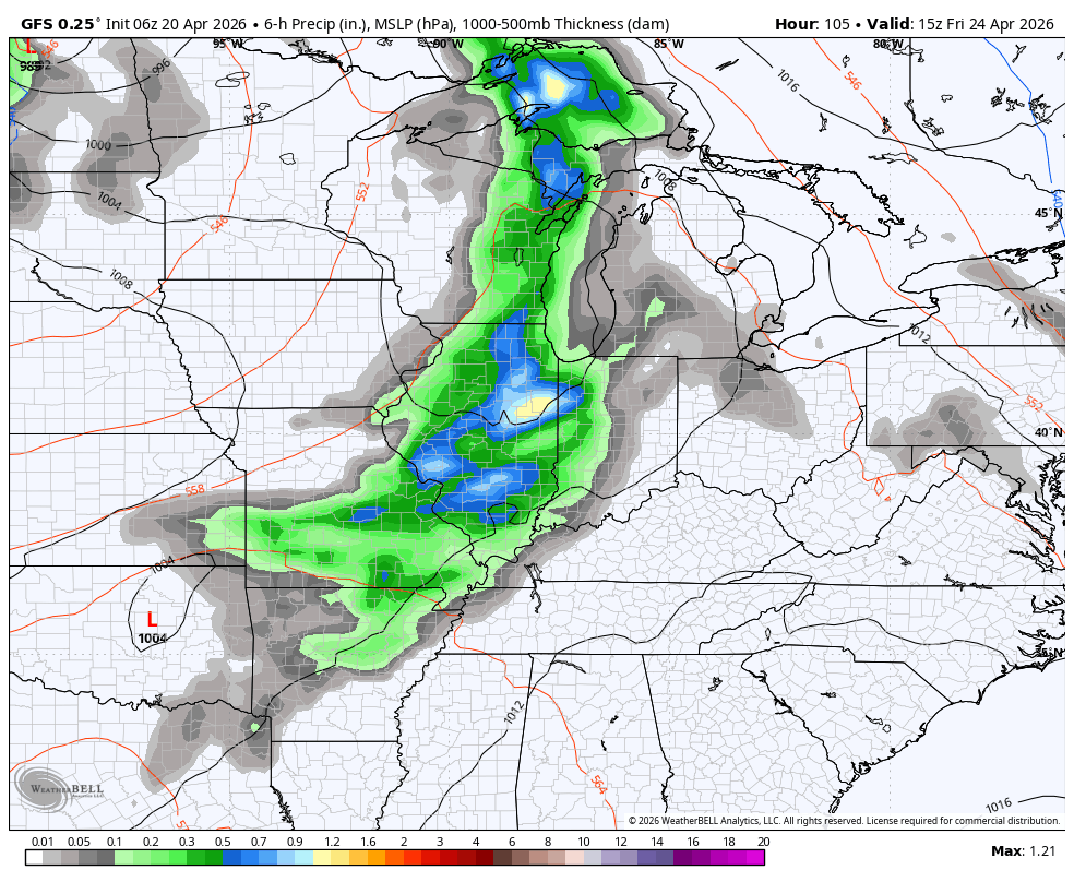
Temps hit the 70s by Tuesday then will make a run at 80 from Wednesday through Friday. This leads us into a setup likely to throw rounds of showers and storms at us over te weekend into Kentucky Derby Week. This animation starts Friday and runs through Kentucky Derby Day…
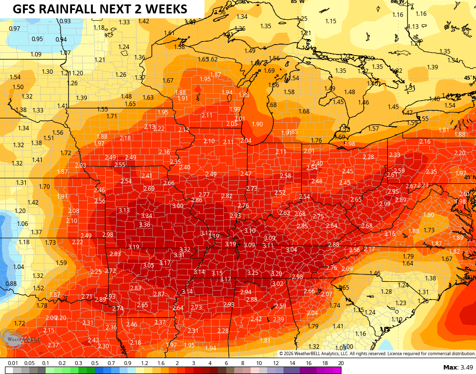
The GFS Ensembles are showing this more active setup on the average rainfall amounts over the next 2 weeks…
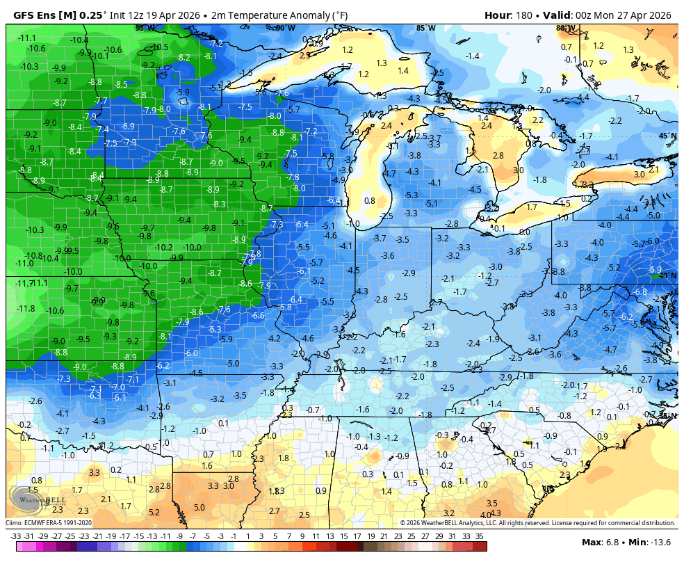
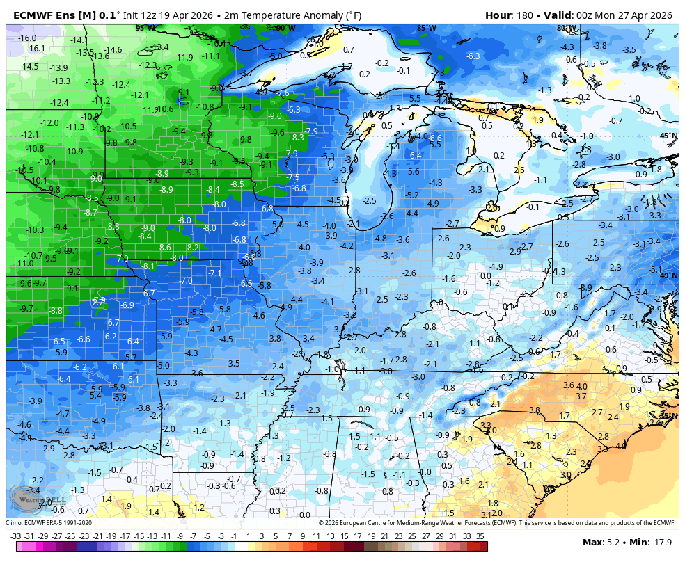
This comes with a below normal temperature pattern showing up on both the GFS Ensembles and the EURO Ensembles…
GFS ENSEMBLES
EURO ENSEMBLES
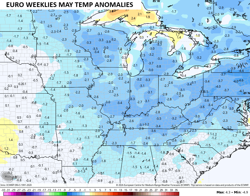
The EURO Weeklies have been running too cool for the spring so far, but they are showing a below normal temperature May…
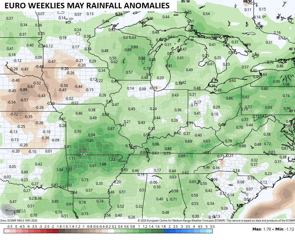
Those below normal temps also come with above normal rainfall…
I’d settle for that!
Have a magnificent Monday and take care.

I don’t think this verifies.
Probably so, Jeff, especially if you check the forecast dates displaying on the first animation!
I’m not rooting against needed rain. I’m just not convinced it will happen, based on recent trends.
I agree. I’ve seen too many rainfall forecast maps that show Warren County will get plastered by 4 to 8 inches of rain over a one or two week time span, when in reality we get barely 3/4 of an inch.