Good Sunday to one and all. Chilly winds are blowing across the region today as our recent run of summertime days comes to an end. This won’t last long as we go right back toward a warm pattern in the week ahead before much bigger changes show up.
Temps today range from the upper 50s to low 60s in many areas. Skies are partly sunny with some clouds creeping in from the north later today. This is ahead of another weak boundary that may keep just enough clouds going to prevent widespread frost tonight. Still, green thumbs should take precautions.
Highs Monday may actually be a few degrees cooler than today in the east and northeast with the 60s in the west.
Mild winds surge in for Tuesday with highs in the 70s.
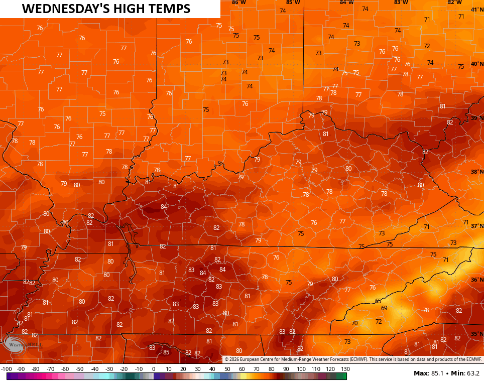
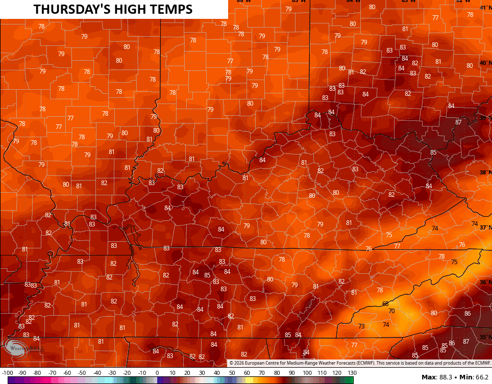
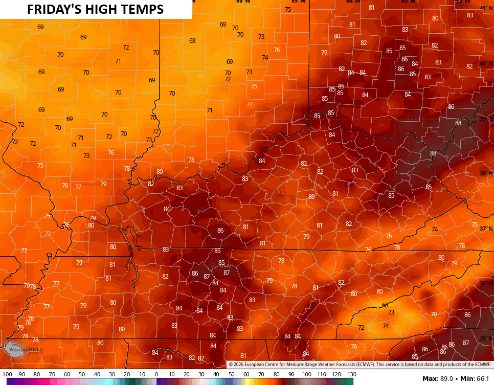
From there, we see the 80s creeping back in from Wednesday through Friday. Look at the daily high temps from the EURO…
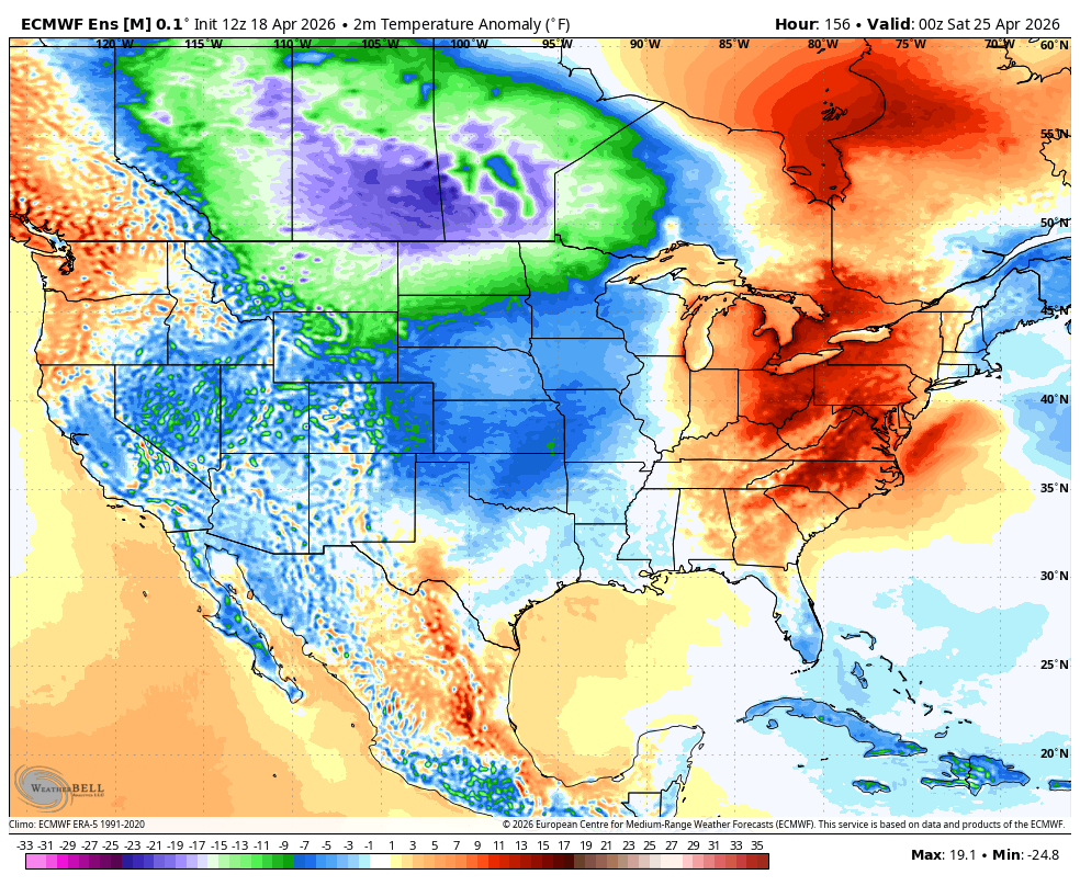
This above normal pattern has been the theme of the spring with numerous record highs since early March. Cooler changes are showing up as we end April and roll into early May. The blocking I’ve been talking about will push below normal numbers into much of the country starting later next weekend into Kentucky Derby Week.
The EURO Ensembles have a really cool look from this far out…
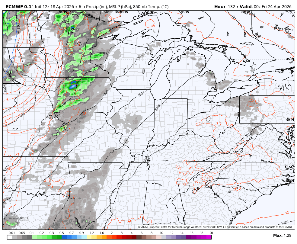
This pattern is also likely to turn wetter and stormier and that’s something the EURO and GFS agree on during this same period…
EURO
GFS
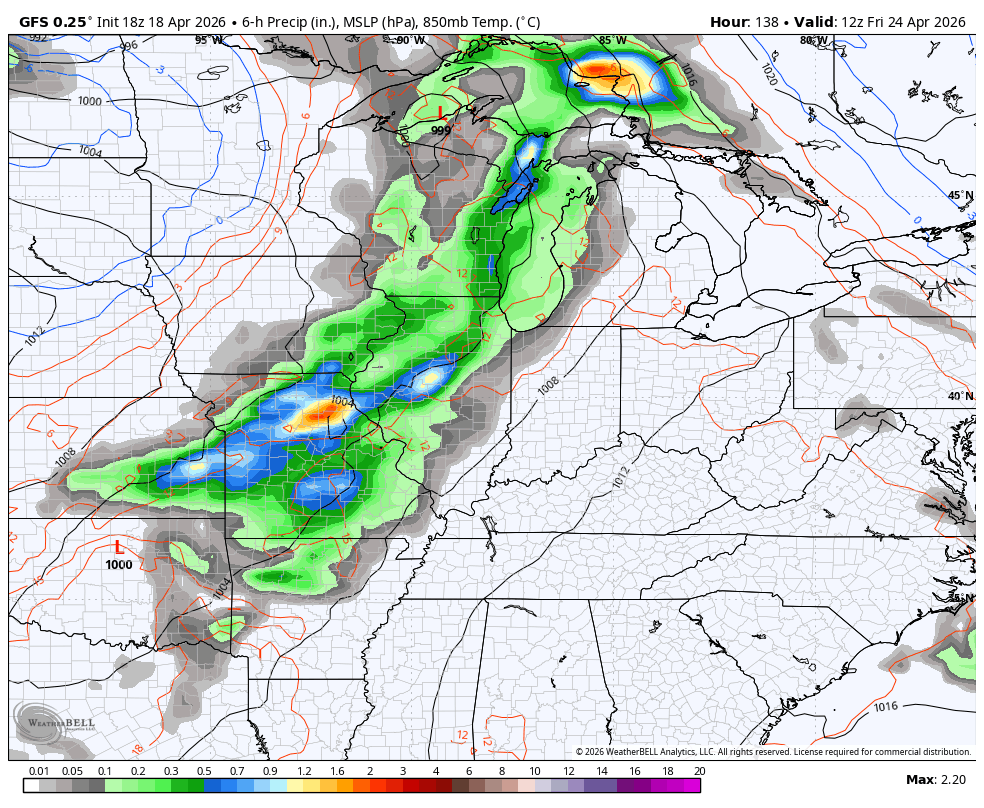
We really need that wetter pattern to show up, folks.
Have a great Sunday and take care.

Hope the wetter pattern verify 2
It’s not going to verify.
Looking forward towards a real pattern change, it actually feels like April this morning. I didn’t get any rain but needed a break from the heat and humidity