Good Saturday, everyone. Some dramatic changes are sweeping across Kentucky today with crashing temps and some much-needed rains. While the rains won’t add up to a ton, it will certainly help us out just a bit.
Today’s showers and storms will be weakening across the west early today before increasing a bit the farther east it gets this afternoon and evening. The threat for severe storms is low, but it’s there across parts of central and eastern Kentucky.
The greatest threat will be northeast of Kentucky with some of that extending into northeastern Kentucky. Here’s today’s Severe Weather Outlook from the Storm Prediction Center…

The individual threats from the SPC continue to highlight damaging wind as the main player…


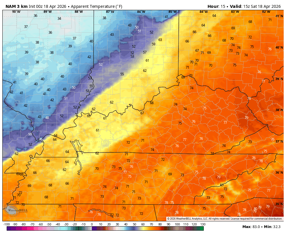
Temps will tank from west to east throughout the day. Eastern Kentucky hits the 80s at the same time areas of the west and north are dropping through the 50s. Check out the feels like temperature plunge from midday today through 7am Sunday…
Highs Sunday range from the upper 50s to low 60s with the chance for some frost Sunday night for areas with clear skies.
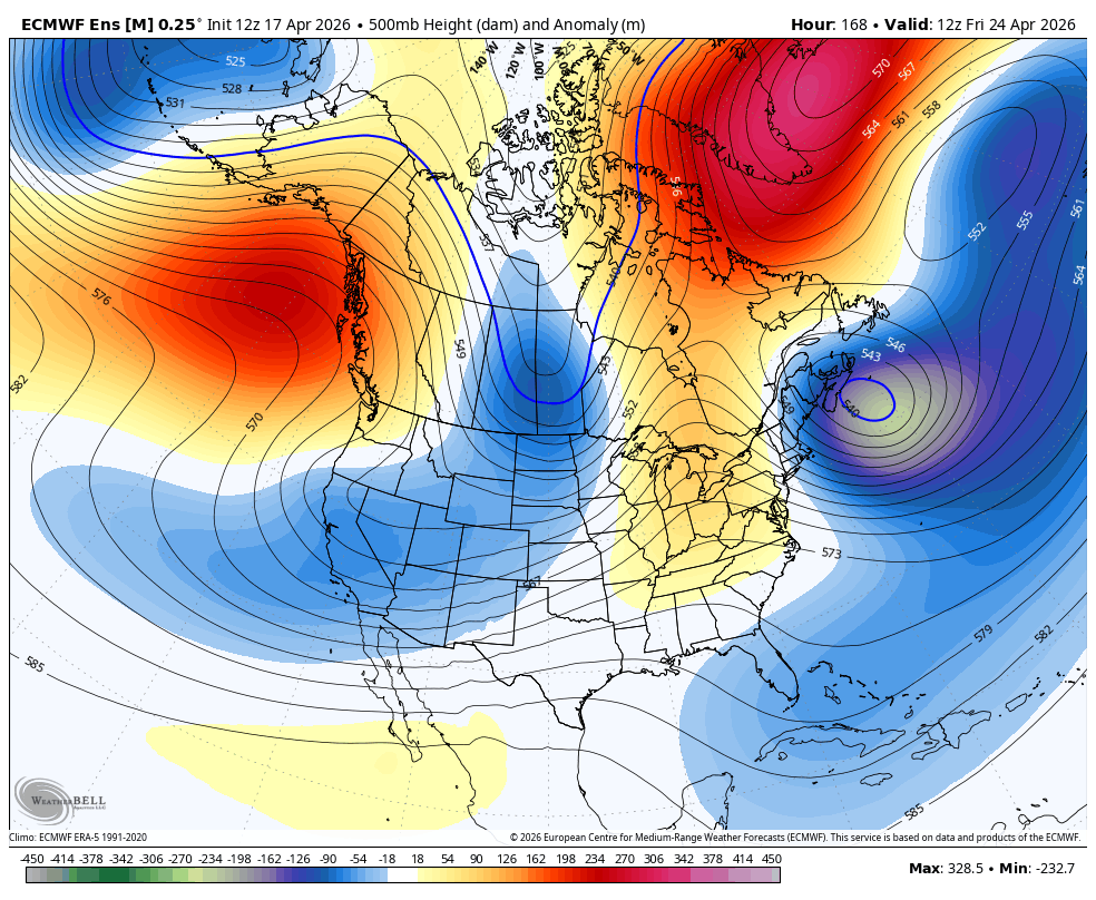
Temps surge back toward the 70s by Tuesday and may hit the 80s later next week before large scale hemispheric pattern changes show up in the closing days of April and early May. Watch how a trough looks to get established across the eastern half of the country during this time…
Notice the cooler than normal air looking to overwhelm much of the country…
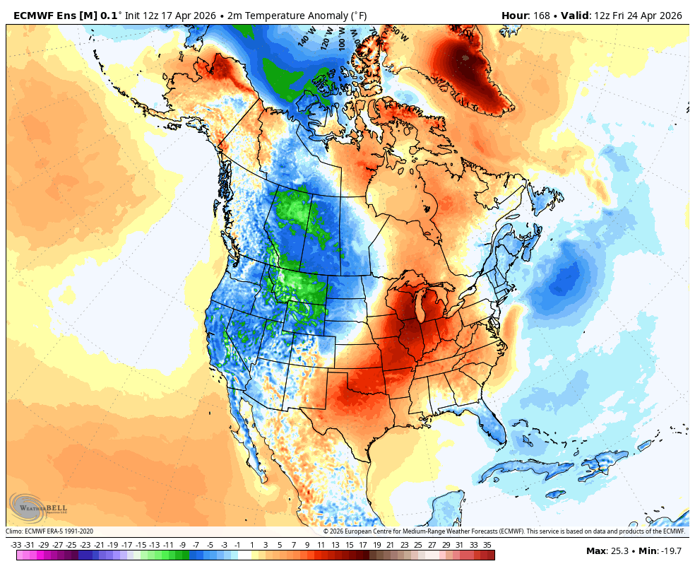
Cooler than normal doesn’t necessarily mean cold, but that likely comes along with a wetter looking setup. That’s something sorely needed around here.
As always, I have you guys all set to track the storms and the big changes out there today…


Current watches

Possible Watch Areas

Make it a fantastic Friday and take care.

I’m still not buying the long-term changes forecasted. I’ll believe it when I see it.
Finally got some rain to settle the dust down, hopefully the pattern change that’s coming will give us beneficial rain to damp the long dry spell