Good Friday to one and all. Our summertime pattern continues out there today, but it’s living on borrowed time. A major change blows in for the weekend, bringing much needed showers and storms with a frost threat to follow.
Temps today reach 80-85 across most of Kentucky on a gusty southwest wind. Skies will be partly sunny.
A potent cold front sweeps across the state from west to east on Saturday. Showers and storms will roll along and ahead of this boundary through the wee hours of Sunday morning before exiting eastern Kentucky. You can see all this from the future radar of the WRF…
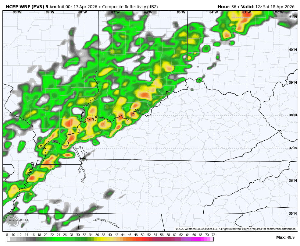
A few of these storms may be strong or severe with the best chance across the northeastern part of Kentucky…

Here’s a look at the individual severe weather threats…


Temps tank from west to east on Saturday as the much-needed rains work through here. Some areas hit the 80s early Saturday while at the same time other parts of the state are dropping into the 40s.
This temp animation shows the drastic change with some 30s showing up late Saturday night into Sunday morning…
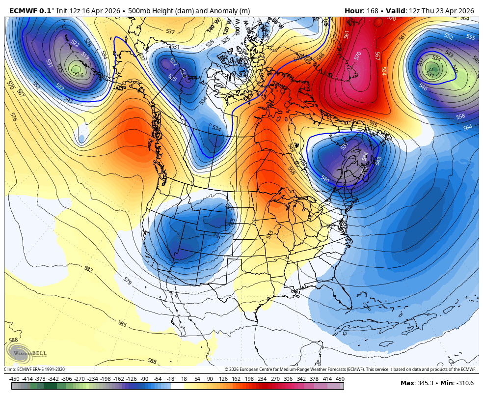
Temps rebound into the 70s very quickly by Tuesday then make a run toward 80 later next week. That’s ahead of a blocky looking pattern setting up for the closing days of April into early May. This setup leads to the potential for big dips in the jet stream across our region. The EURO shows this well…
So do the EURO Ensembles…
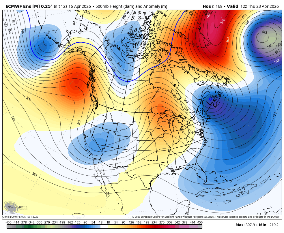
That’s a much better look for some rains around here and would also bring rounds of below normal temps into the region.
I’ll have the latest on WKYT-TV and WKYT+ later today. As always, I have you guys all set to track whatever storms go up out there today…


Current watches

Possible Watch Areas

Make it a great Thursday and take care.

Trends say that the forecast for a blocky pattern won’t pan out. I’ll go with the trends.
The issue where Akismet rejects posts longer than a sentence or two is driving me nuts.