Good Tuesday, everyone. Rounds of strong to severe storms continue to target the Bluegrass state through tonight. This will move away, leaving us with a much cooler pattern setting up shop for Kentucky Derby Weekend. Can we keep the rain way for the big weekend? Maybe.
Strong to severe storms exit the southeast before the sun comes up this morning with a pretty good setup following. Much of the day features temps in the upper 70s to near 80 on a strong southwest wind flow.
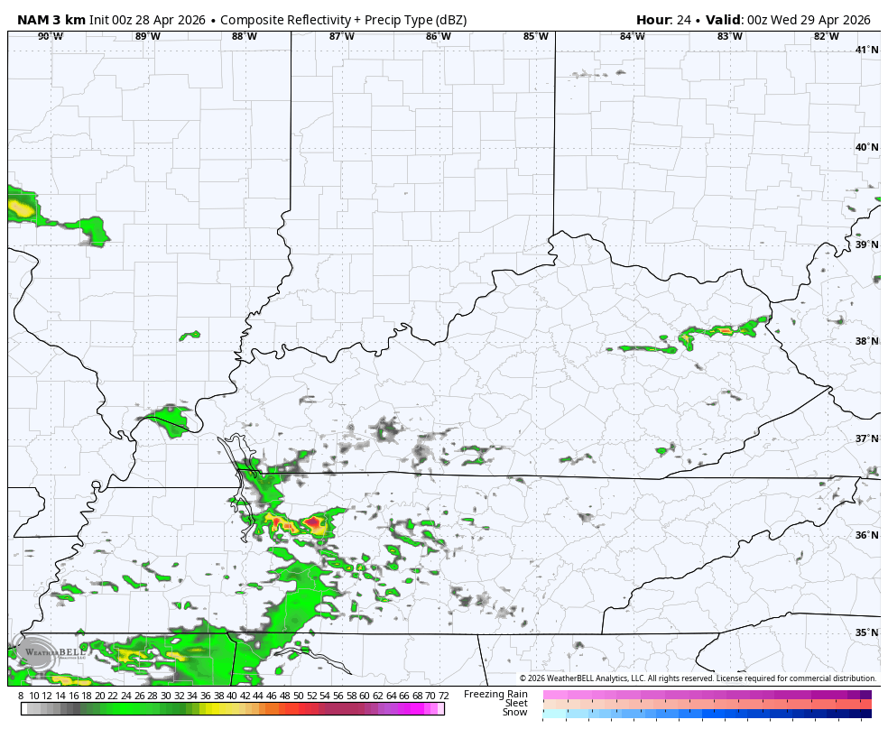
Thunderstorms then flare up from southwest to northeast this evening and continue into the start of Wednesday with some leftover showers throughout the rest of Wednesday.
The future radar from the Hi Res NAM shows all this from 8pm this evening through 8pm Wednesday…
The severe storms threat isn’t as robust today and is centered just a little farther south. The Storm Prediction Center has a Marginal Risk to Slight Risk for much of the state through tonight…

Here’s a look at the individual threats we are facing out there today…


Cool winds settle in as the Wednesday morning storms depart with a few showers lingering. This cool air turns downright chilly Thursday and into Kentucky Derby Weekend.
I’m still worried about showers if not a band of out and out rains impacting the state later Friday into part of Derby Day. The forecast models are showing this opportunity as our southern low creeps a bit farther north compared to earlier runs of the GFS…
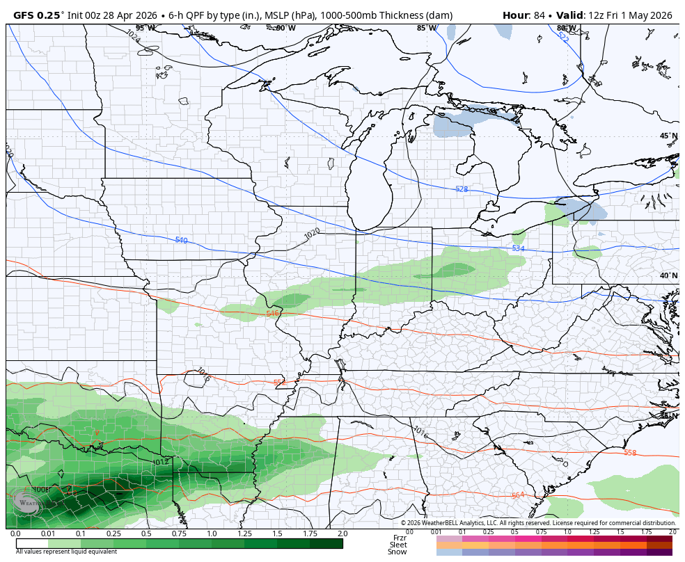
The Canadian is trying but has much more upper level energy to create some showers with Great Lakes Flakes…
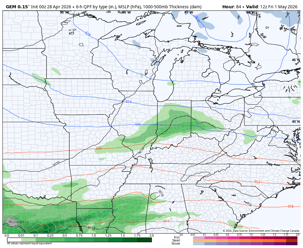
The chance for some WV mountain snowflakes are there in this type of a setup.
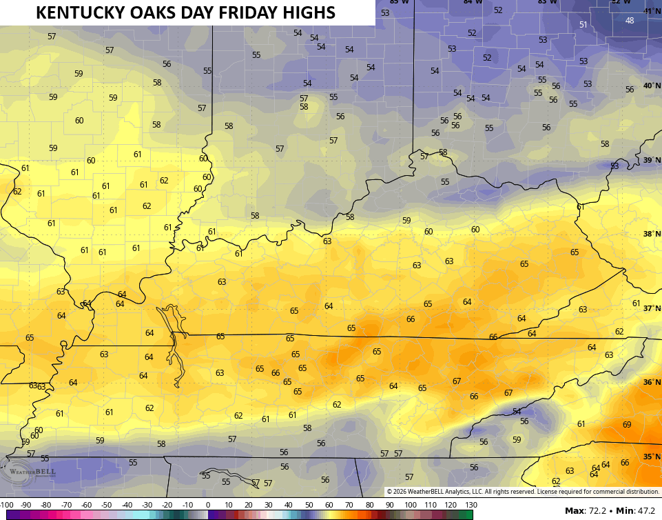
Oaks Day high temps depend on how quickly the upper level system drops in from the northwest. Temps range from the mid 50s to mid 60s…
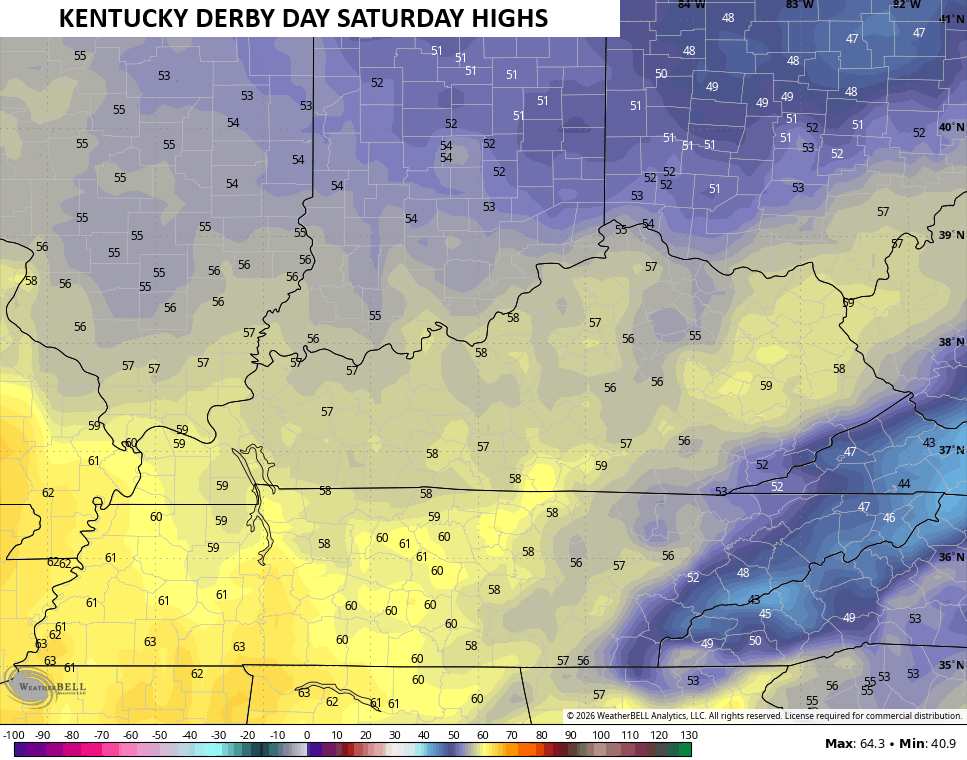
Kentucky Derby Saturday will be among the chillier ones we’ve had with highs that may not get out of the 50s…
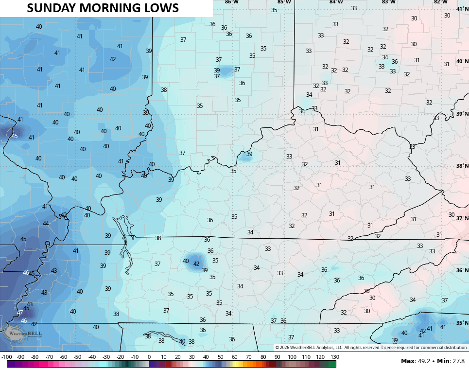
If skies clear Saturday night, frost and/or a light freeze will be possible across many areas…
I’ll have the latest on WKYT-TV and WKYT+. Until then, I leave you with the tools you need to track today’s severe weather threat…


Current watches

Possible Watch Areas

Make it a terrific Tuesday and take care.

Schroder hope all is good with you. Haven’t heard from you in a while.
He posted several weeks ago that he is undergoing treatment and therapy for cancer, and won’t be able to post for quite a while.
No big deal.
While severe weather was confined to downstate IL on Monday, NE IL and surrounding areas were hit by strong non-thunderstorm wind gusts of between 45 MPH and 77 MPH early Monday afternoon, which caused some damage. The wind gusts were caused by a “wake low” that formed behind a decaying squall line of storms that moved through the area, which caused barometric pressures to drop rapidly.
Here’s the link to the summary, along with a detailed explanation of what a wake low is: https://weather.gov/lot/2026_4_27_WakeLow