Good Thursday to one and all. It’s another cool day as the sun returns for the entire region. As we look ahead toward Mother’s Day Weekend, temps should rebound as we track two systems bringing rain chances to the Commonwealth.
Lingering showers are out there this morning in the south and southeast, but those move away fairly quickly with partly sunny skies. Many areas reach 60-65.
Friday looks REALLY good with temps hitting the upper 60s and low 70s under a mix of sun and clouds. Winds will increase as some clouds thicken from northwest to southeast ahead of a weak system dropping in.
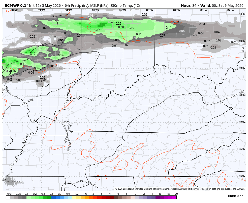
This brings a scattering of showers and storms in here Friday night and early Saturday…
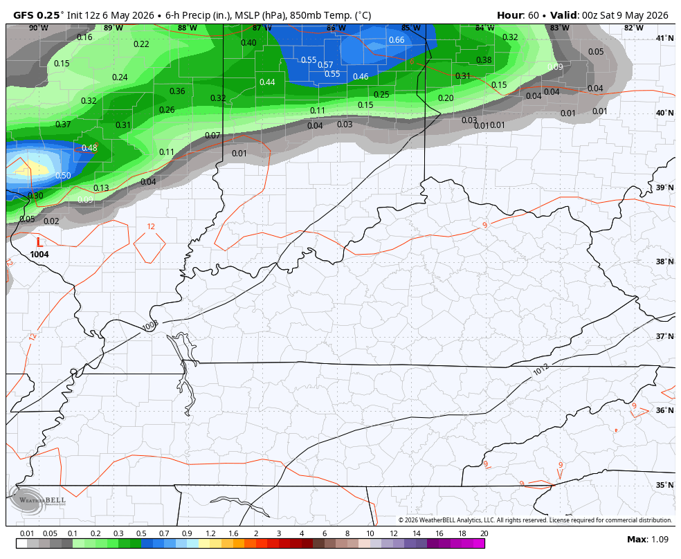
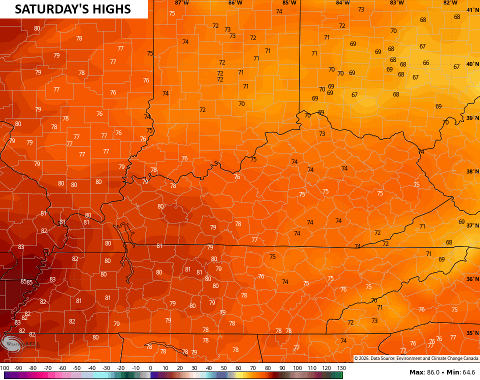
Once the early morning action moves away, temps jump up toward 70-75…
Temps can be even warmer for Mother’s Day…
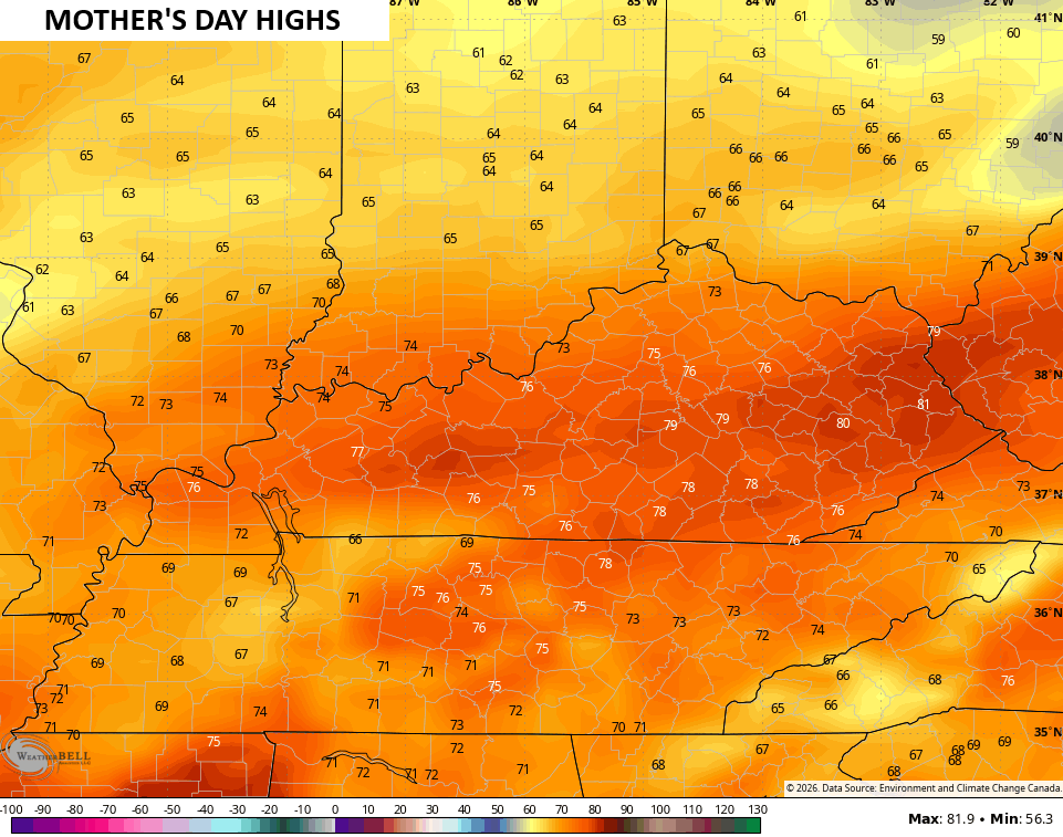
Scattered showers and storms will be dotting our skyline, but lots of dry times will be showing up…
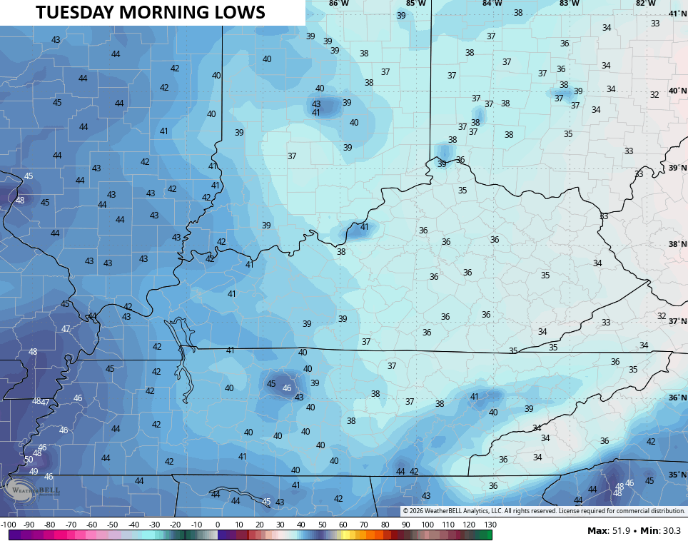
Much cooler air comes right back in behind this boundary for Monday and Tuesday. Lows Monday night and early Tuesday can drop toward patchy frost levels in some areas…
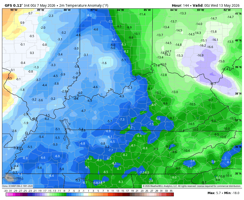
There’s another shot of well below normal air waiting on us for the second half of next week. A little more Barney may show up…
I leave you with your Kentucky Weather Radars to track any early day action left in the tank…

Have a great Thursday and take care.

I hated Barney before, but now I really despise him.
Iam pretty sure everything CB has said in the past month has been pretty spot on, where is that negative Nancy that always doubts the models???
Where is your sense of intelligence?
It won’t happen anyhow.