Good Wednesday, everyone. We have a cold front dropping into the region today and it’s bringing along a quick hitting blast of chill. This has the chance to produce a touch of frost tonight before we track a big surge of summer temps.
Today’s front has a few showers along and ahead of it early today. This zips in and out very quickly with sunshine taking over. Once the front enters the picture this afternoon, a couple of scattered thunderstorms blowing up in the east. I’ll have your tracking tools for all this at the end of the post.
The chilly winds behind this knock out temps down into the upper 30s and low 40s tonight…
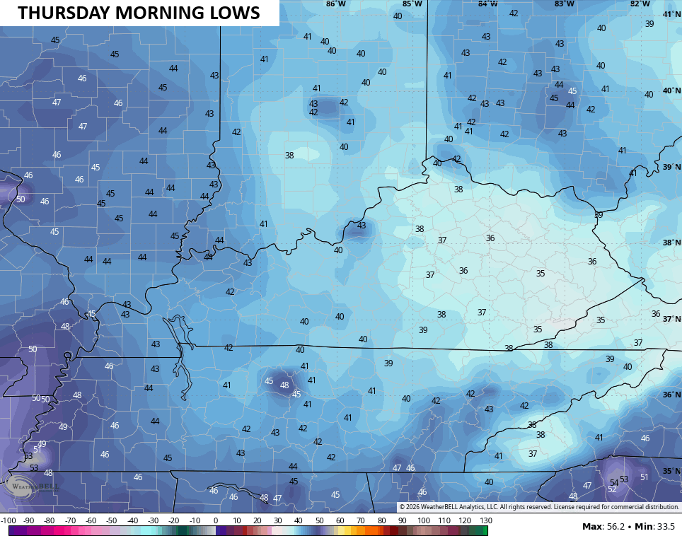
Some patchy frost is possible for areas with clear skies.
Highs on Wednesday are generally low and middle 60s, making for another incredibly cool May day.
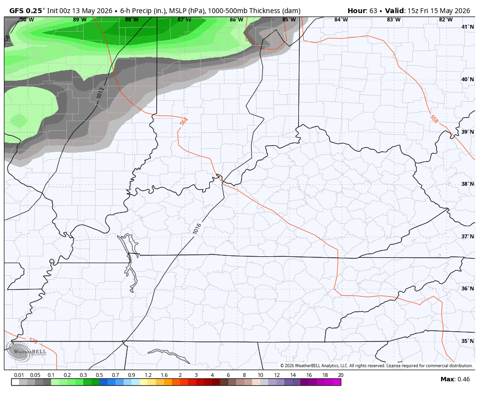
Warmer winds kick in from the southwest for Friday. There’s the chance for a shower or storm rolling in along and ahead of that. A better chance for a few storm clusters rolls in Friday night and Saturday…
Highs this weekend really take off with the 80s on Saturday and highs that can reach 85-90 Sunday and Monday with the chance to reach the low 90s in some areas…
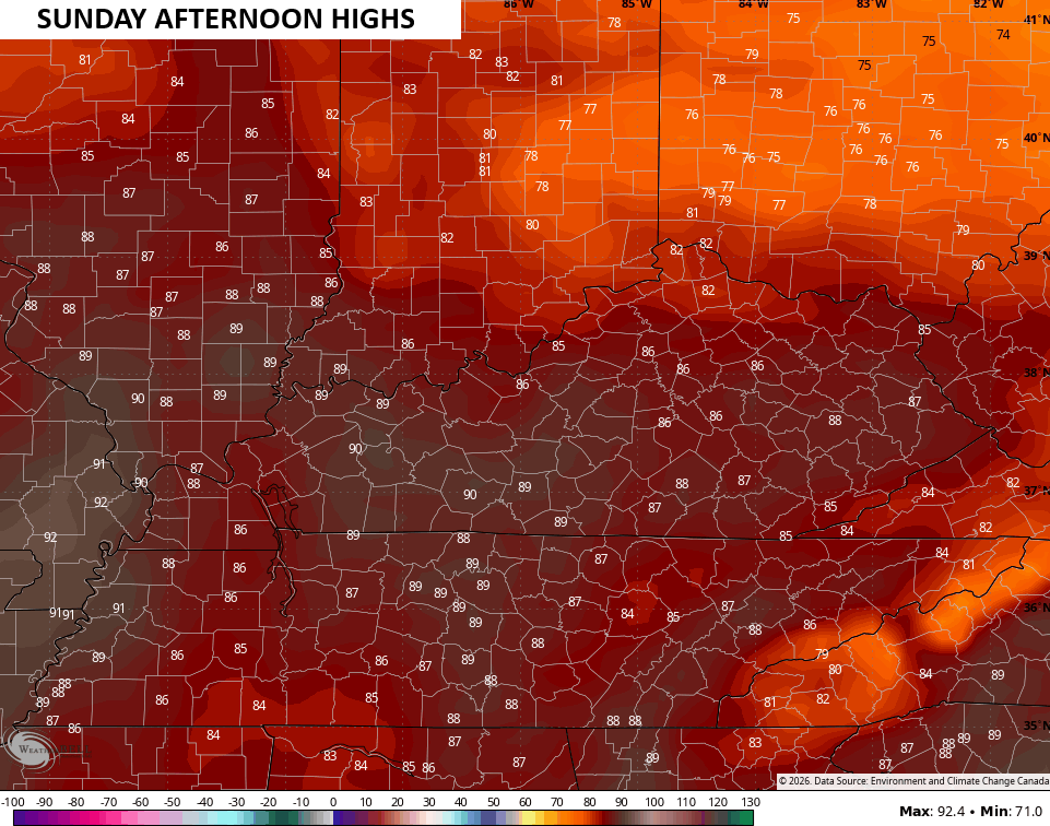
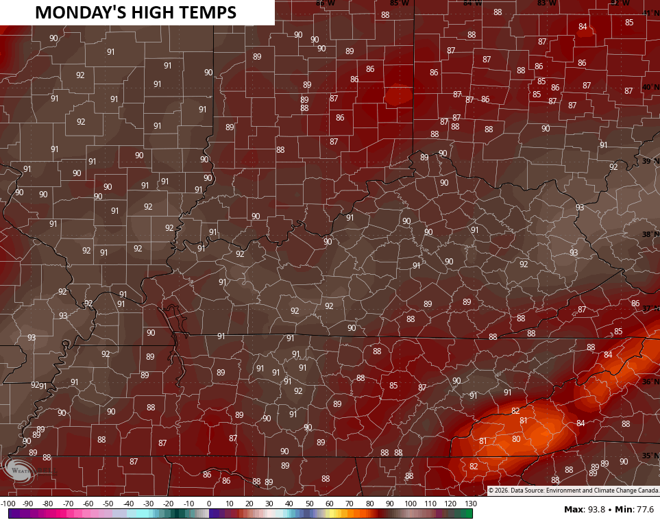
Can we break a few record highs? Maybe.
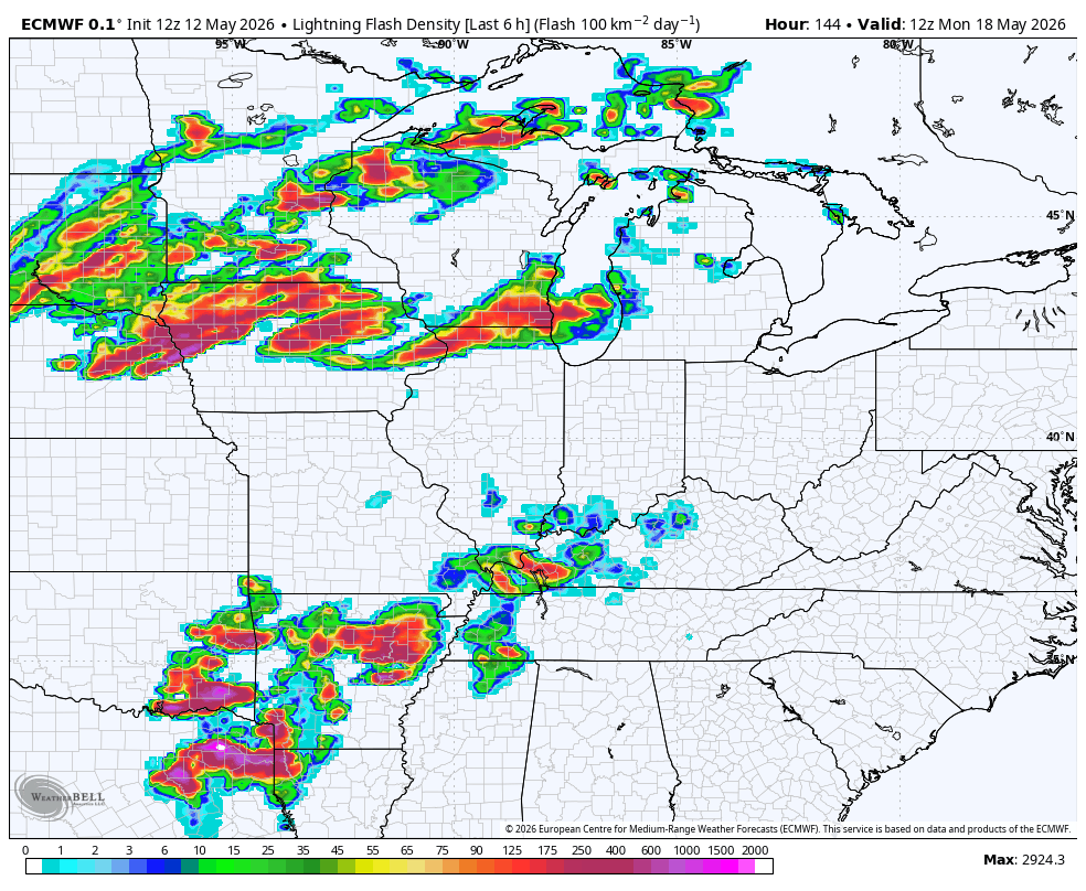
The pattern then looks active into much of next week and through Memorial Day Weekend. This animation from the EURO starts Monday morning and goes through the Tuesday after Memorial Day…
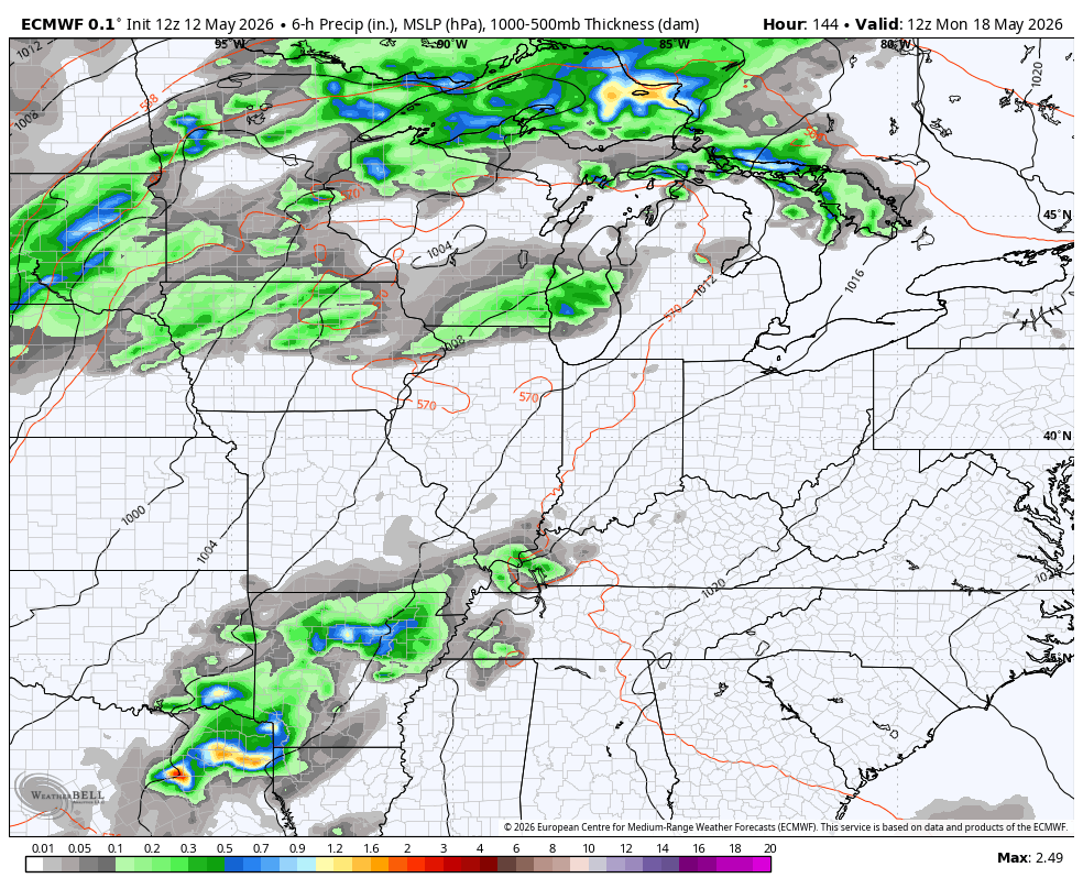
This setup can give us our first threat for severe weather this entire month. Look at the amount of lightning for this same time period…
I’ll have the latest on WKYT-TV and WKYT+. Until then, I leave you with the tools you need to track the rain and rumbles of thunder through the region…


Current watches

Possible Watch Areas

Make it a wonderful Wednesday and take care.

Bring on the 90s