Good Thursday to one and all. Chilly winds are blowing across Kentucky today, but the focus is on a major surge of summer temps for the weekend into next week. This could bring 90 degree temps in here with the potential for some thunderstorms.
Temps this morning are in the upper 30s to low 40s in many areas and only stay in the 60s for highs. Skies will be mixed with some clouds and sun.
Friday morning starts chilly with the chance for some upper 30s in the valleys out east. Warmer winds kick in throughout the day with highs in the 70s and just a slight chance for a shower or storm streaming in from the northwest. This action will be more prominent to our northwest before it weakens as it moves toward the state.
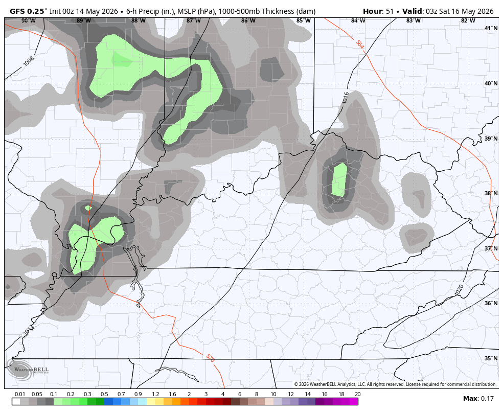
A much better shot for some storms will be noted late Friday night into Saturday with the potential for some strong storms with locally heavy rains. You can see all this action on the future radar…
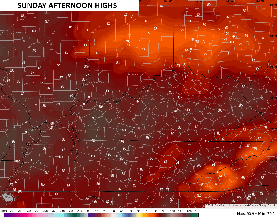
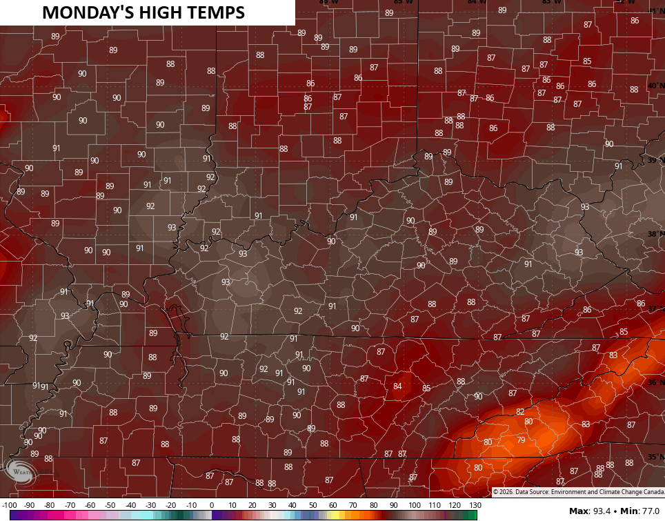
Temps hit the 80s for most areas on Saturday with the increasing potential for near record highs Sunday through Tuesday. That’s when highs reach the upper 80s to low 90s across the state…
It’s pretty wild we are talking about 30s and 90s within a few days of one another, but the weather only walks on the wild side nowadays.
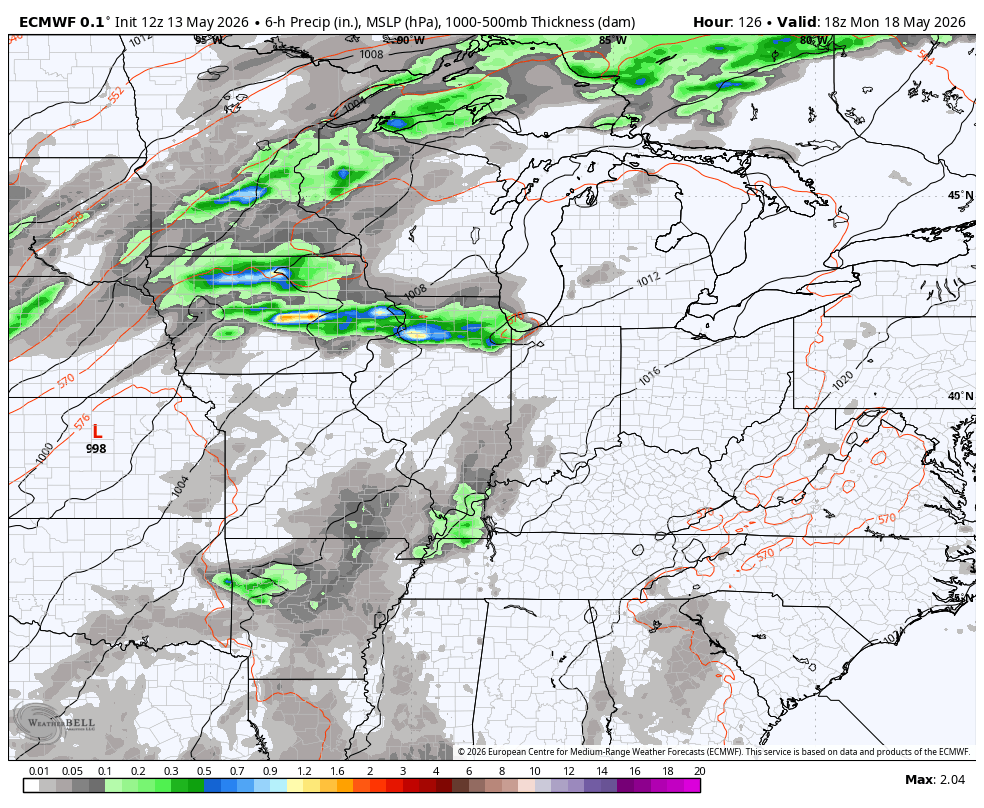
The pattern next week looks to kick off a pretty stormy setup that may roll through the Memorial Day Weekend and into the final week of May. This animation from the EURO starts on Monday and goes through May 28th…
That’s a lot of lightning the model is spitting out during this same time…
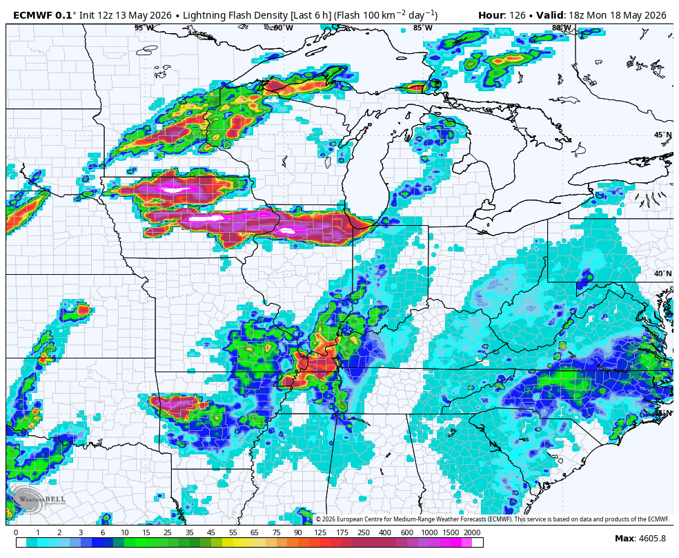
I would imagine we get some severe weather out of this.
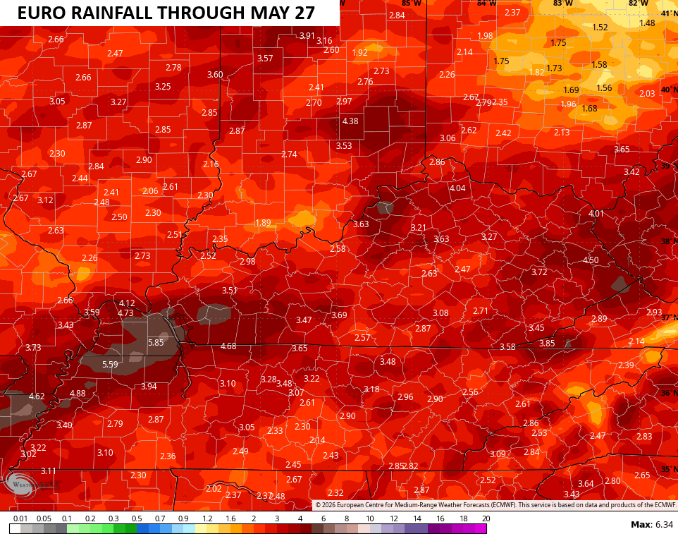
Some healthy rains also show up…
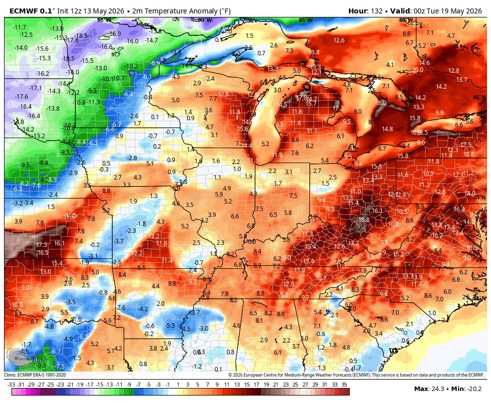
With the chance for more active setup, we see the temps bouncing around a bit in terms of above normal and below normal. Here’s the EURO…
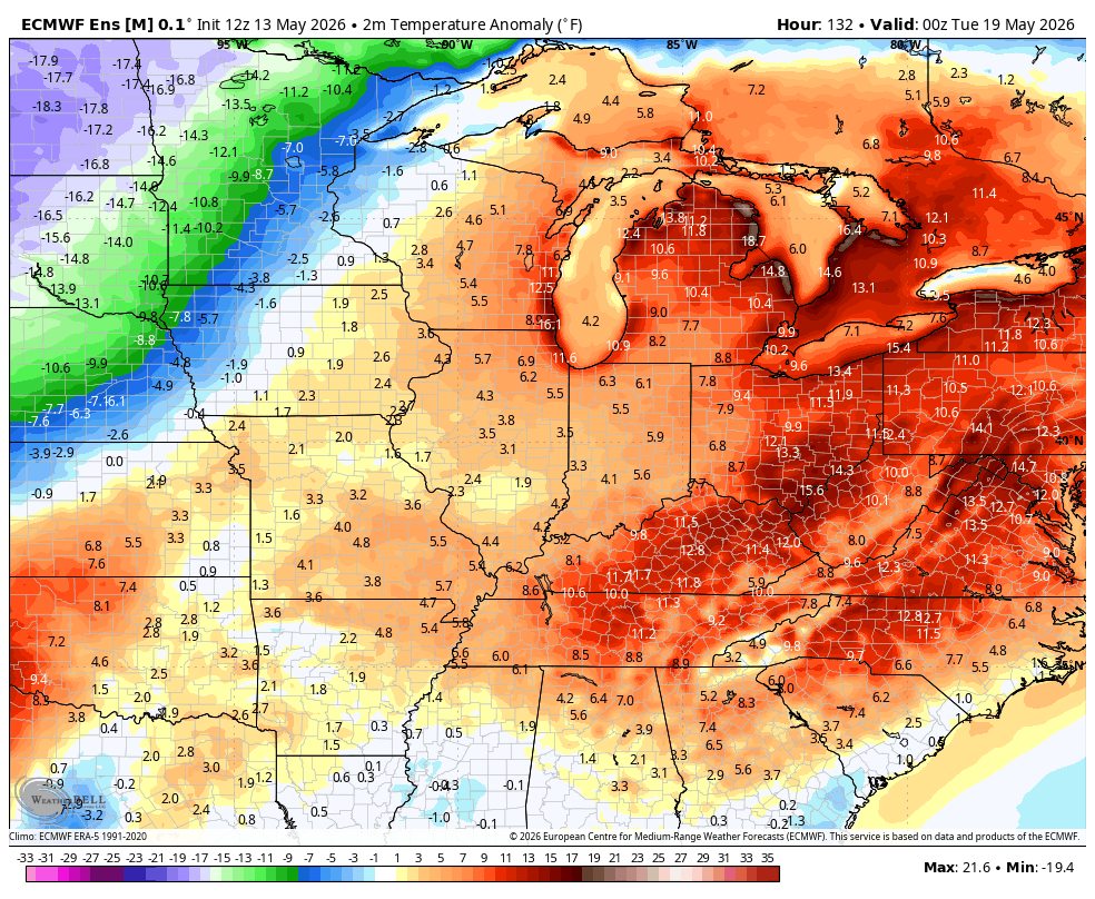
The EURO Ensembles…
I’ll have the latest on WKYT-TV and WKYT+. Until then, I leave you with your daily dose of tracking tools…


Current watches

Possible Watch Areas

Make it a great Thursday and take care.

We could use some moisture the d word has came out to by some experts. It doesn’t stand for dry. I hope 2012 isnt repeating itself hot and dry
As much as I enjoy warmth, I have zero want for a 2012 drought repeat. Unfortunately we are overdue for such a thing to happen again.
For some reason, 2012 doesn’t stand out in my mind nearly as much as 1999… That summer it would absolutely NOT rain
I’m afraid we are facing a similar drought this summer. The El Nino event that was forecasted to begin in late July early August has already established, and is forecasted to be one of the biggest in modern times. This event, combined with a southeast ridge that is at typical summer strength right now, will push the jet stream farther to our north. If tropical activity kicks off in the Gulf of Mexico, it could send some needed moisture our way, but El Nino will tend to weaken systems in the Atlantic, or push them north into the mid Atlantic.
The worst heat will set up west of the Mississippi, where climatologists are forecasting a heat dome. Forest fire danger on the west coast and western Canada will be off the charts.
So far this month, the average temperature at Chicago’s O’Hare Airport is 52.7 degrees, which is a hefty 5.1 degrees per day below normal. But with the big warmup about to begin, the month will likely average above normal by the time it’s over.
After a wet April for the Chicago area, this month is very dry, with only .30 inches of precipitation. I’m not sure I can believe the predicted high rainfall totals for the next few weeks.