Good Thursday to one and all. June temps are slowly taking control as the numbers continue to climb through the upcoming weekend. That’s also when some showers and storms show up, kicking off what looks like a pretty active setup over the next few weeks.
Temps are cool again this morning with upper 40s and low 50s. Highs hit the low 80s for most of Kentucky with a mix of sun and clouds. Humidity levels remain low but start to climb a bit on Friday’s southwest winds kick in, boosting temps into the middle 80s.
Saturday is a very warm day with middle 80s and the chance for a few upper 80s.
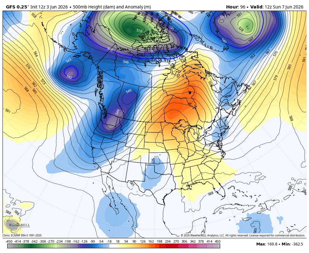
The active pattern starts after this as the overall pattern across the Northern Hemisphere takes on a pretty non-summertime look. If we just focus on North America, the 500mb height anomalies animation doesn’t look like June. Look at the blocks on the GFS…
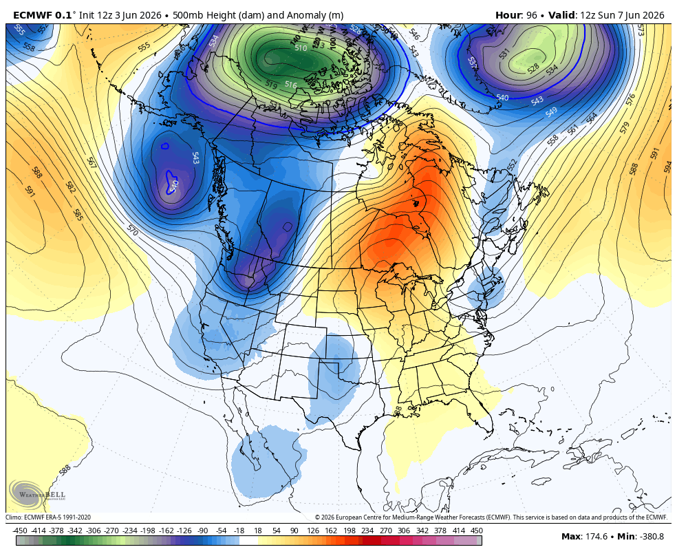
And the EURO gives us the same look…
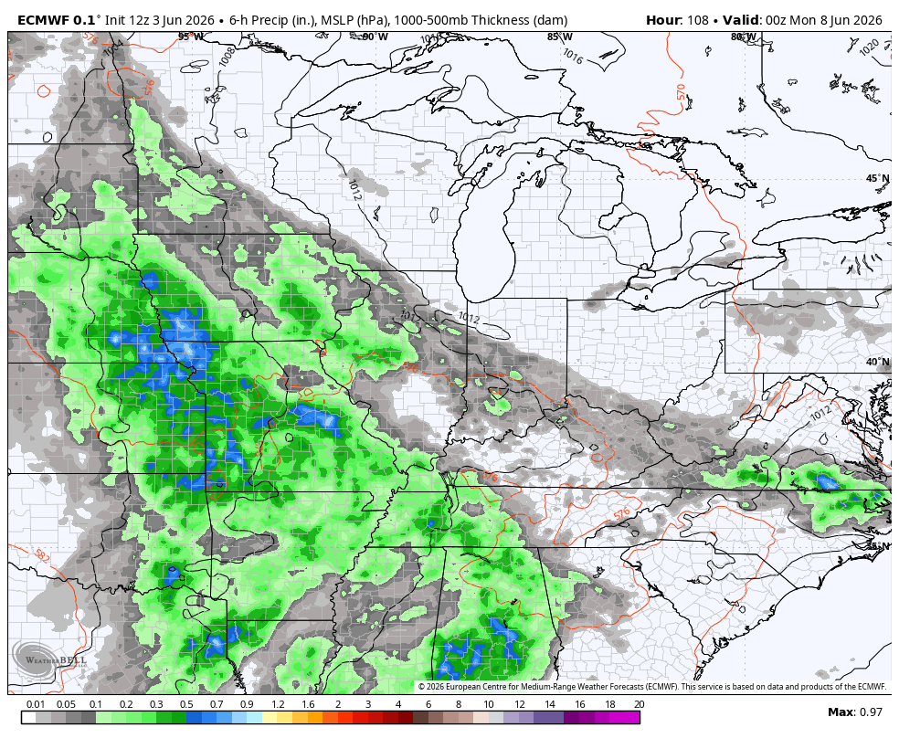
The end result is a busy setup that will likely feature a lot of shower and thunderstorm activity for much of the country, including here in Kentucky. Scattered stuff looks to fire up Sunday with the opportunity for waves of rain and storms showing up after that. Here’s the EURO through 18th…
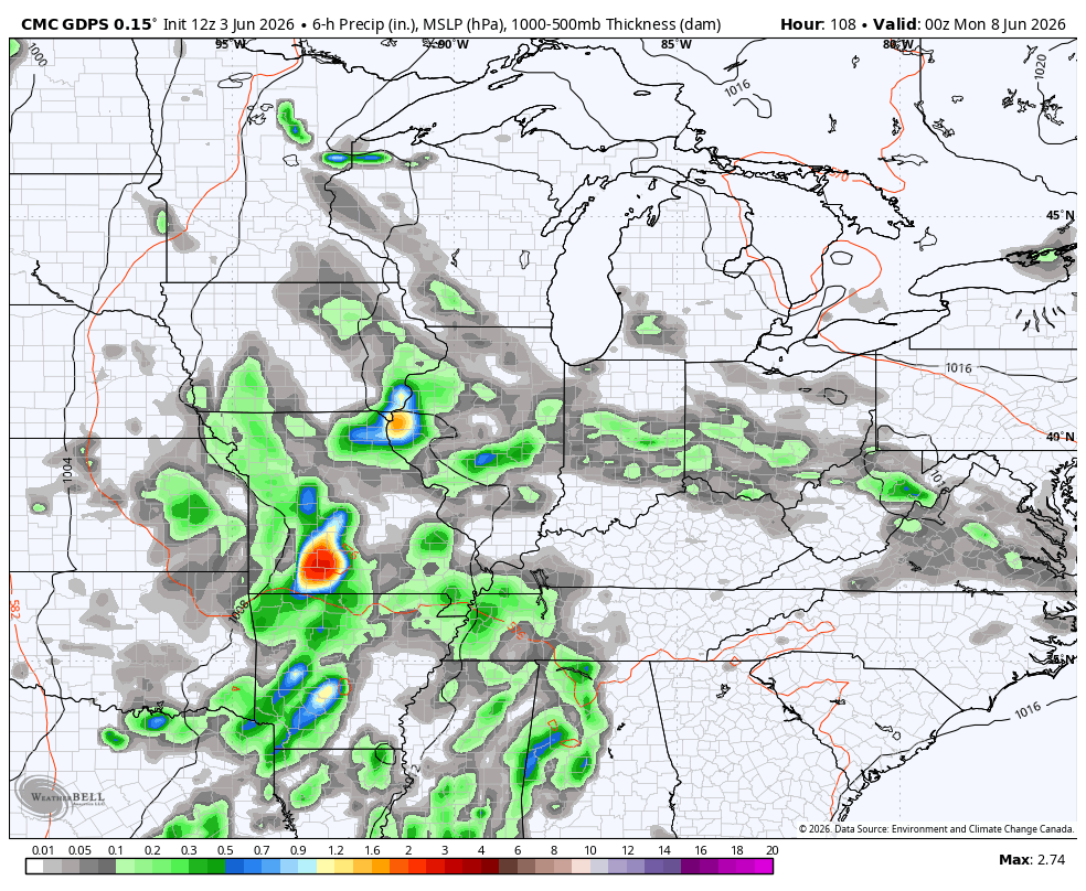
The Canadia only goes into July 13th, but has a similar view…
Have a great Thursday and take care.

I think this spring so far has been a record in terms of BORING weather. But I’m loving the fact that it’s not disgustingly hot. I hope it remains this way through the entire summer, minus the boring(ness)
It won’t. 🙂
Bring on the heat.
You can go to Phoenix get all the eat you want. 100 degrees there everyday. I dot mind some heat just not prolong ones
And you can go to northern Alaska for plenty of winter. I don’t mind some cold, just not extended or extremely so. 😉
What’s wrong with moderately warm or moderately cold? You want endless straight up oppressive heat.
False