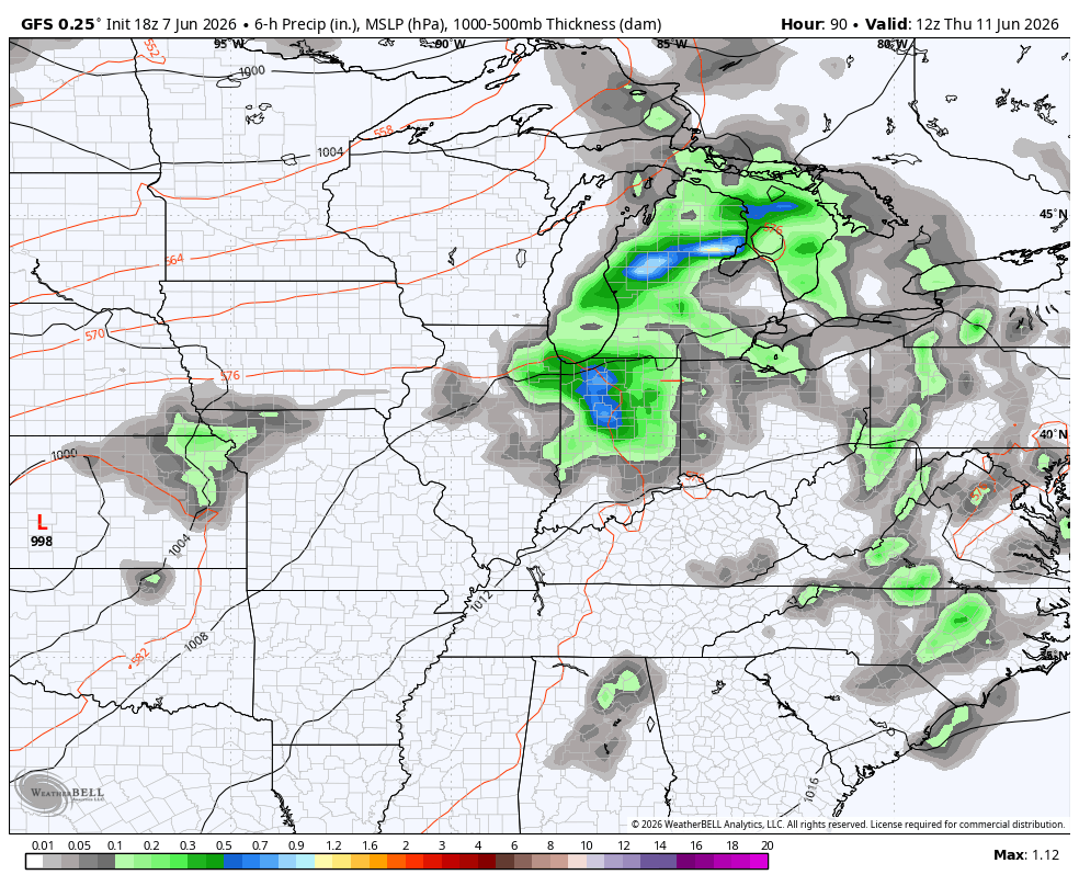
Good Monday, everyone. Rounds of showers and storms are kicking in across the Commonwealth and these may create a few issues. Torrential rains will cause local flash flooding issues to develop from time to time through the middle of the week.
The storms today through Wednesday will be coming at us in clusters, meaning it will NOT be raining all the time. The greatest concentration of heavy rain producing storms will be across the central and west today into Tuesday.
This action then spreads farther east later Tuesday and Wednesday.
Computer forecast models don’t do well with thunderstorms, but we continue to see a healthy signal for torrential rains showing up…
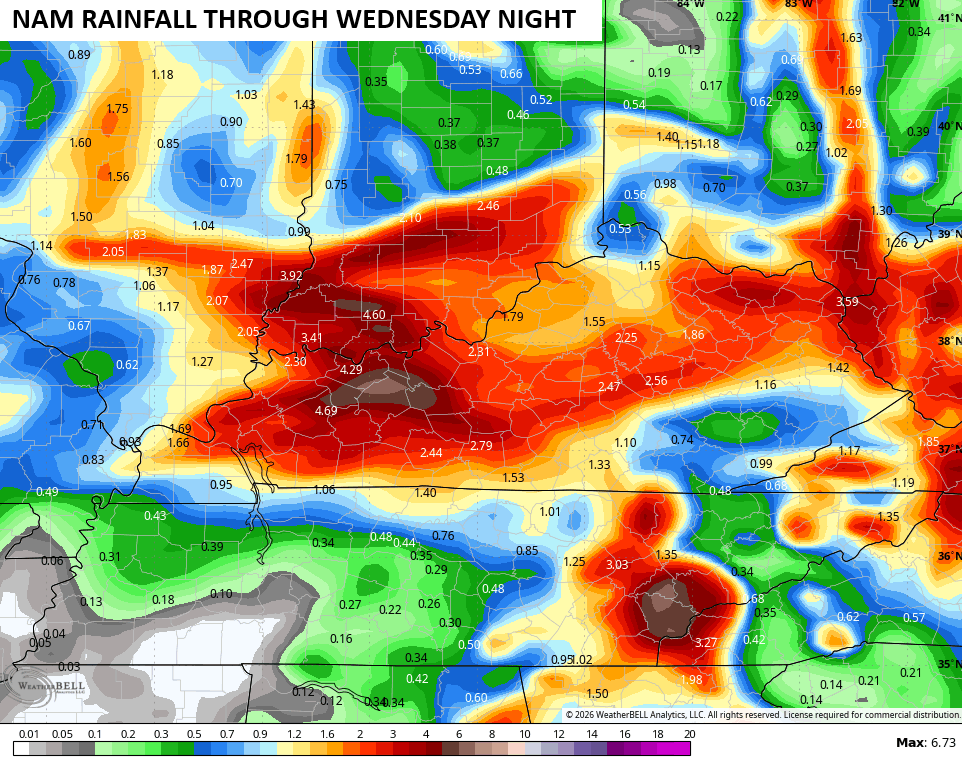
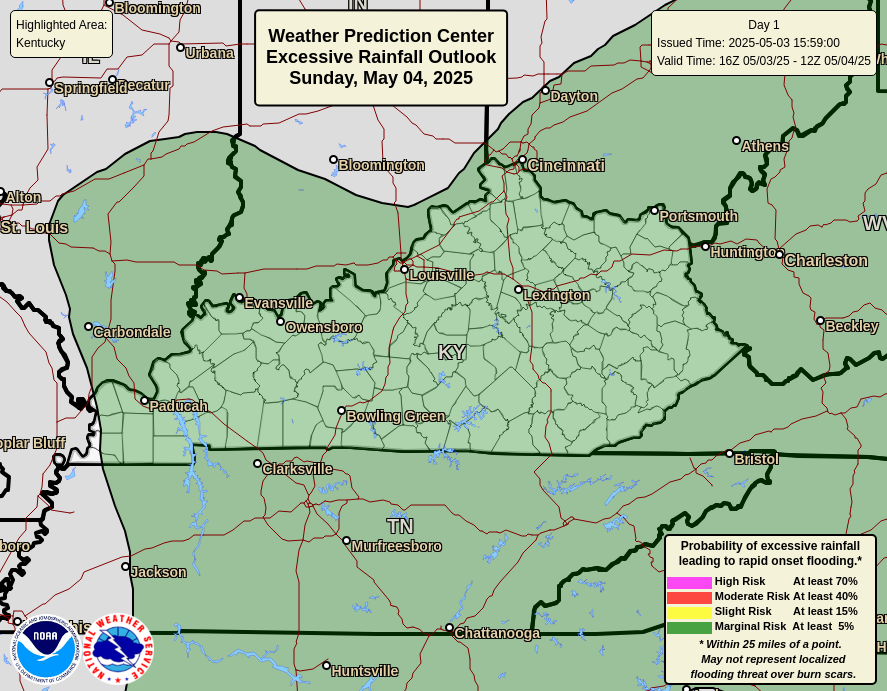
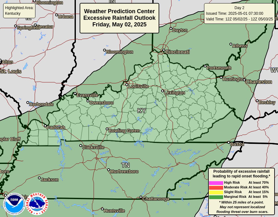
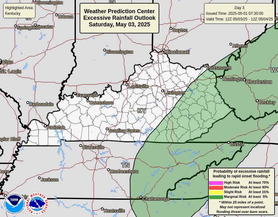
The Weather Prediction Center continues to highlight the Excessive Rainfall potential for our region over the next few days…
Some of the storms today may also be strong or locally severe across the west. This is where the Storm Prediction Center has a low-end severe storms threat…

More in the way of showers and storms roll through here later in the week into the weekend…
Some of those storms may be strong or severe and put down enough rain to cause more high water concerns.
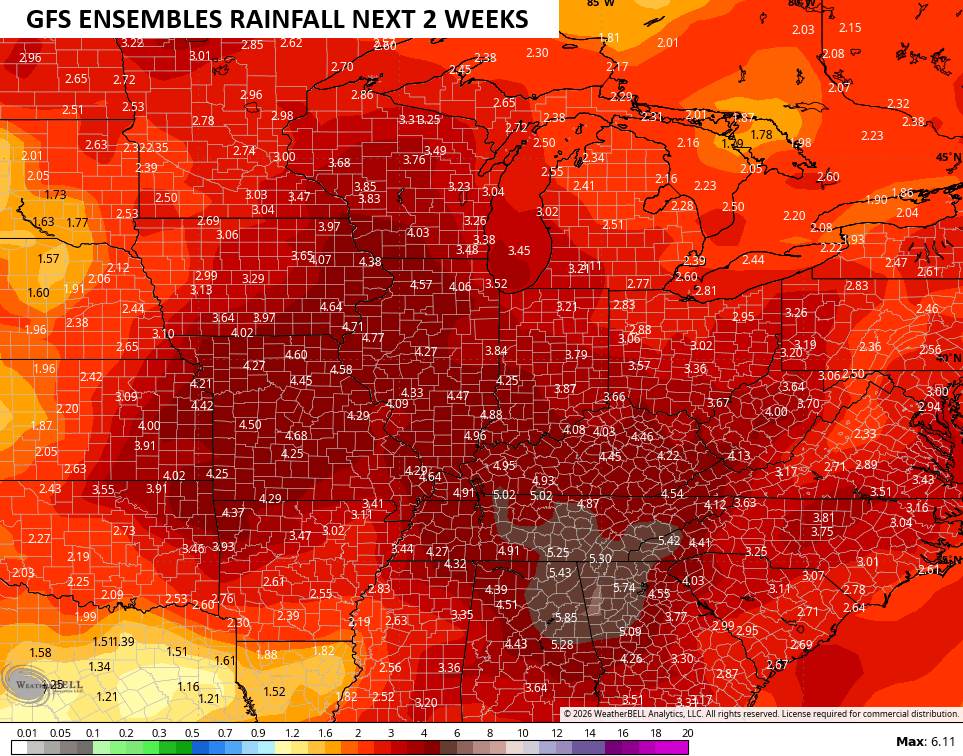
The GFS Ensembles average rainfall forecast for the next 2 weeks continues to throw down a lot of rain in our region…
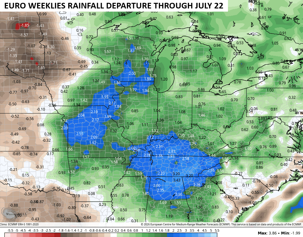
The latest from the EURO Weeklies continue to advertise above normal rainfall on average through July 22nd…
As always, I leave you with your daily rain and storm tracking tools…


Current watches

Possible Watch Areas

Make it a magnificent Monday and take care.

These models show all this rain, yet barely a drop of late.
There’s an Areal Flood Watch for Warren County, including the BG area through Tuesday morning.has recorded 0.85 inches of rain since 7:00 am. It’s the first we’ve seen in 6 days, and the current rainfall rate is 0.90 “/hr. As El Nino strengthens, our weather will continue range from one extreme to another; a week or more with no precip, followed by 3 inches of rain in 36 hours, and then back to a week or more of hot and dry. It’s no wonder that the forecast models and ensembles are wonky!
And why I take models with a grain of salt.
Thanks Chris. Just have a day off from my Chemotherapy, and decided to post a comment. The rains predicted for Taylor County, so far have been very light. Barely wetting the ground. We had some decent rains this month, but we could use more. Crops are looking great though.
Tomorrow, I start the more intense Chemo. I will sure be glad when this is all over, and I’m Cancer free. The past few weeks has really wore me down.
Good to see you Schroeder. Hoping that you will be finished with the therapy and cancer free soon.
I’m looking forward to seeing something other than zeros on my PWS rain gauge. Only a few drops here so far.