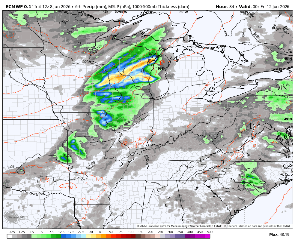
Good Tuesday, everyone. Rounds of strong storms continue to press across Kentucky, bringing the increased threat for flash flooding. With a lot of tropical juice available, these storms can put down a lot of water in a short amount of time.
A Flood Watch is out for much of the region and should be expanded to include most of Kentucky through the first half of Wednesday. Here’s a look at the current watch…

In addition to the flood threat, some of the storms will be strong and locally severe. Damaging winds will be the primary player and this is what today’s Severe Weather Outlook from the Storm Prediction Center looks like…

Let’s break down some things to know:
- A mesoscale convective system/complex is rolling across Kentucky early Today.
- This will likely have spiraling rounds of showers and storms with it.
- Our complex of storms may actually expand some throughout the day.
- As this slowly weakens across the east and southeast this afternoon and evening, an old boundary may set up right behind it.
- This boundary may fire up additional big storms along it from northwest to southeast across central and eastern Kentucky.
- The whole setup is one where tremendous amounts of rain may fall in a short amount of time, leading to flash flooding.
- These storms will also be loaded with lightning.
- A few damaging wind producing storms will be possible with the chance for a few bowing segments to show up.
- Not everyone sees severe weather or flash flooding. This stuff will be more localized.
High humidity levels will be noted today through Thursday as temps make a run at 90 by Thursday with a heat index showing up higher. None of this is out of the ordinary for June or any summer month.
A storm or two will still be possible into Thursday.
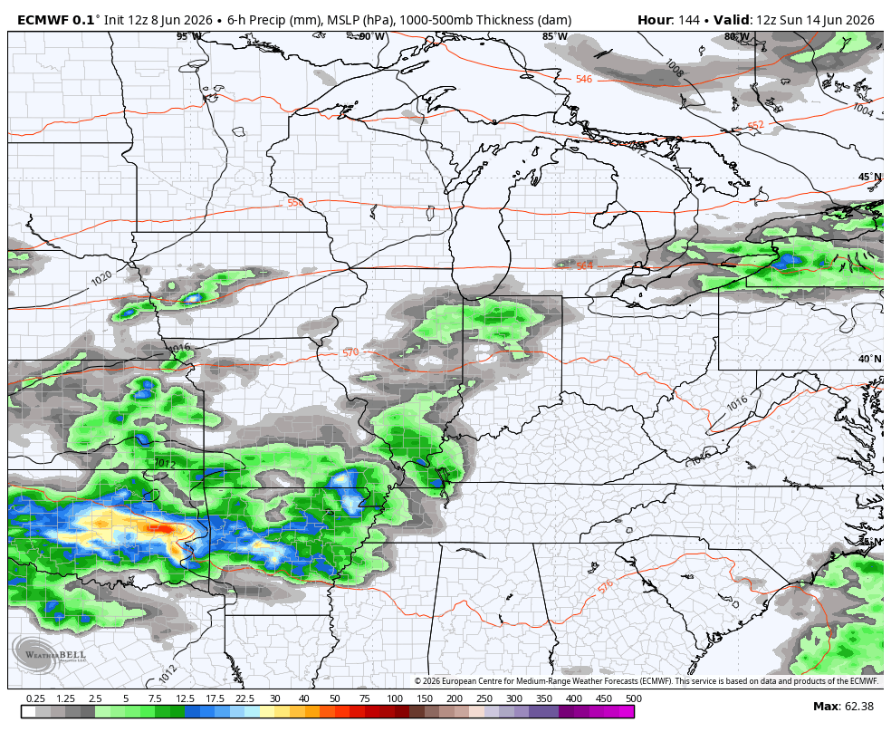
Another cold front slams in here with more showers and storms for Friday…
Cooler and calmer skies come in behind that boundary for Saturday and early Sunday. The Calm won’t last long as out pattern turns stormy again as we get into next week. The setup also has the look of potential hefty rain amounts…
As always, I leave you with your daily rain and storm tracking tools…


Current watches

Possible Watch Areas

Make it a terrific Tuesday and take care.

Hopefully not too much rain.