Good Wednesday to one and all. We continue to track a few flash flood producing showers and storms out there today before things calm down for just a bit. The overall pattern continues to look very active as we head into the middle of June.
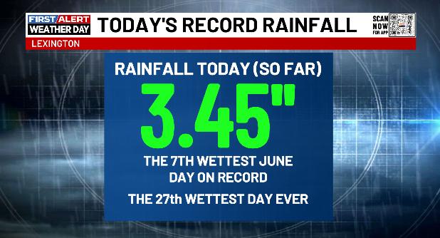
The rains early Tuesday were nothing short of amazing and, in a few spots, historic. Lexington has been recording weather history for approximately 55-thousand days since the 1870s. Only 26 pf those days have been wetter than the one we had Tuesday…
Storms out there this morning will continue to impact central and eastern Kentucky before winding down this afternoon. Additional flash flooding issues may show up with many counties still under a Flood Watch…

Humidity levels are off the charts, making this afternoon’s 80s feel even toastier.
Highs on Thursday are into the 85-90 degree range for many with a heat index in the 90s. We will need to watch for a storm or two going up.
A cold front rolls in here on Friday with a broken line of showers and storms that reaches peak intensity across the east…
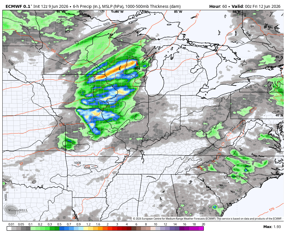
The low-end risk for severe storms is there across the eastern half of the state. Here’s the Friday Severe Weather Outlook from the Storm Prediction Center…

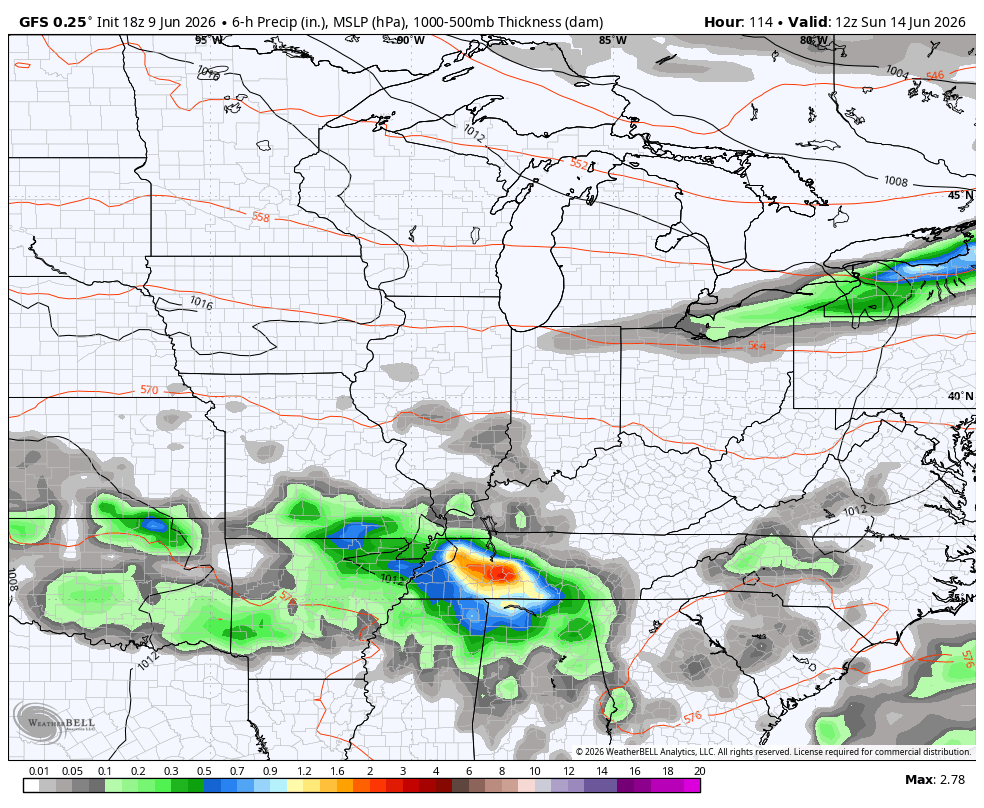
Cooler and drier air comes in behind this for Saturday, but this won’t last very long as more in the way of showers and storms return Sunday and Monday. This is part of a trend that will feature several big rainmakers over the next few weeks as big dips in the jet stream show up.
The EURO and GFS are both showing this very active setup. These animations run from Sunday through June 24…
EURO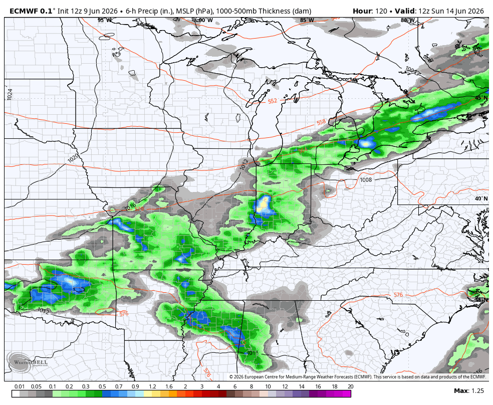
GFS
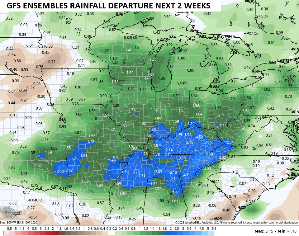
The GFS Ensembles are also highlighting the much above normal rainfall over the next two weeks…
As always, I leave you with your daily heavy rain and storm tracking tools…


Current watches

Possible Watch Areas

Make it a wonderful Wednesday and take care.

Ok but the rain came down in torrents. Amazing rains. Zero thunder, zero storms, Just heavy rain. My question: Where was the lighting and thunder? Am I the only one who thinks it’s odd to feel like it’s been FOREVER since I’ve even heard thunder at all.
Mark, My area of Taylor county received one of those scattered Thunderstorms yesterday afternoon. Cloud to ground lightning and loud thunder for about an hour. We received about 3.00 inches of rain in that one thunderstorm. You are right, thunderstorm are not as widespread as they use to be. Something has changed in the Pacific Ocean. I believe it’s the widespread warming of sea surface temperature, and the cooler waters off the west coast, that have been continuing for years.
Let’s hope it dries out soon for a bit.
I bet it will at the end of the month, and July and August will have it’s normal heat and humidity. That’s my two cents worth long ranged outlook Jeff.
Sounds good