Good Thursday, everyone. We have some serious steam across the region today, but a couple of cold fronts are about to wipe that out. The first front arrives Friday with another due into town on Sunday. This ushers in another much cooler than normal pattern for next week.
Temps are the story of the day, but this is just a normal summertime air mass that’s bringing some steam. Highs are 85-90 in most areas with a heat index in the 90s. Gusty winds will help us out once again.
A line of thunderstorms is diving into the region to start the day, but this loses energy as it sweeps in. Much of the day is dry with just an isolated storm or two popping this afternoon. Another big complex of severe weather develops to our northwest later today and may impact parts of western and central Kentucky in weakening fashion late tonight.
The greatest potential for severe weather is to our northwest through this time, with a low-end threat sneaking into the north and west…

As the cold front moves through on Friday, the air turns better from west to east. This is a classic “jump zone” setup for storms with a lot of this action weakening before it gets to central Kentucky then firing back up across the east later in the day.
The Storm Prediction Center has a low-end risk for severe storms in the east on Friday…

Temps behind this front turn awesome for Friday night and Saturday. Lows reach the upper 50s with highs generally 80-85 degrees. This is all ahead of several big dips in the jet stream taking shape over the next few weeks.
This map shows the average 500mb height departures from normal for a 7 day period and illustrates the deep trough in the eastern half of the country…
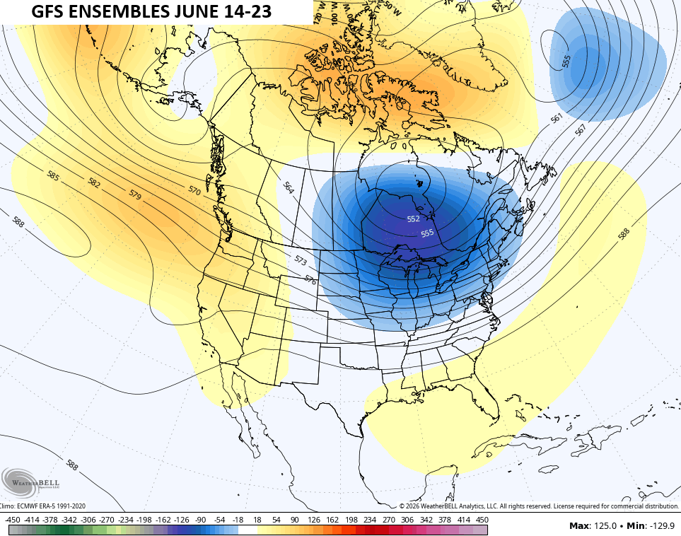
That looks nothing like a typical summertime setup, but matches what we sometimes see during developing strong/super El ninos.
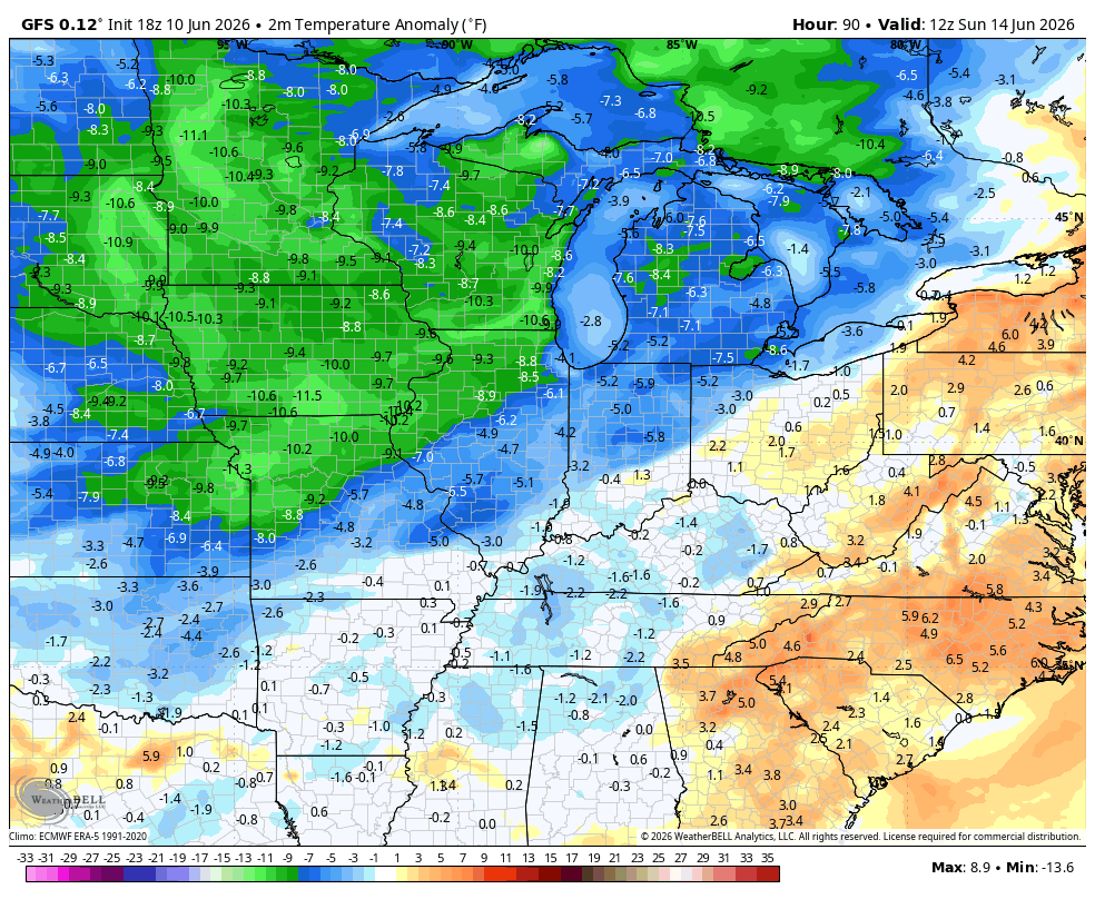
The end result is temps that are well below normal for an extended period of time. This animation from the GFS runs from this Sunday through June 26th and shows how far below normal the numbers are…
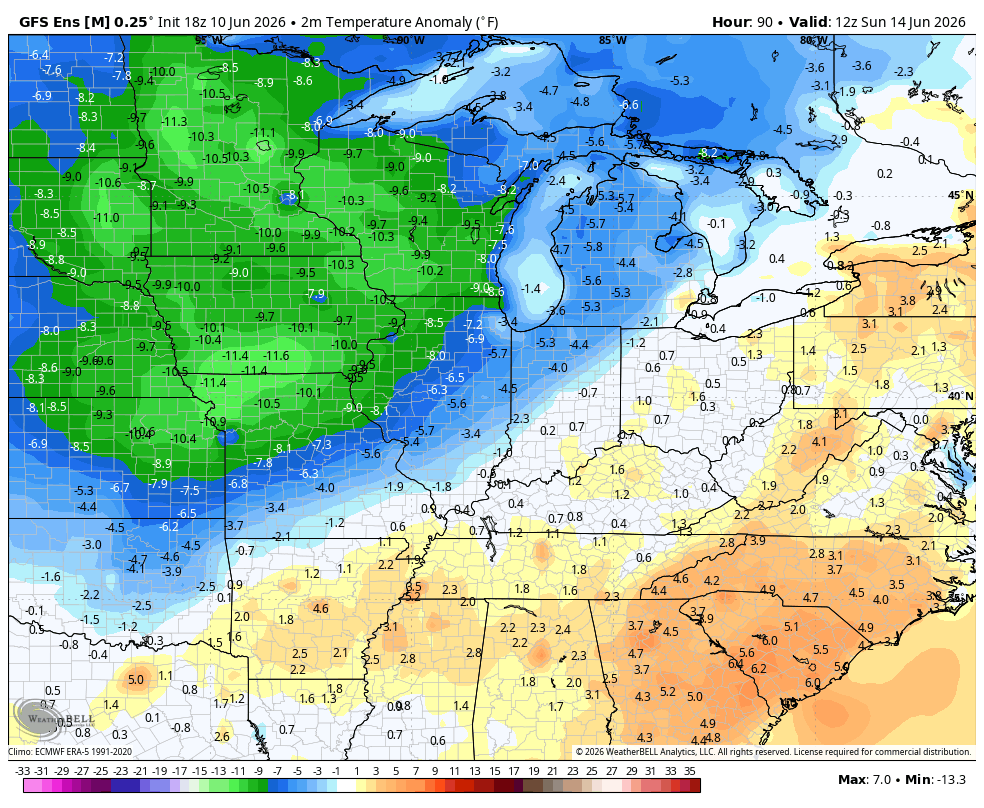
It’s not just the operational models, either. The average of the GFS Ensembles has a lot of below normal air during the same time…
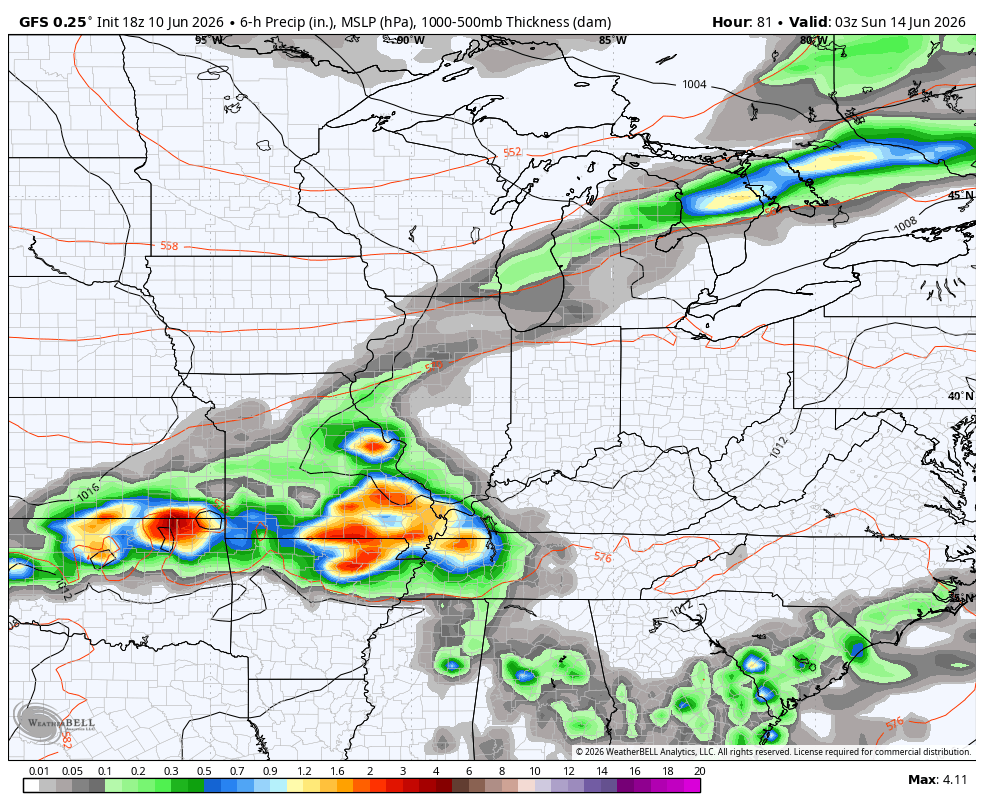
With these deep troughs we get active cold fronts dropping through here and one or two of those may even have a wave of low pressure developing along it. This action start Sunday and goes through June 26th…
As always, I leave you with your daily heavy rain and storm tracking tools…


Current watches

Possible Watch Areas

Make it a great Thursday and take care.

Thanks Chris. I just want to say that your forecasting has been SPOT ON. I just wish we had the same meteorological information here in Taylor County. Louisville does a good job there also, but my area is barely mentioned. Bowling Green has good service also, but too far away. I love where I live. Lots of beautiful trees and rolling hills, and just a few great Neighbors. I am always watching the skies when your forecasting Severe Weather for Central Kentucky. When the barometer falls, I take notice. Also beginning to learn the various cloud types. This morning on your great radar system, shows a very Severe line in South Central Indiana where I grew up. I remember some very Severe Thunderstorms in that part of the State. Also some very Big Snowstorms. I would like to have a Personal Weather Service, but I’m not able to set it up due to my weak legs.
Unless we’re talking mid 70s or lower for highs, it’s not getting well below normal.
Could be more like the mid – eighties. Suppose to be 90 degrees here in Maple this afternoon. Will feel like 105 degrees. Which is normal.