Good Tuesday, everyone. It’s another awesome weather day across Kentucky with pleasant temps and low humidity levels. This awesome air will give way to a scattered storms tonight with a much better chance for storms late Wednesday into Thursday.
Temps to start today are about as cool as you will ever find them in June. Lows reach the upper 40s and low 50s this morning before rebounding into the 75-80 degree range this afternoon. Skies are nice overall with some clouds increasing late.
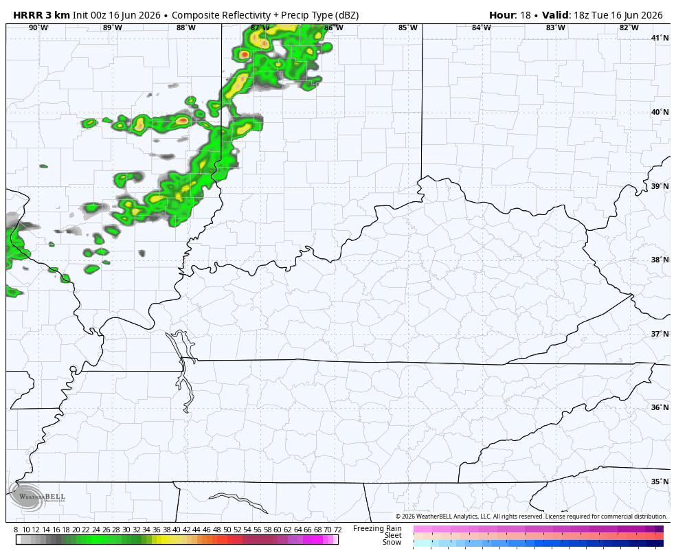
This is ahead of a weak front dropping in tonight with a broken line of showers and storms…
That boundary slides back to the north quickly on Wednesday as warmer winds kick in from the southwest. There’s a slight chance for a storm or two around, but most of the action appears to be holding off until late Wednesday night and Thursday.
The setup for Wednesday is one to where a significant severe weather outbreak is likely to our north and northwest. Here’s the Wednesday Severe Weather Outlook from the Storm Prediction Center…

The line of storms moving in here Wednesday night is likely weakening as it does so, but may carry a few severe storms south of the Ohio River. The boundary then slows down on top of us Thursday, firing up some more storms.
Some of the Thursday storms may be strong or severe. Here’s the Severe Weather Outlook for Thursday…

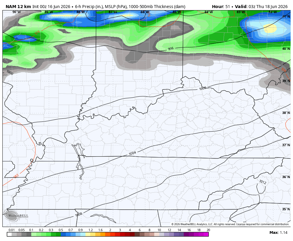
A wave of low pressure may develop along this boundary just to out south Thursday night and Friday. That could keep some showers and storms going into the first half of our Juneteenth. Here’s how the NAM sees things from Wednesday night through Friday…
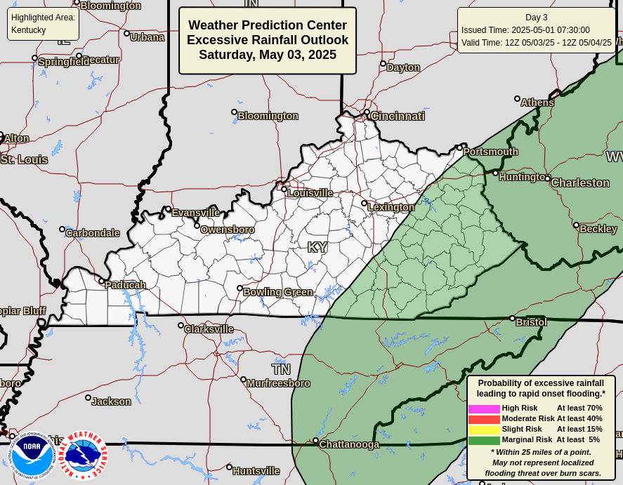
The potential for some hefty rain totals is there Thursday and Thursday night. Here’s the Excessive Rainfall Outlook from the Storm Prediction Center for this time period…
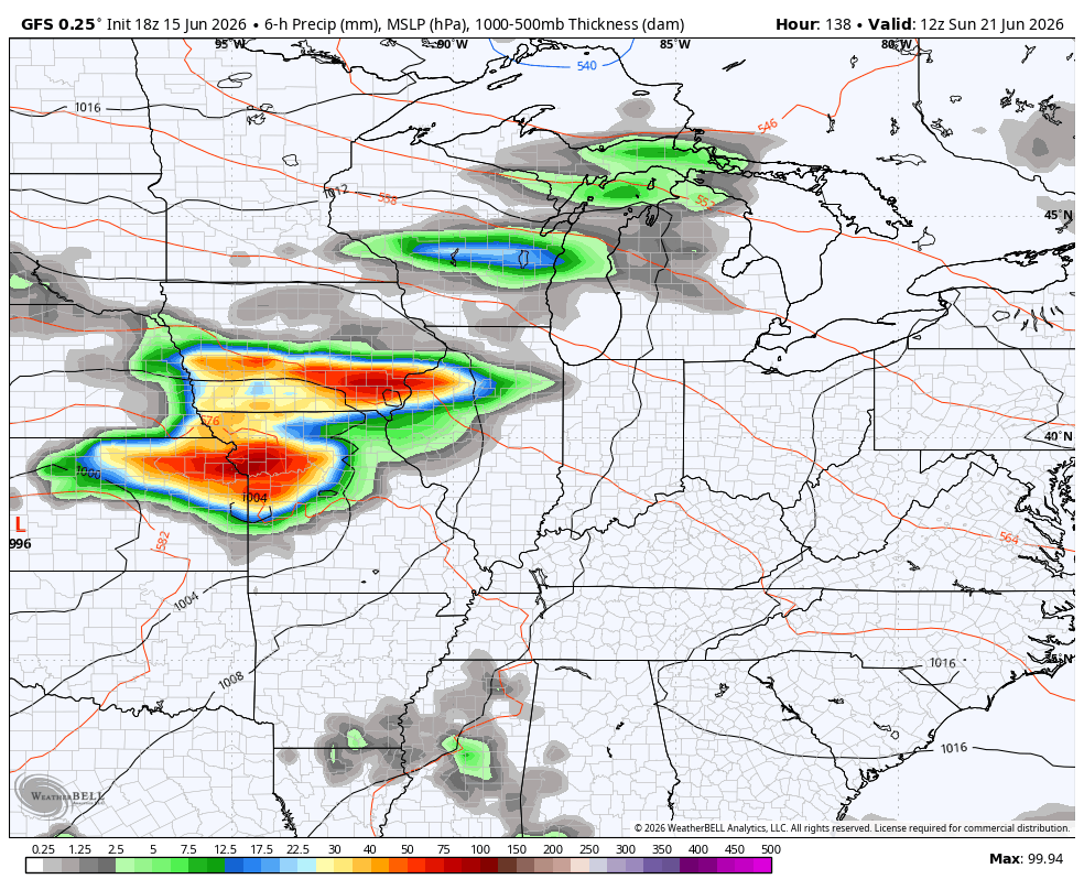
Calm and awesome weather then moves in late Friday into Saturday. That’s ahead of another stormy setup from late Sunday into early next week…
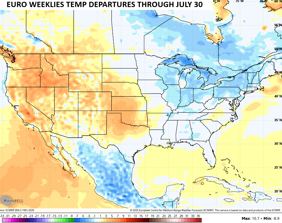
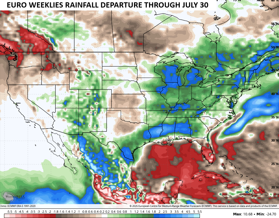
The longer range view from the EURO Weeklies keeps showing much of the eastern half of the country averaging below normal for temps and above normal for rainfall through the end of July…
As always, I leave you with your daily tracking toys…


Current watches

Possible Watch Areas

Make it a terrific Tuesday and take care.
