Good Monday to one and all. It’s the middle of June, but Mother Nature is throwing us a full-blown blast of September temps. This well below normal air is pretty darn awesome for the next few days. More storms them rumble in for the middle and end of the week and some of them may be severe.
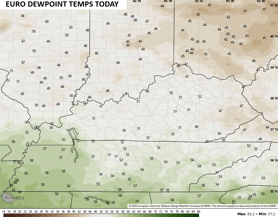
Let’s talk today because it’s amazing. Humidity levels are about as low as you will ever find them in summertime as dewpoint temps range from the upper 40s to low 50s…
Highs in the low and mid 70s will be common…
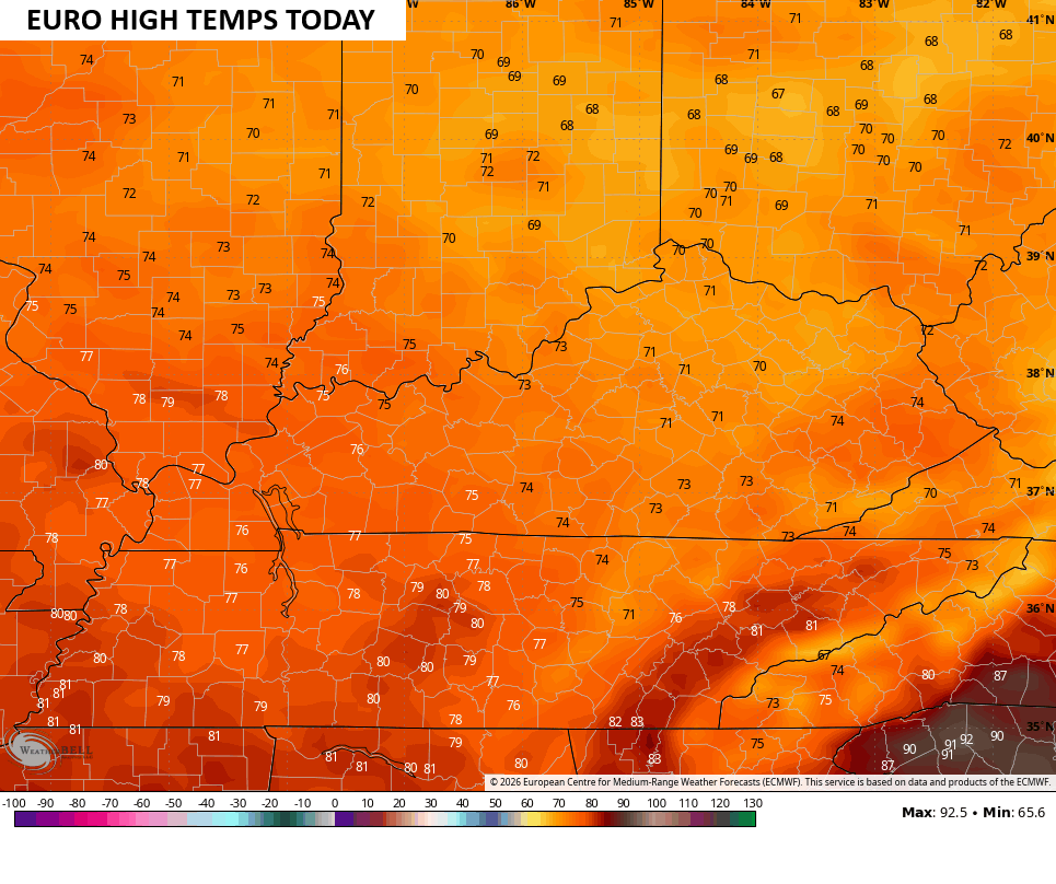
This sets the stage for overnight lows to again head toward the 50-degree mark in many areas. Highs Tuesday are still awesome with mid and upper 70s for most of the state.
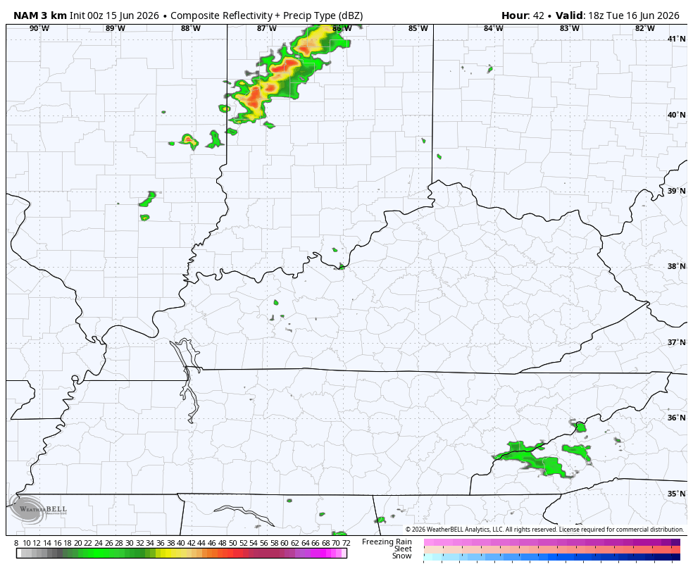
A weak cold front drops in with a line of showers and storms late Tuesday into Tuesday night. This shows up well on the Hi-Res NAM future radar…
Here’s a look at the Tuesday Severe Weather Outlook from the Storm Prediction Center…

A much stronger cold front arrives from the northwest late Wednesday into Thursday. This looks like a severe weather maker for the Ohio Valley with some of that possibly getting into Kentucky. Here’s the Wednesday Severe Weather Outlook…

Thursday is just outside the normal 3-day window so the risk area is generalized…

At the same time this is happening, we are watching the western Gulf for possible tropical development. This would be with a system coming off the coast of Mexico and heading toward Texas or Louisiana. Here’s the current satellite shot from the Gulf…

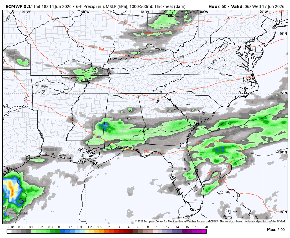
Whatever becomes of that system gets drawn northward toward the booming storm producing front crossing our region later in the week. This animation from the EURO starts Tuesday night and goes through Saturday…
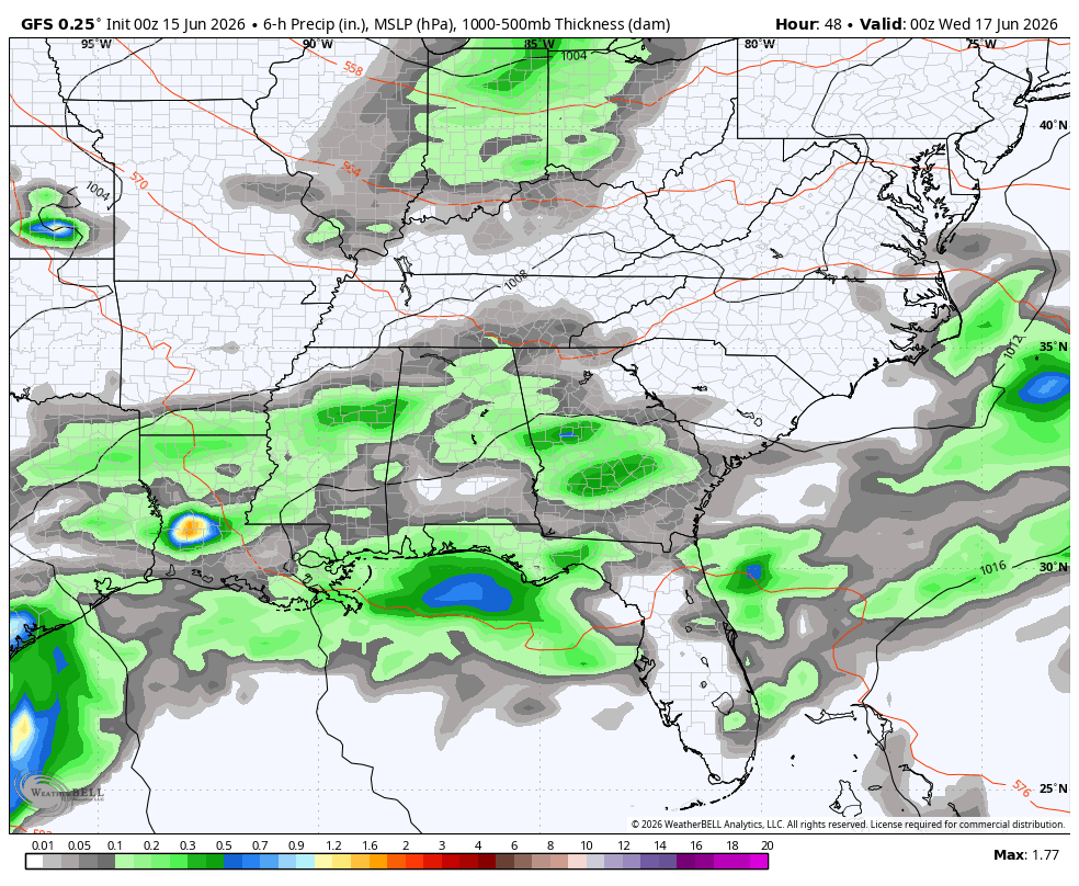
The GFS is similar…
As always, I leave you with your daily tracking toys…


Current watches

Possible Watch Areas

Make it a magnificent Monday and take care.

Thanks Chris. Beautiful weather, but I’m unable to get outdoors due to my health issues. What I think is a serious situation is the lack of rain here in central Kentucky. Taylor County has only had 9.13 inches ( Kentucky mesonet ) of rain since January first, when it usually has 25 inches. I blame this on the on going negative PDO which amplifies the Bermuda High in the western Atlantic. Notice that all the rains are well north around the northern edge of the high pressure system : Illinois, Indiana, Ohio. Hope this all changes soon. We don’t need a crop failure. Climate Change Sucks !
Watching the Gulf, as I believe we will have one named Hurricane before the tropical storm season is over ?
The Kentucky Mesonet is way off on rainfall totals for the year 2026 state wide. Taylor County has actually received 15 to 20.6 inches since January first. We are in good shape agriculturally.
What a gorgeous mid-June day in the Chicago Metro Area. Here in the SW Suburbs under a sun/cloud mix, it’s 72 degrees with a dewpoint of only 48.
Normal high here this time of year is 81 degrees.
Mike, Your area has the best chance for the stormy weather through the week. Here in Central kentucky the drought is back, due to the stronger than normal Bermuda High pressure prevailing off the Atlantic Coast.