Good Wednesday, everyone. It’s a windy and warmer day out there as we get set for the potential for a few severe storms late tonight and Thursday. This is the first in a series of storm systems set to impact our region in the next week or so.
Strong southwest winds kick in today with temps returning to the 80s. A potent storm system rolls through the Ohio Valley later today and Thursday putting a major severe weather bullseye across the northern Ohio Valley. This is where today’s Severe Weather Outlook is really focused…

The threat moves into Kentucky later tonight and into Thursday. Here’s the Severe Weather Outlook for Thursday…

One line of big storms likely drops southward overnight, weakening along the way. This boundary moves in and fires up more storms Thursday afternoon and evening with the greatest concentration across the southern half of Kentucky. Hit and run flash flooding is also possible.
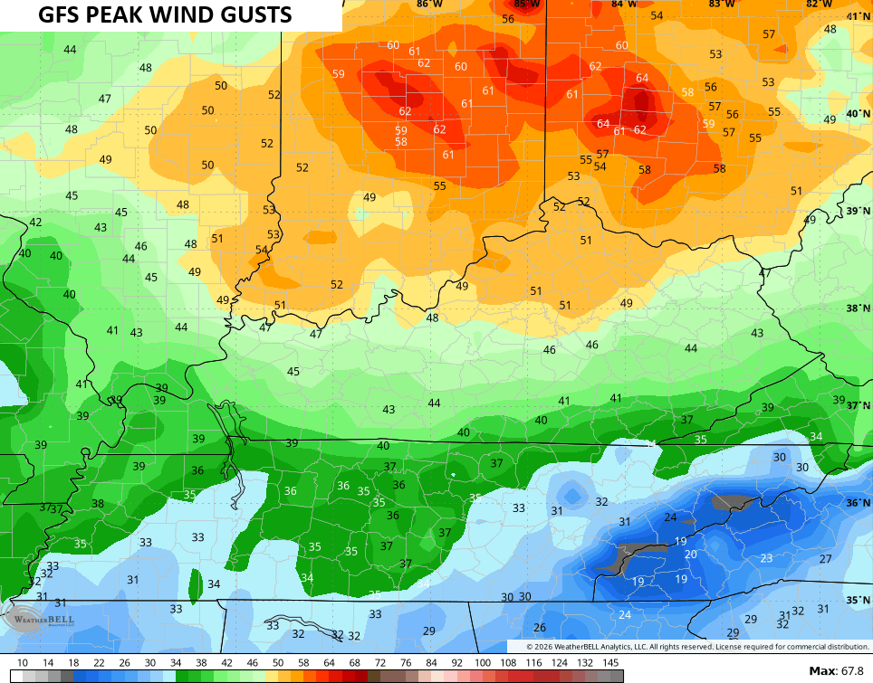
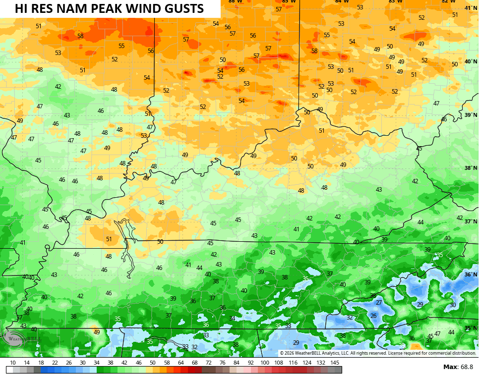
Some big wind gusts are likely with or without severe storms later tonight. Some of the models are going with 40mph to 50mph peak wind gusts…
Pleasant weather moves in later for Juneteenth Friday and lasts into Saturday. Highs are generally in the upper 70s to around 80 both days.
Father’s Day finds clusters of showers and storms increasing from west to east with this action lasting into Monday…
Once again, a few strong storms and hit and run flash flooding will be possible.
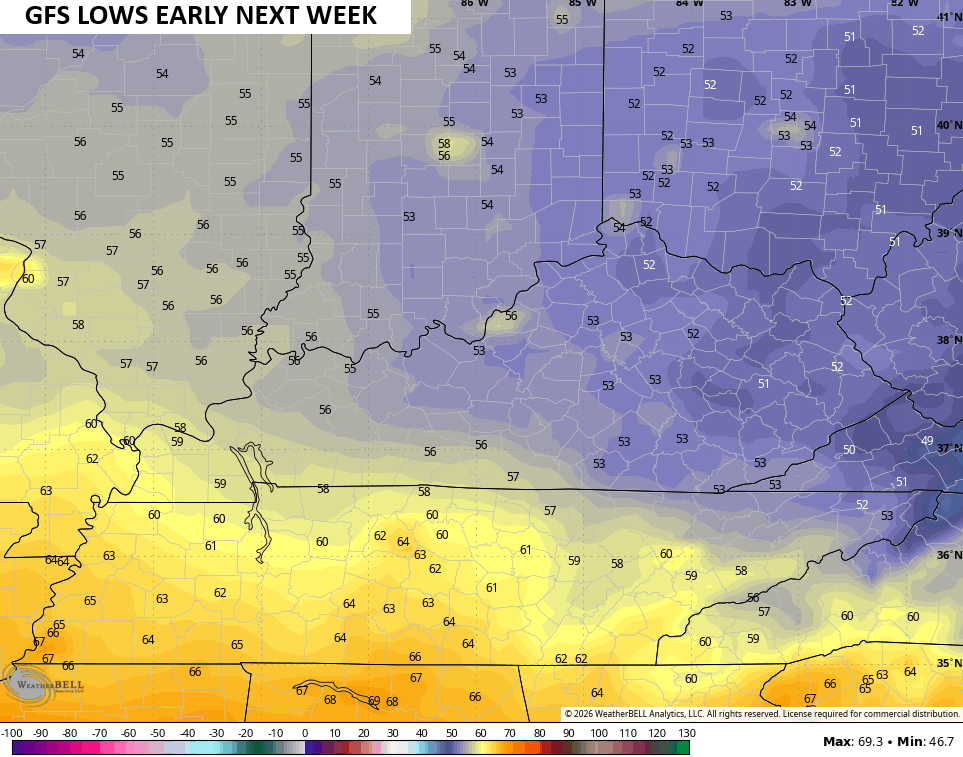
Temps continue to run well below normal during this time and that lasts through next week. Lows into the first half of the week are likely in the 50-55 degree range again…
The active pattern looks to resume later next week into the final days of June with several systems set to cross the region with showers and storms…
As always, I leave you with your daily tracking toys…


Current watches

Possible Watch Areas

Make it a wonderful Wednesday and take care.
