Good Friday, everyone. As we celebrate Juneteenth, much better air continues to take control of our weather. Calm and cooler than normal will be with us into much of the weekend before more in the way of storms return, just in time for Father’s Day.
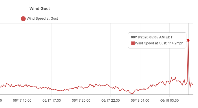
The flooding rains and severe weather from early Thursday gave us some wild numbers. Some areas picked up more than 6″ of rain with quite a bit of wind damage. The wildest number came from the Kentucky Mesonet site in Mason County as it recorded at wind gust of 114mph. Yes, the Mesonet folks verified this at 114mph…
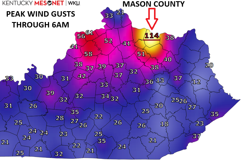
That came as a severe storm, and likely tornado, slammed the Maysville area. Severe damage was reported in a swath throughout Mason County. The NWS did not have a tornado warning out and have been surveying the damage there.
Today’s weather is calm with pleasant temps hitting the upper 70s to around 80 with a mix of sun and clouds. High 70s to low 80s will be common for Saturday with a few clouds rolling in and just the slightest chance for a stray shower or storm going up in the north and west.
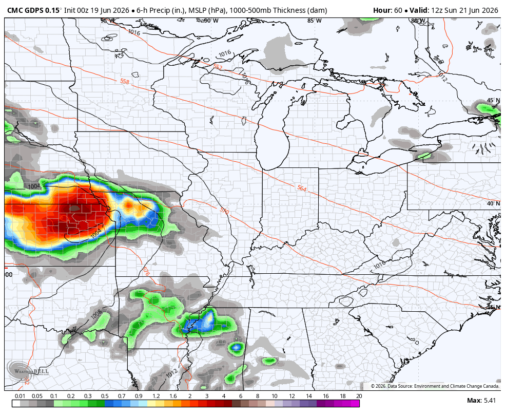
Temps for Father’s Day spike a little more as scattered showers and storms fire back up. This is ahead of a storm system developing across the Plains and sweeping into the Great Lakes early next week.
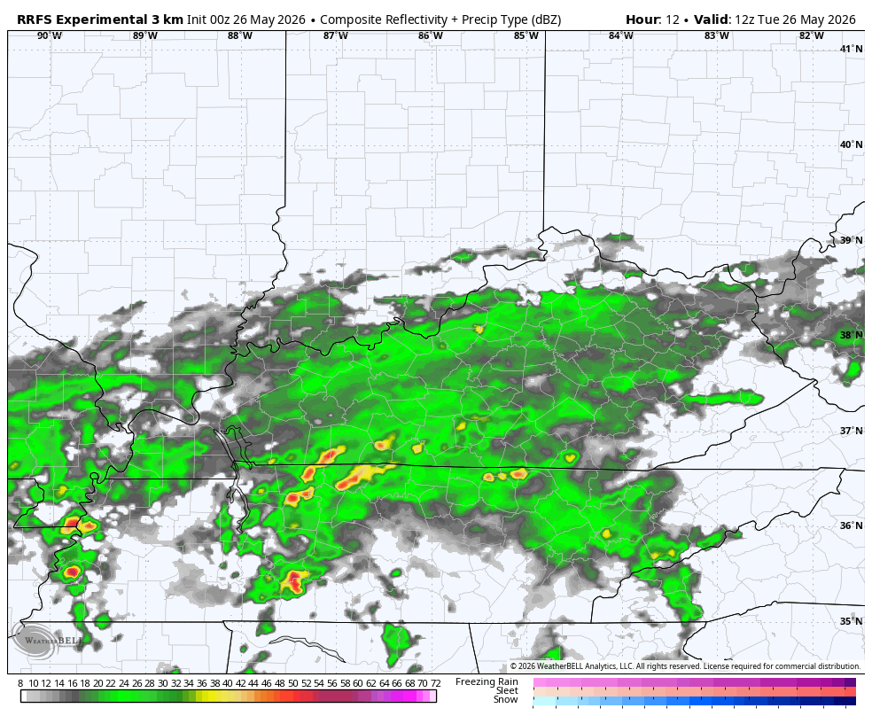
The future radar from the RRFS shows some pretty good thunderstorm clusters rolling through here from Sunday afternoon through 8am Monday…
We may also wind up with a low-end severe storms risk for Sunday. Here’s what the Storm Prediction Center is thinking for Father’s Day…

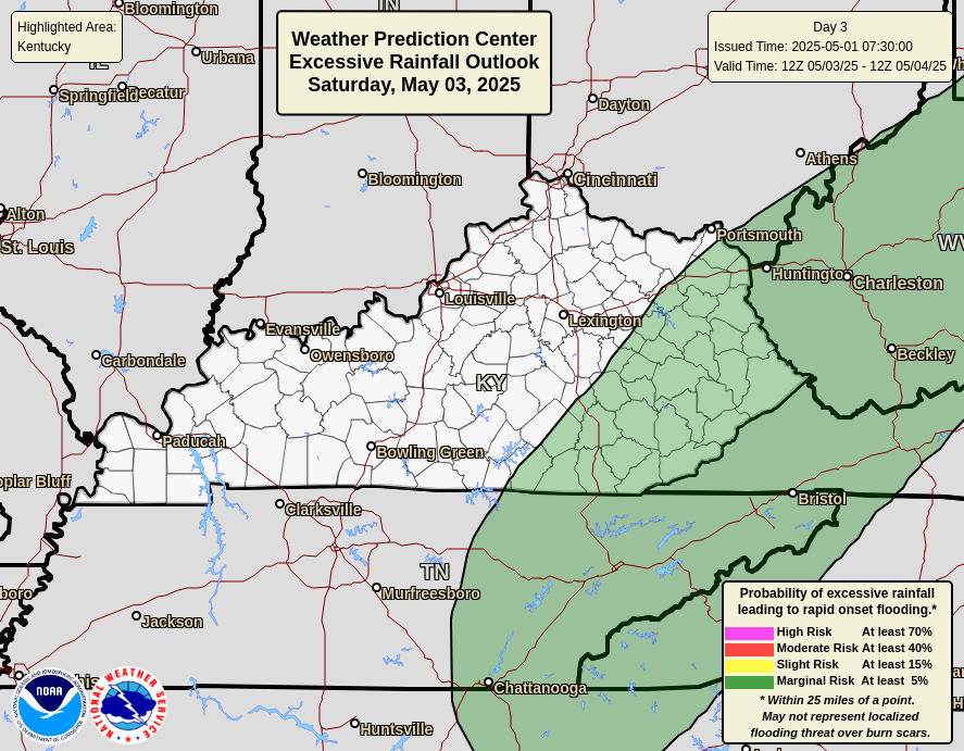
Torrential rains will also be possible with these storms from late Sunday into Monday. The potential for high water issues is there and the Weather Prediction Center is highlighting the potential for these two days…

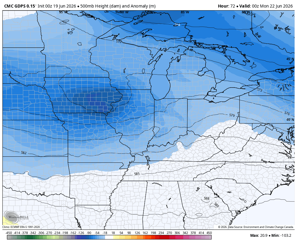
All of this may turn into that slow-moving upper level system that keeps cool and damp weather throughout much of next week…
I mean… does anything about this upper level map look like the last full week of June???
Have a fantastic Friday and take care.

Thanks Chris. The 114 mph wind gust in Mason County, has my interest. Sounds like an intense microburst / downburst from a severe thunderstorm, or a tornado if damage evidence shows rotation rather than straight – line wind patterns. Also could have been a violent downburst, especially if the storm was part of a fast – moving squall line.
Very unusual to have upper level troughs this late in June. Another bout of stormy weather ahead. Our usual Summer weather features the southeast ridge, bringing hot and humid weather. I think that weather pattern will happen sometime in July, and maybe extend into our Autumn months. That is depressing to say the least.
My cheap rain gauge recorded 2.50 inches of very welcome rains. Hope the areas of extreme drought ( Casey County ) had the same.