Good Saturday, everyone. It’s another pretty nice weather day across Kentucky as temps finally feel a little more like what we should be feeling. By Father’s Day, we have to be on guard for a few more waves of strong to severe storms rumbling across Kentucky.
Let’s start with our Saturday and roll forward.
Highs today are generally 80-85 in most areas with a mix of sun and clouds. There’s just the slightest chance for a stray storm going up in the north or west.
Temps are seasonably warm again for Father’s Day with humidity levels coming up, too. This is ahead of another potent low pressure rolling into the Ohio Valley and dragging a cold front into Kentucky.
Rounds of showers and storms increase along and ahead of this front with the greatest threat coming Sunday afternoon through early Monday. You can see all this firing up on the future radar from early Sunday into Monday…
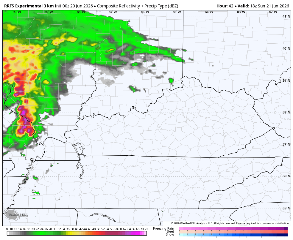
Some of the storms may be strong or severe, especially Sunday afternoon into Sunday night. Here’s the latest Severe Weather Outlook from the Storm Prediction Center for Sunday…

A lingering low-end severe risk may show up still early Monday. Here’s the outlook for then..

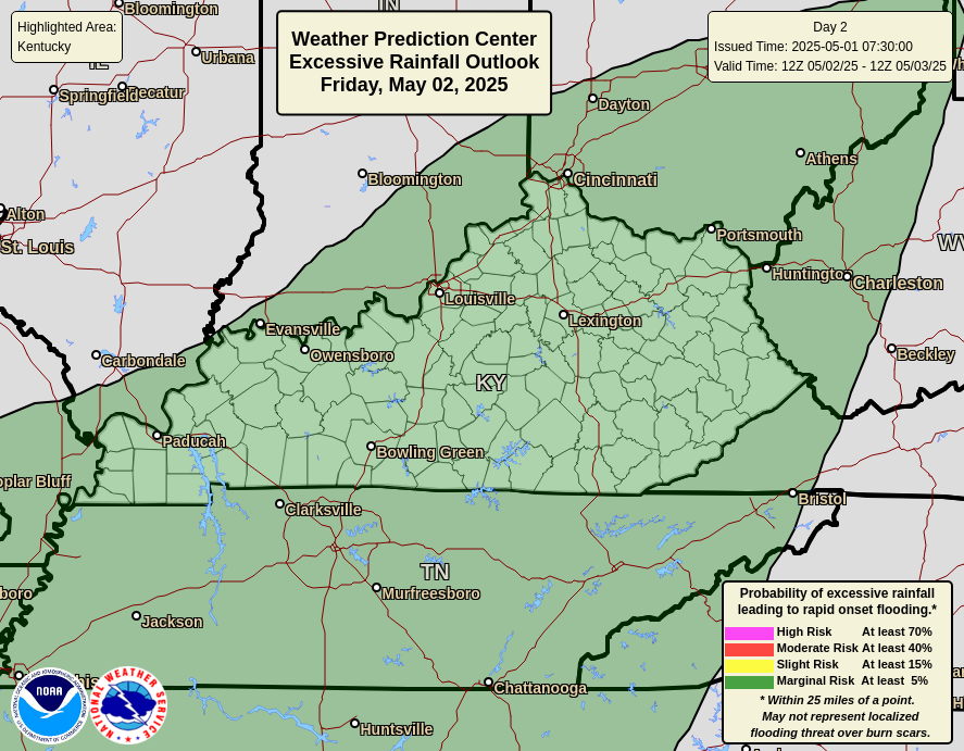
With a waterlogged ground in many areas, the threshold for flash flooding is lower than normal, so any storm that goes up can cause some issues. Here’s the area the Weather Prediction Center is monitoring for Father’s Day…
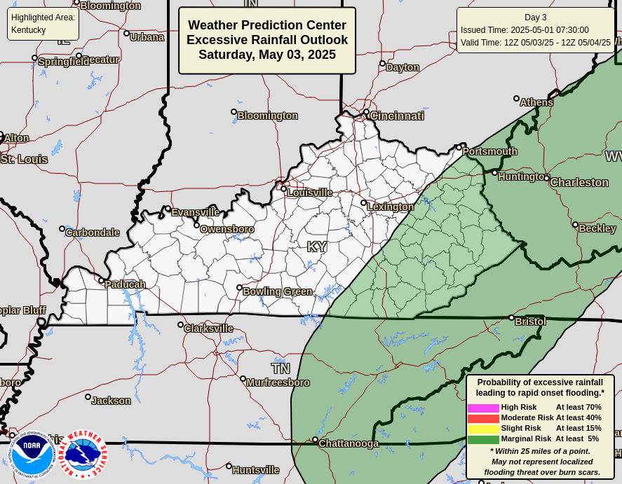
The area of interest on Monday…
Once this system moves through, the overall pattern remains very active into the closing days of June. The upper air pattern looks like something out of the cold weather months instead of the lead up to the 4th of July…
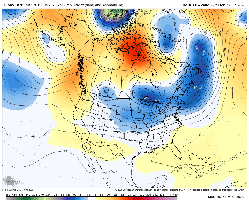
That pattern likely has additional rounds of heavy rain-making showers and storms to go along with below normal temps.
As always, I leave you with your daily tracking toys…


Current watches

Possible Watch Areas

Make it a sensational Saturday and take care.
