Good Tuesday to one and all. Much better air takes control of our weather for the next few days before we storm it up again later this week and weekend. That’s when more in the way of strong storms and heavy rains roll through.
Very early day showers across the southeast pull away with a few clouds lingering throughout the day. Northwest winds usher in a mix of sun and clouds this afternoon with highs generally 75-80 for most areas.
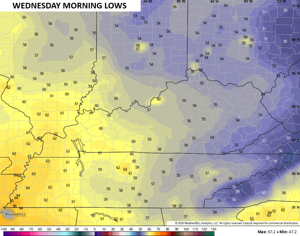
This sets the stage for temps tonight and Wednesday morning to settle into the low and mid 50s for most of central and eastern Kentucky…
Wednesday is another nice day with upper 70s to low 80s for most areas.
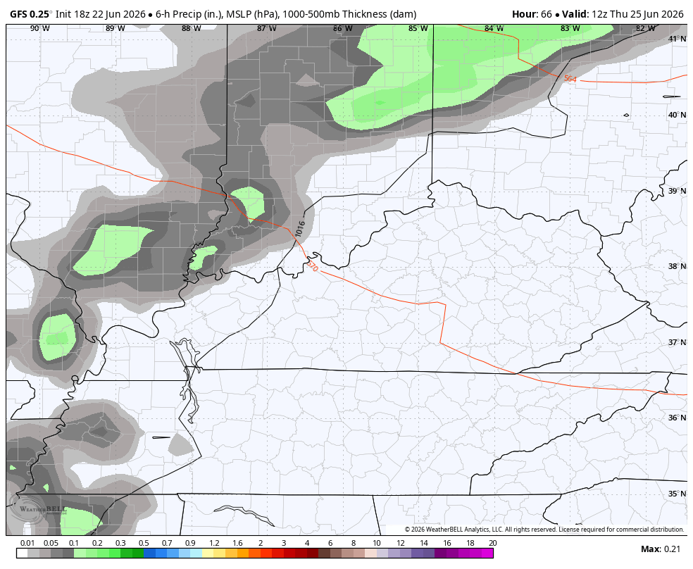
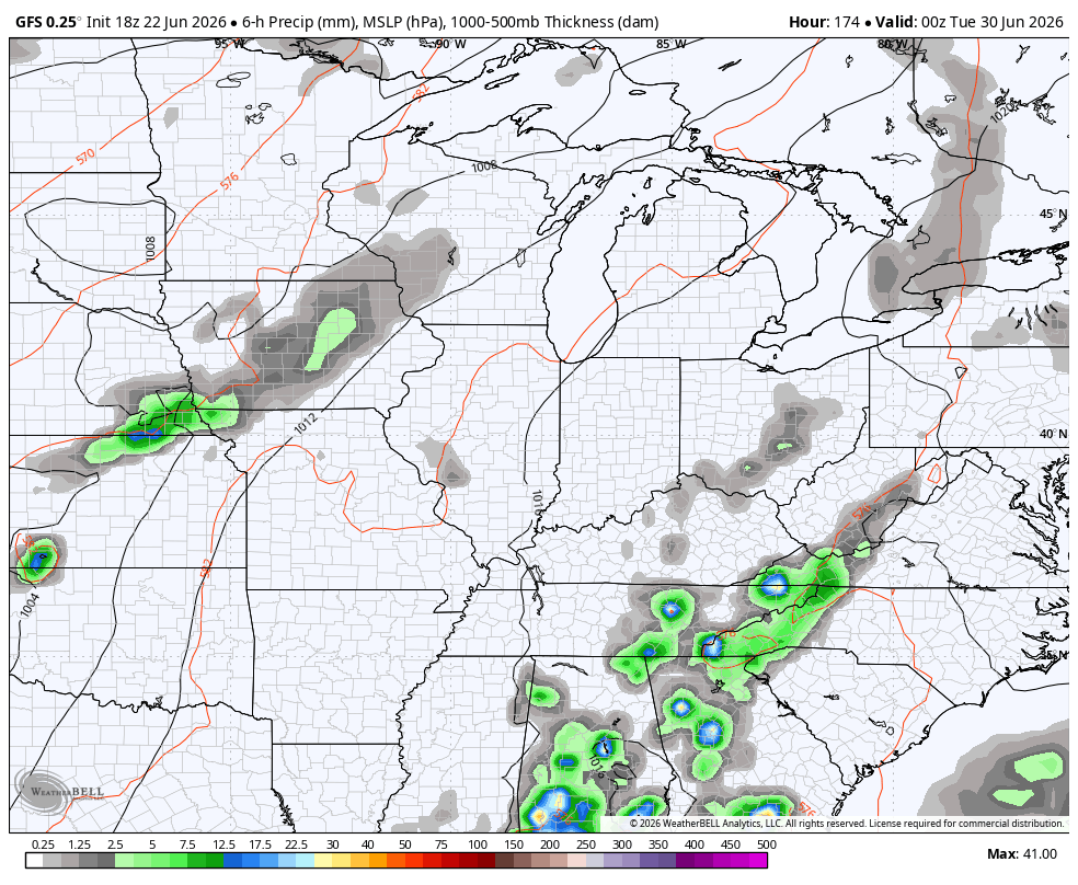
Temps jump back well into the 80s for Thursday as we gear up for waves of showers and storms to rumble across the region from Thursday night into the weekend. Here’s the GFS during this time…
A few strong to severe storms will be possible, but my biggest concern is for flash flooding. The models are spitting out a lot of rain during this time…
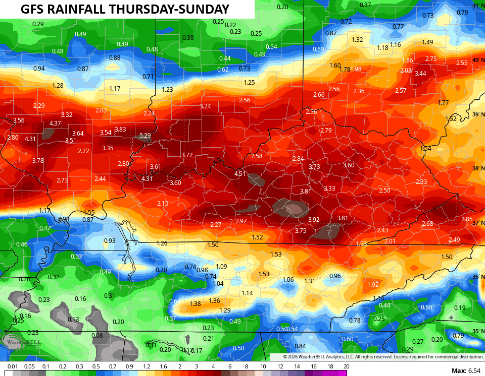
Those kinds of numbers can cause additional flash flooding concerns.
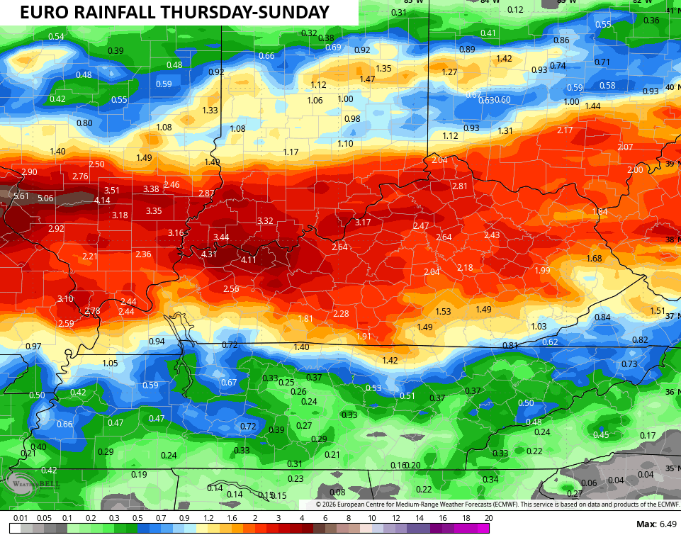
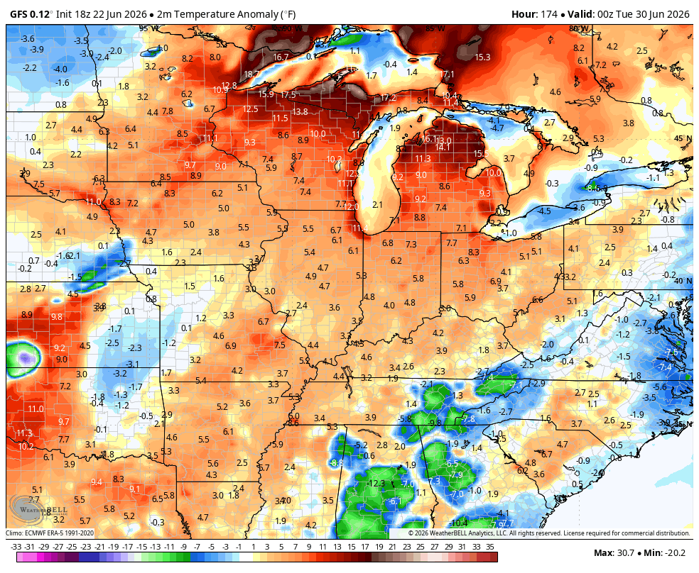
Toasty temps make a run at us after this into early next week, but the potential is there for big thunderstorm complexes to knock those numbers down. The EURO has been showing this for a while and now the GFS has joined the party…
The GFS also shows that trough trying to get back into the east around the 4th of July Weekend. You can see the colder temperature anomalies showing up…
As always, I leave you with your daily tracking toys…


Current watches

Possible Watch Areas

Make it a terrific Tuesday and take care.

Yesterday our temperature only got up 72 degrees. That’s well below like Chris has mentioned.
This weather pattern shows no signs of ending. The high pressure block in Greenland this morning was still 30.2 inHg. Maybe we will have our Summer weather in August and September. That would be very depressing. Also the NAO is still negative.