Good Thursday, everyone. We have rounds of showers and storms getting ready to rumble back into the region for the next several days. This action brings the possibility of strong storms and more in the way of flooding rains.
The first round of, at least, scattered showers and thunderstorms move into areas of western and northern Kentucky late this afternoon into the evening. The chance is there for a few of them to be strong with a low-end risk for severe storms.
The Storm Prediction Center is highlighting these areas for the low-end severe risk today…

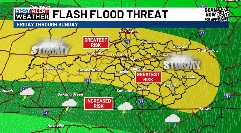
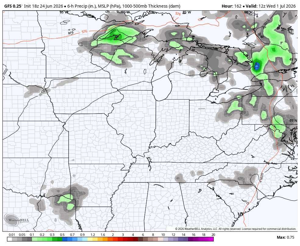
Rounds of showers and storms then roll in from west/northwest to east/southeast Friday through Sunday. Corridors of torrential rains will show up, leading to flash flood concerns. Here’s a look at the area I’m thinking is most at risk for seeing, at least, some flash flooding…
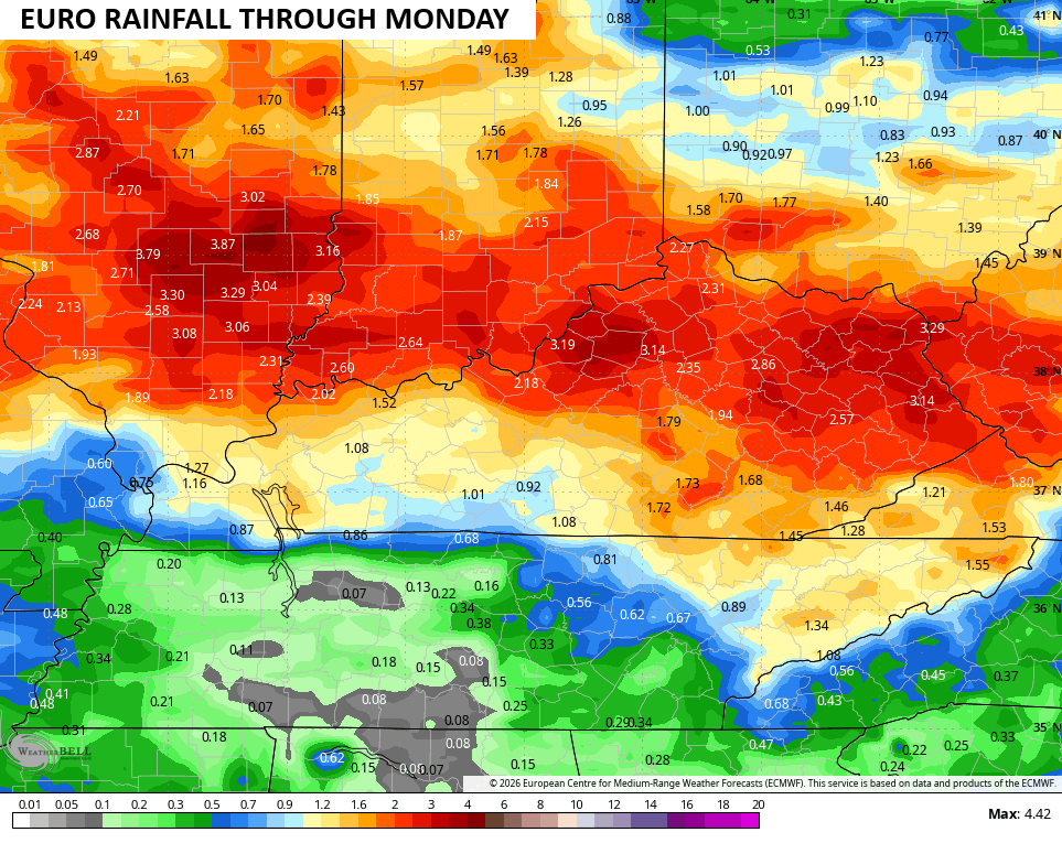
The EURO matches up pretty well with that…
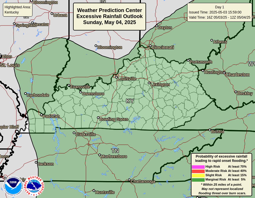
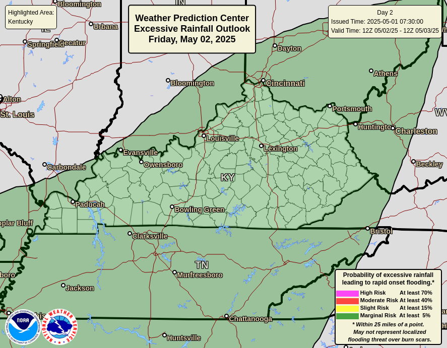
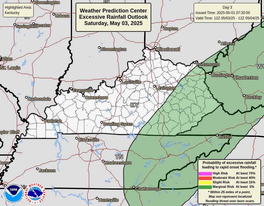
The Weather Prediction Center is monitoring the potential for flooding in our region through early next week. Here’s a daily breakdown of what they’re thinking, starting with today and running through Sunday…

Temps turn seasonably toasty next week as we flip the calendar from June to July. The pattern for our region is one that will feature some clusters of thunderstorms going up each day…
Highs in the upper 80s to low 90s show up during this time.
While the models are showing a massive upper level heat ridge, you have to remember that doesn’t always translate to the surface in the same manner, especially with some storms around. Regardless, this big ridge gets pushed back to the west with the trough coming back into the east into the first 10 days of July…
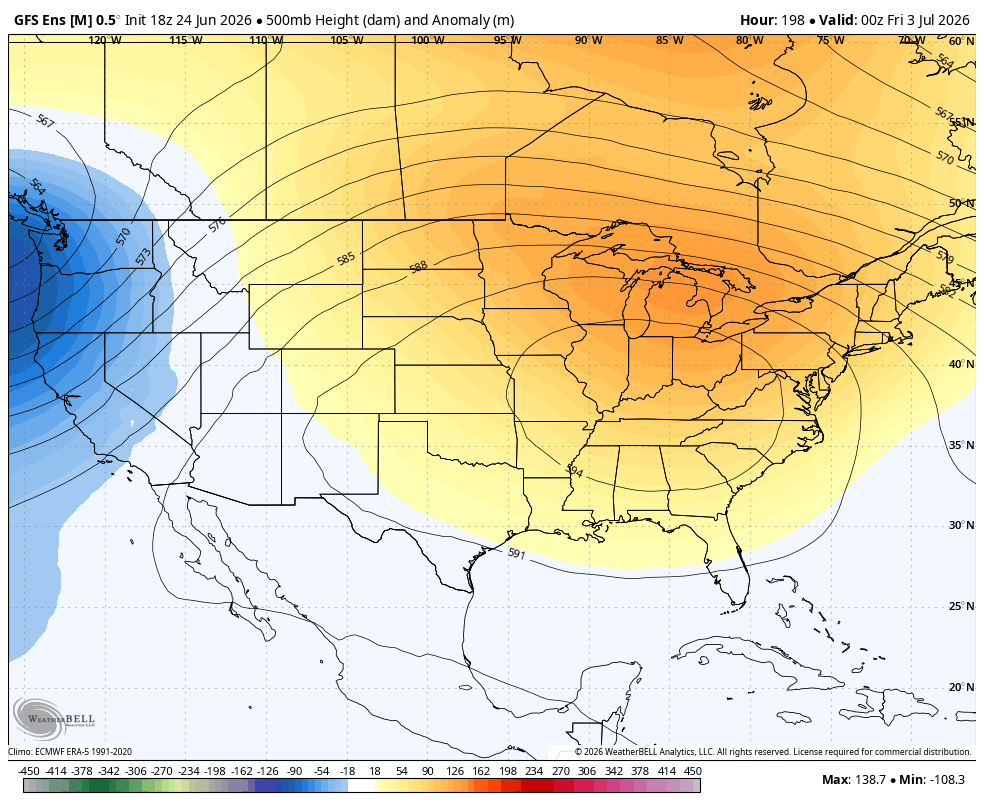
That’s the retrograding pattern I talked about yesterday.
As always, I leave you with your daily tracking toys…


Current watches

Possible Watch Areas

Make it a great Thursday and take care.

I hope none of this verifies. Bring on the heat.
Thanks Chris. Maybe we will receive some good rains this time around. Hope the pleasant temperatures come back. Enjoying the cool mornings, and low dew points in the late afternoon. Very unusual Summer weather for our part of the Country.